Garmin Outdoors
Garmin Overlander® Navigator Navigation Tools
Garmin Overlander® Navigator Navigation Tools
Couldn't load pickup availability
ROAM THE UNKNOWN
Built for every part of the journey, Overlander is the rugged, all-terrain navigator with on- and off-road navigation.
Overview:
Built tough for the journey ahead.

ON AND OFF-ROAD:

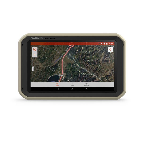
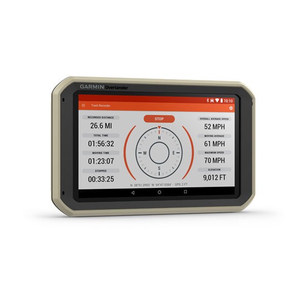
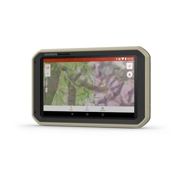
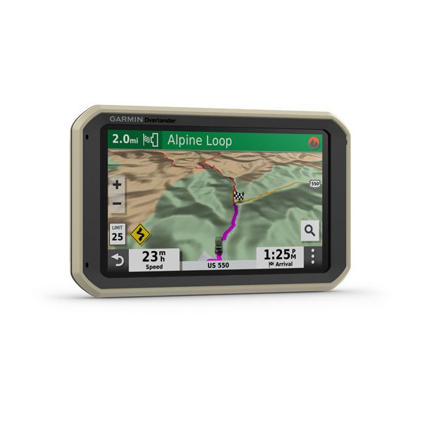
7” color touchscreen features turn-by-turn directions for on-road “turn-by-turn” navigation and topography maps for off-road “point-to-point” guidance in North and South America. Also compatible with HuntView maps (sold separately).
MILITARY STANDARD 810:

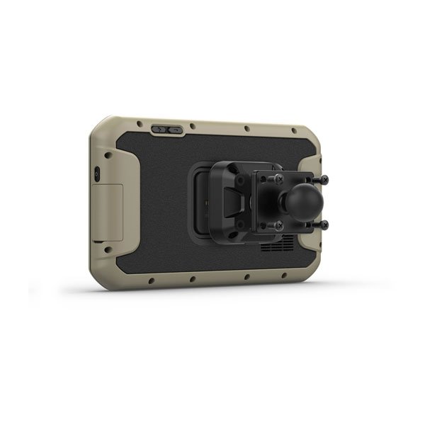
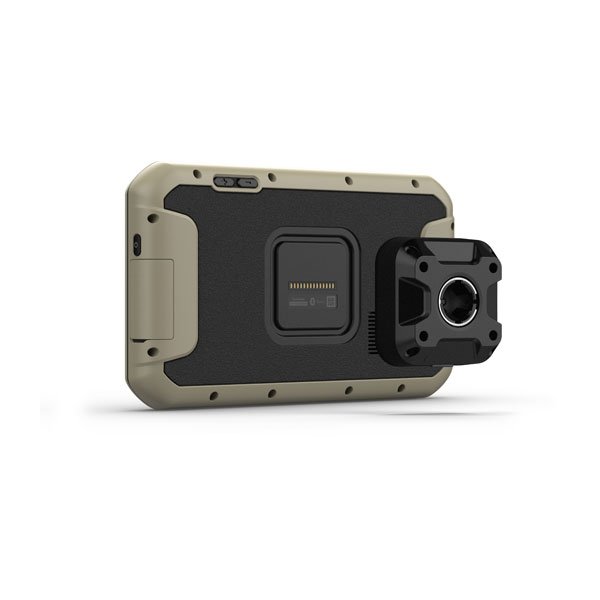
Overlander is built to the U.S. military standard 810 for thermal and shock resistance. It can be mounted anywhere, thanks to the powered magnetic mount that comes with a suction cup and 1” ball adapter with AMPS plate compatible with RAM mounting systems.
IP5X DUST RATING:

This essential piece of Overlanding gear is purpose-built from the circuit board up and is designed to withstand dust and extreme temperatures.
GARMIN EXPLORE:

Use the Garmin Explore app to download additional maps — such as satellite imagery and USGS quad sheets on 64 GB of internal storage — and sync all your data between devices. Easily import and export GPX files to Garmin Explore — even if offline.
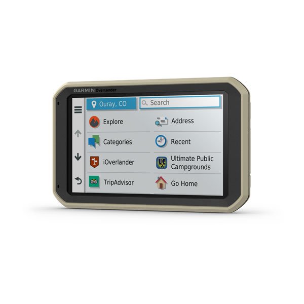
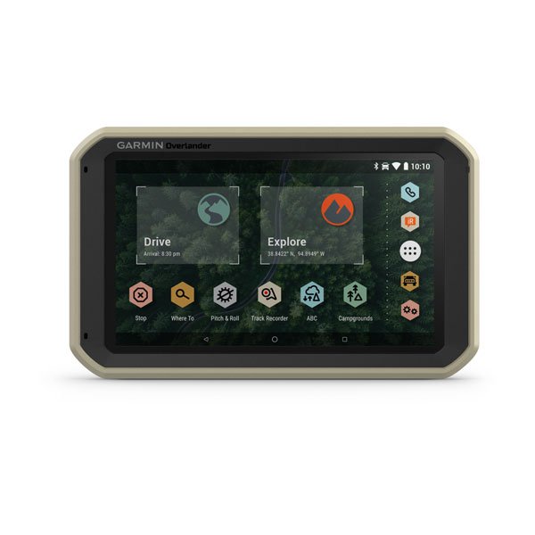
FIND CAMPSITES:

Overlander is preloaded with iOverlander POIs and Ultimate Public Campgrounds, so you don’t need a cell signal to route to the best-established, wild, and dispersed campsites.
FIND BOUNDARIES:

Overlander features topographic maps, including public land boundaries, 4x4 roads, forest service roads, waterways, trails and other land use data.
KNOW YOUR VEHICLE:

Customize street navigation for the size and weight of your overlanding vehicle, plus get alerts for upcoming bridge heights, weight limits, sharp curves, steep grades and more.
MULTI-GNSS SUPPORT:

GPS, GLONASS, and Galileo support help track in more challenging environments than GPS alone.
NAVIGATION TOOLS:

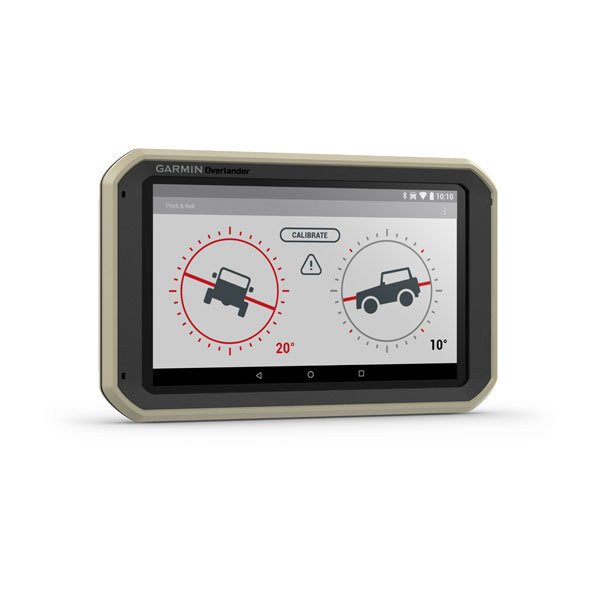
All of your Overlanding equipment — such as a built-in compass, altimeter, and barometer — is now in one device.
The right tools for the roughest roads.

Specifications:
- BRAND NAME: GARMIN Overlander®
- PHYSICAL DIMENSIONS: 7.84" W x 4.79" H x 0.93" D (19.9 x 12.2 x 2.4 cm)
- DISPLAY SIZE: 6.0" W x 3.5" H (15.2 x 8.9 cm); 6.95" (17.7 cm)
- DISPLAY RESOLUTION: 1024 x 600 pixels
- DISPLAY TYPE: multi-touch, glass, WSVGA color TFT with white backlight
- WEIGHT: 15.4 oz (437 g)
- BATTERY TYPE: rechargeable lithium-ion
- BATTERY LIFE: up to 3 hours
- DROP RATING: MIL-STD-810
- DUST RATING: IP5X
- MAGNETIC MOUNT: 1" BALL ADAPTER WITH AMPS PLATE
- RELOADED STREET MAPS Yes
- DATA CARDS microSD™ card (not included)
- 3D TERRAIN Yes
- INTERNAL STORAGE 64 GB
- INCLUDES MAP UPDATES Yes
- DOWNLOADABLE SATELLITE IMAGERY Yes (U.S. only)
- DOWNLOADABLE USGS QUAD SHEETS Yes
In The Box:
- Overlander
- Vehicle suction cup with a powered magnetic mount
- 1" ball adapter with AMPS plate
- Vehicle power cable
- USB cable
- Documentation
Package Included:
- 1x Overlander