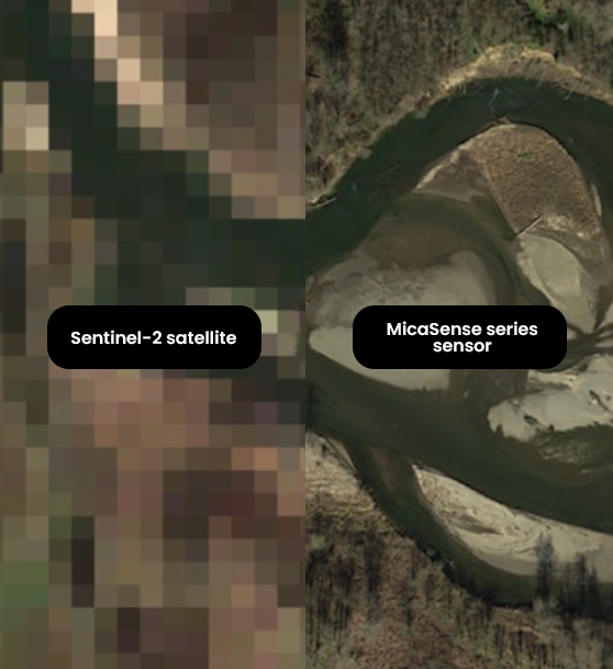
Correlate drone and satellite data
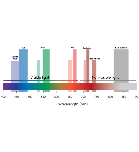
The RedEdge-P dual bands cover Landsat 8 and Sentinel-2 satellite bands (~10 m / 32 ft per pixel) at an enhanced spatial resolution of 2 cm / 0.8 in. It enables the use of many indices already created using satellites.