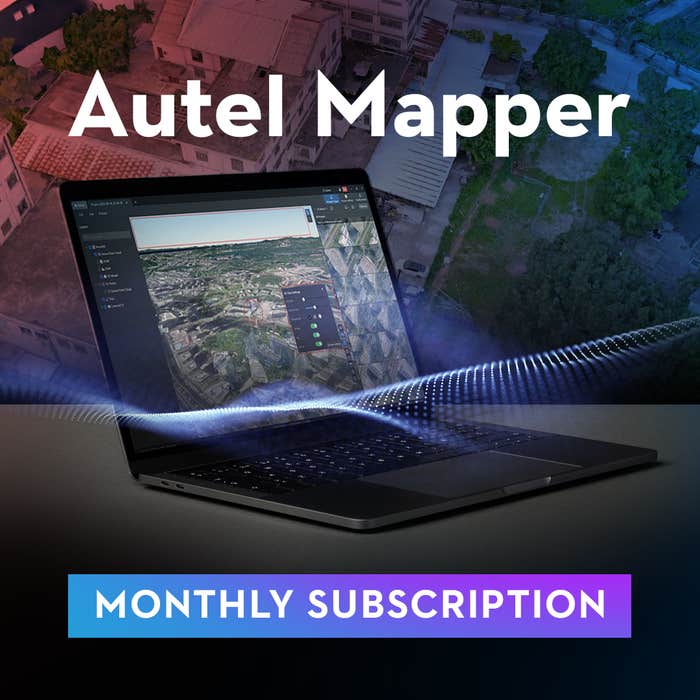
Skip to product information
1 of 3

Autel

Autel Mapper Monthly, Perpetual and Yearly Subscription Drone Software

Autel Mapper Monthly, Perpetual and Yearly Subscription Drone Software

Regular price $1,490.00 USD
Regular price Sale price $1,490.00 USD
Sale Sold out
Shipping calculated at checkout.
Subscription

Autel Mapper Monthly, Perpetual and Yearly Subscription Drone Software

DESCRIPTION

Autel Mapper Yearly Subscription

Autel Mapper Yearly Subscription offers dynamic and professional-grade PC model reconstruction software capabilities, perfect for creating detailed 2D and 3D models from aerial drone data. With its yearly subscription model, users gain access to the latest deep learning and algorithmic advancements for superior reconstruction efficiency and quality in various fields, including surveying, mapping, and construction.

Features and Benefits

  • Rapid and Precise Mapping: Employs cutting-edge AI algorithms for fast, accurate 2D and 3D model reconstructions, enhancing model and map quality.

  • Superior 3D Model Reconstruction: Combines algorithms to significantly enhance 3D model completeness, with customizable quality settings for diverse industrial applications.

  • Adaptive 2D Reconstruction: Utilizes deep learning to adjust AI algorithms for different scenarios, achieving high precision without the need for GCPs.

  • Comprehensive Aerial Triangulation: Supports diverse camera technologies and manages extensive datasets with sophisticated matching algorithms for varied resolutions and elevations.

  • Real-time 2D Imaging: Streams live drone imagery for instant 2D map stitching, enabling on-site workflow adjustments with advanced imaging algorithms.

  • Quick Batch Stitching: Quickly processes images from Autel drones, producing 2D maps and renderings efficiently through advanced algorithms.

  • Scalable Project Handling: Offers easy data import/export with networking and cloud support for managing projects of any scale efficiently.

  • Intuitive User Experience: Provides a straightforward workflow for users to engage with their projects effortlessly and effectively.

  • Enhanced by Cloud Technology: Utilizes cloud computing for faster rendering and output, improving project delivery times.

Applications

Designed for use in public safety, surveying and mapping, search and rescue, and powerline inspection.

Quality Rebuild and System Requirements

Features comprehensive mapping and quality evaluation tools. Compatible with Windows 10 or later (64-bit) and requires specified hardware for best performance.

SPECIFICATION

Operating System & Type

Specification Details
Operating System Windows 10 or later (64-bit)
Type 2D/3D Reconstruction

Computer Specifications

Specification Minimum Recommended
CPU Intel Core i5 8 series or AMD Ryzen 5 3000 series Intel Core i7 11 series or newer or AMD Ryzen 7 5000 series or newer
GPU NVIDIA GeForce GTX1070 NVIDIA GeForce RTX 2080 Ti or higher
VRAM 6GB 8GB or higher
RAM 16GB 32GB or higher
Storage 200GB of usable hard drive space 256GB SSD + 2TB Enterprise HDD
Display 1280x1024 1920x1080 or higher

Function and Performance Specifications

Feature Specification Details
3D Reconstruction Standalone Task 500 images/1GB free memory
Standalone Time Required 10,000 images in 18 hours
Accuracy Centimeter level (1:500 mapping accuracy)
Output Format B3DM, OSGB, OBJ, PLY
2D Reconstruction Standalone Task 500 images/1GB free memory
Standalone Time Required 8000 sheets in 6 hours
Accuracy Centimeter level (1:500 mapping accuracy)
Output Format GeoTIFF
Quick Stitching Output Format DOM, DSM, 2.5D visualization
Supported Output Platforms App, Autel SkyCommand Center, third-party platforms
Stitching Methods On-the-fly stitching, Rapid processing
Aerial Triangulation Pass Rate 0.98
Dense Point Clouds Output Format PNTS, LAS, XYZ
Rebuild Optimization KML Import Support
Model Reconstruction Processing
Camera Parameters
Image POS Data Management
Ground Control Point (GCP) Management

IN THE BOX

  • 1x Autel Mapper Yearly subscription

Autel Mapper Perpetual

Autel Mapper Perpetual is a premier PC model reconstruction software, engineered for generating high-precision 2D and 3D models from drone imagery. By integrating deep learning with traditional algorithms, it delivers unmatched efficiency and quality in reconstruction for sectors like surveying, mapping, security, inspection, transportation, and construction. This perpetual license ensures users have continuous access to the software without the need for subscription renewals.

Features and Benefits

  • Unparalleled Speed and Accuracy: Utilizes advanced AI deep-learning algorithms for rapid and accurate map processing, setting a benchmark in model and map fidelity, especially for small object reconstructions.

  • Enhanced 3D Reconstruction: Offers improved 3D model completeness through a mix of traditional and deep learning algorithms, with selectable reconstruction quality levels to suit various industry needs.
  • Precise 2D Reconstruction: Features deep learning technology for scenario-specific AI algorithm adaptation, meeting the 1:500 precision requirement in surveying and mapping without GCPs.
  • Advanced Aerial Triangulation: Supports an array of camera types and employs intelligent processing for handling large datasets, ensuring efficient data management across different resolutions and heights.
  • Immediate Real-time 2D Stitching: Allows for the streaming of real-time drone imagery for on-the-fly 2D stitching, providing operators with immediate data for workflow adjustments.
  • Efficient Quick Stitching: Facilitates batch image imports from Autel drones, swiftly generating 2D maps and renderings with sophisticated image processing algorithms.
  • Flexible, Scalable Solutions: Easy import/export capabilities, alongside networking and cloud functionalities, offer scalable solutions for any project size.
  • Intuitive, User-Friendly Workflow: Designed for ease of use, allowing users to fully engage in their projects confidently and without complexity.
  • Cloud-Enhanced Productivity: Boosts output and rendering speeds with cloud computing, significantly reducing project turnaround times.

Applications

Ideal for public safety, search and rescue, surveying and mapping, and powerline inspection, among other applications.

Quality Rebuild and System Requirements

Offers robust 2D & 3D mapping capabilities, aerial triangulation, and quality evaluations. Requires Windows 10 or later (64-bit), with recommended hardware specifications for optimal performance.

SPECIFICATION

Operating System & Type

Specification Details
Operating System Windows 10 or later (64-bit)
Type 2D/3D Reconstruction

Computer Specifications

Specification Minimum Recommended
CPU Intel Core i5 8 series or AMD Ryzen 5 3000 series Intel Core i7 11 series or newer or AMD Ryzen 7 5000 series or newer
GPU NVIDIA GeForce GTX1070 NVIDIA GeForce RTX 2080 Ti or higher
VRAM 6GB 8GB or higher
RAM 16GB 32GB or higher
Storage 200GB of usable hard drive space 256GB SSD + 2TB Enterprise HDD
Display 1280x1024 1920x1080 or higher

Function and Performance Specifications

Feature Specification Details
3D Reconstruction Standalone Task 500 images/1GB free memory
Standalone Time Required 10,000 images in 18 hours
Accuracy Centimeter level (1:500 mapping accuracy)
Output Format B3DM, OSGB, OBJ, PLY
2D Reconstruction Standalone Task 500 images/1GB free memory
Standalone Time Required 8000 sheets in 6 hours
Accuracy Centimeter level (1:500 mapping accuracy)
Output Format GeoTIFF
Quick Stitching Output Format DOM, DSM, 2.5D visualization
Supported Output Platforms App, Autel SkyCommand Center, third-party platforms
Stitching Methods On-the-fly stitching, Rapid processing
Aerial Triangulation Pass Rate 0.98
Dense Point Clouds Output Format PNTS, LAS, XYZ
Rebuild Optimization KML Import Support
Model Reconstruction Processing
Camera Parameters
Image POS Data Management
Ground Control Point (GCP) Management

IN THE BOX

  • 1x Autel Mapper Perpetual subscription

Autel Mapper Monthly Subscription

Autel Mapper Monthly Subscription delivers state-of-the-art PC model reconstruction with the flexibility of a monthly subscription. This software is ideal for professionals needing high-quality 2D and 3D models from drone imagery, with the convenience of short-term commitments. It incorporates the latest in deep learning and traditional algorithms to enhance reconstruction quality and efficiency in a variety of applications.

Features and Benefits

  • Fast and Accurate Model Generation: Leverages advanced AI deep-learning algorithms for speedy and precise 2D and 3D reconstructions, ensuring top-notch model quality.
  • Enhanced 3D Modeling: Merges traditional and deep learning algorithms to improve 3D model completeness, with adjustable quality for different industry needs.
  • Precision 2D Reconstruction: Adapts AI algorithms to specific scenarios with deep learning technology, achieving exceptional precision without GCPs.
  • Efficient Aerial Triangulation: Accommodates various camera types and intelligently processes large data volumes, ensuring effective management of datasets.
  • Real-time 2D Stitching: Enables live streaming of drone imagery for immediate 2D stitching, using sophisticated algorithms for high-precision orthophoto images.
  • Rapid Stitching Process: Supports batch processing of Autel drone images, quickly generating 2D maps and renderings with advanced orthorectification algorithms.
  • Flexible and Scalable: Simplifies project management with easy data import/export and the integration of networking and cloud functionalities.
  • User-Friendly Workflow: Offers an intuitive interface and workflow, allowing users to navigate and manage projects with ease.
  • Cloud Optimization: Benefits from cloud computing for accelerated rendering and output, streamlining project completion.

Applications

Suitable for applications in public safety, surveying and mapping, search and rescue, and powerline inspection.

Quality Rebuild and System Requirements

Provides full capabilities for 2D & 3D mapping, aerial triangulation, and evaluations. Requires Windows 10 or later (64-bit), with recommended hardware for optimal performance.

SPECIFICATION

Operating System & Type

Specification Details
Operating System Windows 10 or later (64-bit)
Type 2D/3D Reconstruction

Computer Specifications

Specification Minimum Recommended
CPU Intel Core i5 8 series or AMD Ryzen 5 3000 series Intel Core i7 11 series or newer or AMD Ryzen 7 5000 series or newer
GPU NVIDIA GeForce GTX1070 NVIDIA GeForce RTX 2080 Ti or higher
VRAM 6GB 8GB or higher
RAM 16GB 32GB or higher
Storage 200GB of usable hard drive space 256GB SSD + 2TB Enterprise HDD
Display 1280x1024 1920x1080 or higher

Function and Performance Specifications

Feature Specification Details
3D Reconstruction Standalone Task 500 images/1GB free memory
Standalone Time Required 10,000 images in 18 hours
Accuracy Centimeter level (1:500 mapping accuracy)
Output Format B3DM, OSGB, OBJ, PLY
2D Reconstruction Standalone Task 500 images/1GB free memory
Standalone Time Required 8000 sheets in 6 hours
Accuracy Centimeter level (1:500 mapping accuracy)
Output Format GeoTIFF
Quick Stitching Output Format DOM, DSM, 2.5D visualization
Supported Output Platforms App, Autel SkyCommand Center, third-party platforms
Stitching Methods On-the-fly stitching, Rapid processing
Aerial Triangulation Pass Rate 0.98
Dense Point Clouds Output Format PNTS, LAS, XYZ
Rebuild Optimization KML Import Support
Model Reconstruction Processing
Camera Parameters
Image POS Data Management
Ground Control Point (GCP) Management

IN THE BOX

  • 1x Autel Mapper Monthly subscription

Drone Services

https://rippingitoutdoors.com/pages/drone-services

    View full details