


Autel Robotics EVO Max RTK Module | UM037 | Precision RTK Positioning | High‑Accuracy Mapping | For EVO Max
Autel Robotics EVO Max RTK Module | UM037 | Precision RTK Positioning | High‑Accuracy Mapping | For EVO Max
Couldn't load pickup availability
Couldn't load pickup availability


Product Description
Autel Robotics EVO Max RTK Module | UM037 | Precision RTK Positioning | High‑Accuracy Mapping | For EVO Max
DESCRIPTION
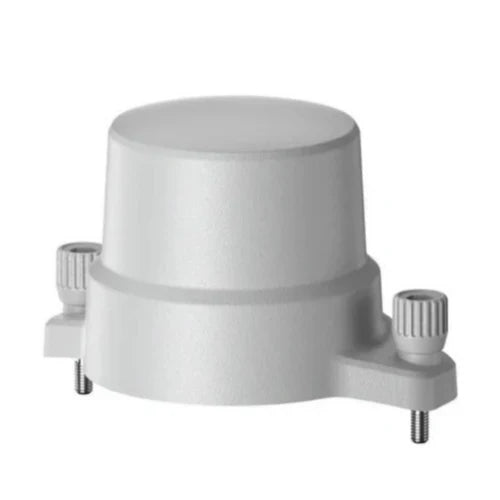
The Autel EVO Max RTK Module elevates your drone’s performance with centimeter‑level positioning, delivering unmatched accuracy for surveying, mapping, and inspection workflows. Engineered for the EVO Max series, this advanced module integrates seamlessly to provide real‑time kinematic corrections, ensuring stable flight paths, precise waypoint missions, and highly reliable data capture. Its lightweight, compact design makes installation effortless while maintaining rugged durability for demanding field environments. With enhanced GNSS multi‑band support, improved anti‑interference capability, and rapid satellite acquisition, the EVO Max RTK Module empowers professionals to achieve superior geospatial accuracy, streamline operations, and maximize productivity across construction, agriculture, utilities, and public safety applications.
Key Features
- High‑Precision RTK Positioning Achieve centimeter‑level accuracy for mapping, surveying, and inspection tasks with advanced GNSS correction technology. Ideal for professionals requiring reliable geospatial precision in complex environments.
- Seamless EVO Max Integration Designed specifically for the Autel EVO Max platform, ensuring effortless installation, stable connectivity, and optimized performance for mission‑critical workflows.
- Multi‑Band GNSS Support Utilizes GPS, GLONASS, Galileo, and BeiDou for faster satellite acquisition, improved signal stability, and enhanced accuracy in challenging or obstructed environments.
- Real‑Time Kinematic Corrections Delivers continuous, real‑time correction data to maintain consistent flight paths and precise waypoint navigation during automated missions.
- Enhanced Anti‑Interference Design Built to operate reliably in areas with magnetic or RF interference, ensuring stable positioning and uninterrupted mission execution.
- Lightweight Compact Build Engineered for portability and quick deployment without adding unnecessary weight to the aircraft, maintaining optimal flight performance.
- Professional Mapping Capability Enables high‑accuracy photogrammetry, 3D modeling, and topographic mapping for construction, utilities, and land management applications.
- Improved Mission Efficiency Reduces ground control point requirements, accelerating field operations and improving workflow efficiency for large‑scale projects.
- Secure Data Transmission Ensures stable, encrypted communication between the drone and RTK base station or network for dependable mission performance.
- Fast Satellite Lock‑On Rapid initialization allows operators to begin missions quickly, minimizing downtime and maximizing productivity in the field.
- Durable Field‑Ready Housing Built with rugged materials to withstand demanding outdoor conditions, ensuring long‑term reliability and consistent performance.
- Plug‑and‑Play Operation Simple attachment and automatic recognition by the EVO Max system make setup intuitive for both new and experienced operators.
- Optimized for Enterprise Use Ideal for public safety, infrastructure inspection, agriculture, and environmental monitoring requiring precise geospatial data.
- Stable Hover & Flight Control Enhances drone stability during stationary and automated flight, improving data quality and mission accuracy.
- Supports Network RTK Services Compatible with NTRIP and other correction networks, expanding operational flexibility across diverse job sites.
Detailed Specifications
| Specification | Details |
|---|---|
| Brand | Autel |
| Product Name | EVO Max RTK Module |
| Model Number | UM037 |
| Compatibility | Autel EVO Max Series |
| Positioning Accuracy | Centimeter‑level RTK |
| GNSS Support | GPS, GLONASS, Galileo, BeiDou |
| Correction Type | RTK / NTRIP |
| Connectivity | Direct EVO Max Interface |
| Operating Frequency | Multi‑band GNSS |
| Module Color | Grey |
| Dimensions | Compact, low‑profile design |
| Weight | Lightweight for optimal flight |
| UPC | 889520209854 |
| SKU | 102002596 |
| Manufacturer | Autel Robotics |
| Use Case | Surveying, Mapping, Inspection |
Manuals & Documents
General Warranty Info:
- Ripping It Outdoors works closely with our manufacturers to supply and support your products warranty needs as best as possible!
- The majority of products come with a manufacturer represented warranty against manufacturing defects for at least a 12 month period after the date of sale.
- Expendable components and "wear parts" including but not limited to blades, knives, teeth, oil, chain sprockets, skid shoes, knife mounting discs, and similar components are usually excluded from manufacturer warranties.
- Please reach out to us for any specific warranty information needed about products and parts you can’t find!
Videos
Shipping
General Shipping Info:
- Instantly calculate shipping quotes to the lower 48 states by 1. adding this product to your cart, 2. click continue to the checkout page and 3. enter your shipping address to check rates. Contact us for quotes for shipping to Hawaii, Alaska, Canada, Mexico and Internationally.
- Complimentary lift gate service on all freight shipments where it’s possible. We guarantee safe delivery!
- Low shipping rates for customers. We have negotiated the best possible rates for customers from our trusted carriers (ODFL, ESTES, UPS, and FedEx).
- Negotiate shipping rates if you think we can do better please reach out. Keep in mind some shipping rates also include assembly & configuration as well!