


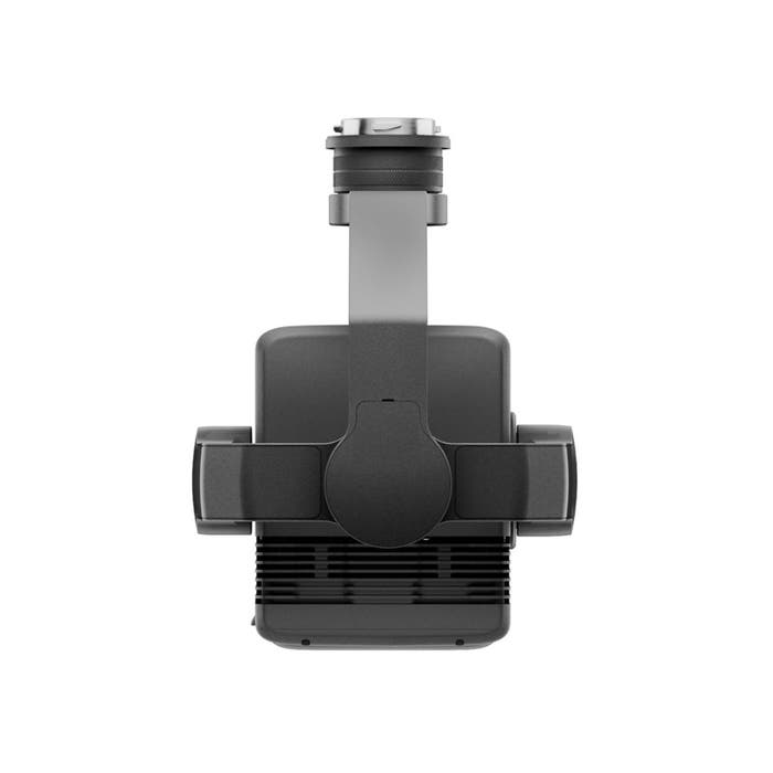
DJI Zenmuse L2 Camera | High-Precision Aerial LiDAR System | Care Plus
DJI Zenmuse L2 Camera | High-Precision Aerial LiDAR System | Care Plus
Couldn't load pickup availability
Couldn't load pickup availability


Product Description
DJI Zenmuse L2 Camera | High-Precision Aerial LiDAR System | Care Plus
DESCRIPTION
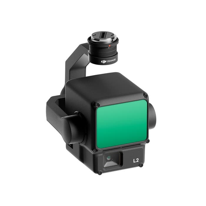
The DJI Zenmuse L2 is an advanced LiDAR system, building upon the success of its predecessor, the Zenmuse L1. It offers improved features, including an enhanced RGB camera, upgraded LiDAR module, and enhanced accuracy, making it a valuable tool for professionals.
Increased hardware power and efficiency
The Zenmuse L2 leverages aerial LiDAR technology to provide efficient and precise 3D data acquisition for professionals in various fields, such as land surveying, mapping, electricity inspection, forestry, and infrastructure management.
It significantly reduces workload and field measurement time while improving detection efficiency.
Perfect for DJI Matrice 300/350 RTK
The Zenmuse L2 incorporates a high-accuracy IMU system and integrates seamlessly with DJI Matrice 300 RTK and Matrice 350 RTK drones.
This combination delivers accurate and efficient data collection while enhancing in-the-field experiences with immediate readiness and high precision.
Improved detection range and safety
With a 30% increase in detection range compared to its predecessor, the Zenmuse L2 enhances operational safety and efficiency. It detects objects from greater distances, has a reduced spot size for more detailed data, and supports multiple return modes for enhanced data acquisition.
Enhanced imaging and reduced operational costs
The Zenmuse L2 features an upgraded RGB mapping camera with improved imaging and colorized point cloud details.
It offers reduced photo intervals, extended shutter life, and the ability to capture photos and videos, even when point cloud data isn't necessary.
Software for control and data processing
DJI Pilot 2 software offers various display modes and real-time monitoring options, enhancing control during operation. It provides access to distance information and supports real-time point cloud coloring.
Additionally, it can generate route operation quality reports and offers point cloud processing.
One tool, multiple use cases
The Zenmuse L2, in combination with DJI Matrice 300 RTK or Matrice 350 RTK drones and DJI Terra software, is suitable for various industries. It excels in applications such as topographic mapping, forestry, and electricity inspection, offering efficient data collection and analysis for diverse scenarios.
More protection with DJI Care Enterprise
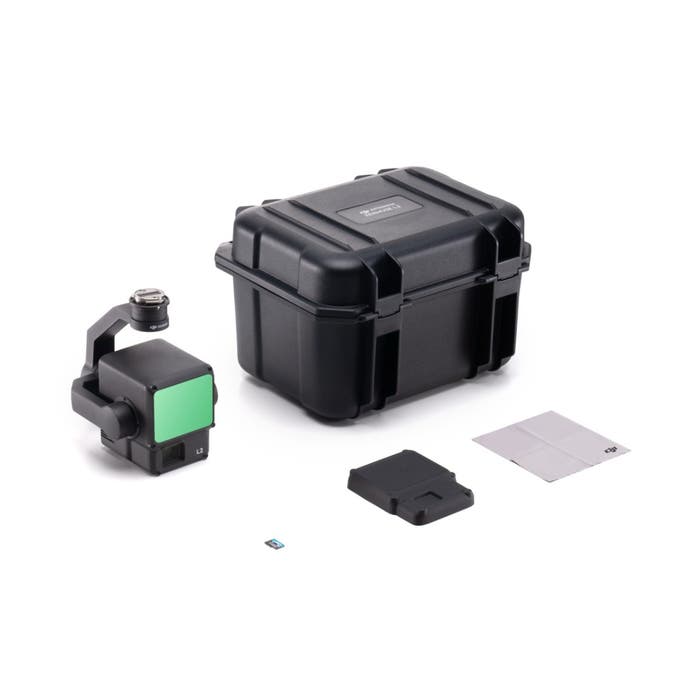
This DJI Zenmuse L2 LiDAR Camera with Care Enterprise Plus package comes with 1-year coverage of DJI Care Enterprise Plus Plan.
The plan includes water damage coverage, unlimited free repair services within the coverage amount, unlimited sharing coverage for your whole fleet, and free two-way shipping.
In summary, the DJI Zenmuse L2 represents a significant advancement in LiDAR technology, building on the success of its predecessor, the Zenmuse L1. Its enhanced features, including an upgraded RGB camera, improved LiDAR module, and higher accuracy, make it an invaluable tool for professionals across multiple industries.
Key Features
- Enhanced Detection: 30% increase in detection range, supporting up to 450m with high accuracy.
- RGB Mapping Camera: 20MP resolution with a 4/3 CMOS sensor, capturing detailed images and colorizing point clouds.
- LiDAR Technology: 1,200,000 pts/s point cloud rate and support for multiple returns for comprehensive data collection.
- Durable Design: IP54-rated for dust and water resistance, suitable for challenging environments.
- DJI Terra Compatibility: Supports post-processing of point cloud models in various formats, including PNTS, LAS, PLY, and more.
Detailed Specification
General Specifications
| Attribute | Details |
|---|---|
| Product Name | Zenmuse L2 |
| Dimensions | 155 × 128 × 176 mm |
| Weight | 905 ± 5 g |
| Power Consumption | 28 W (typical), 58 W (max) |
| Ingress Protection Rating | IP54 |
| Supported Aircraft | DJI Matrice 300/350 RTK |
LiDAR Performance
| Attribute | Details |
|---|---|
| Detection Range | 450m @ 50% reflectivity |
| Point Cloud Rate | Up to 1,200,000 pts/s |
| System Accuracy | Horizontal: 5cm @ 150m |
| Vertical: 4cm @ 150m | |
| Scanning Modes | Repetitive and Non-repetitive |
RGB Mapping Camera
| Attribute | Details |
|---|---|
| Sensor | 4/3 CMOS, 20 MP |
| Lens | 24 mm format equivalent, f/2.8 |
| Shutter Speed | Mechanical: 2-1/2000 s |
| Electronic: 2-1/8000 s |
Gimbal Specifications
| Attribute | Details |
|---|---|
| Stabilization System | 3-axis (tilt, roll, pan) |
| Angular Vibration Range | ±0.01° |
| Mechanical Range | Tilt: -143° to +43° |
| Pan: ±105° |
Manuals & Documents
General Warranty Info:
- Ripping It Outdoors works closely with our manufacturers to supply and support your products warranty needs as best as possible!
- The majority of products come with a manufacturer represented warranty against manufacturing defects for at least a 12 month period after the date of sale.
- Expendable components and "wear parts" including but not limited to blades, knives, teeth, oil, chain sprockets, skid shoes, knife mounting discs, and similar components are usually excluded from manufacturer warranties.
- Please reach out to us for any specific warranty information needed about products and parts you can’t find!
Videos
Shipping
General Shipping Info:
- Instantly calculate shipping quotes to the lower 48 states by 1. adding this product to your cart, 2. click continue to the checkout page and 3. enter your shipping address to check rates. Contact us for quotes for shipping to Hawaii, Alaska, Canada, Mexico and Internationally.
- Complimentary lift gate service on all freight shipments where it’s possible. We guarantee safe delivery!
- Low shipping rates for customers. We have negotiated the best possible rates for customers from our trusted carriers (ODFL, ESTES, UPS, and FedEx).
- Negotiate shipping rates if you think we can do better please reach out. Keep in mind some shipping rates also include assembly & configuration as well!