


| Category | Specification |
|---|---|
| Detection Range | 80 m (reflectivity ≥ 10%) |
| Detection Range | 200 m (reflectivity ≥ 54%) |
| Detection Range | 300 m (reflectivity ≥ 90%) |
| Accuracy (Vertical) | 5 cm @ 70m |
| Typical Flight Speed | 5-10 m/s |
| Weight | 1.12 kg |
| Memory | 256 GB TF Card |
| Voltage | 12~24 V |
| Power Consumption | 24 W |
| Operating Temperature | -20~50 ℃ |
| Storage Temperature | -30~60 ℃ |
| Communication | WIFI |
| LiDAR Unit | |
| Wavelength | 905 nm |
| Number of Channels | 32 |
| Point Rate | |
| First Return | 640,000 points/s |
| Dual Return | 1,280,000 points/s |
| Triple Return | 1,920,000 points/s |
| FOV | 360° (Horizontal)×40.3° (Vertical) |
| Number of Returns | 3 |
| Inertial Navigation System | |
| GNSS | GPS, GLONASS, Galileo, BD |
| Azimuth Accuracy | 0.038° |
| Attitude Accuracy | 0.008° |
| IMU Data Frequency | 200 Hz |
| Camera | |
| Pixels | 26 Megapixels |
| Image Size | 6252×4168 |
| Focal Length | 16 mm / 24 mm (Equiv. Focal Length) |
| Software | |
| Pre-processing | LiGeoreference |
| Post-processing | LiDAR360 / LiPowerline (Optional) |
| Compatible Platforms | |
| Platforms | DJI, Freefly, etc. |
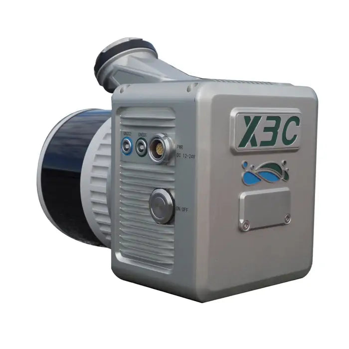
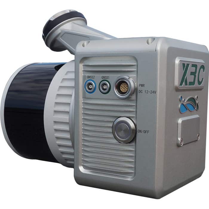
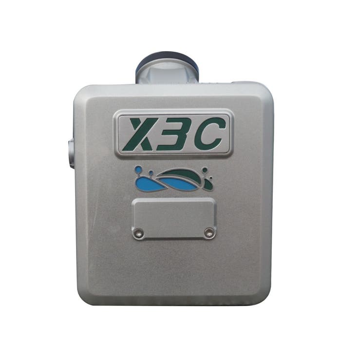
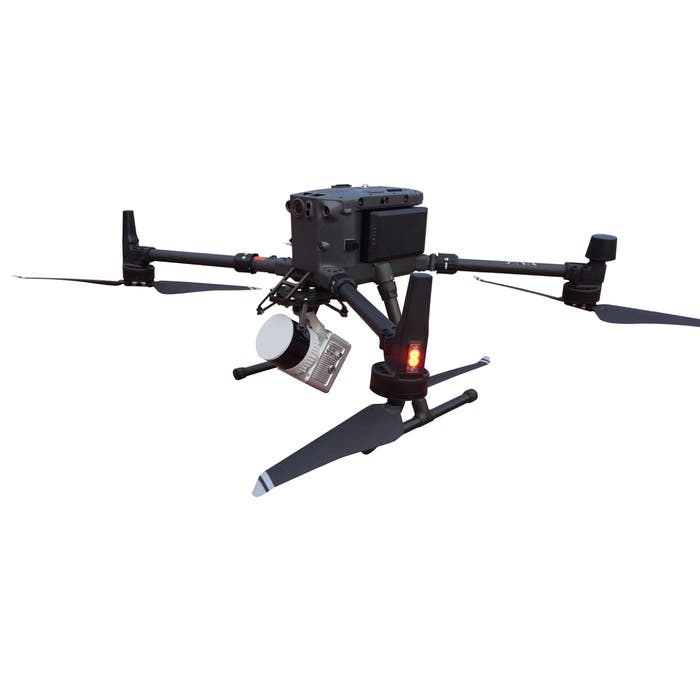
Green Valley LiAir X3C-H Compact UAV LiDAR System | Detects Up To 300m | Optional LiDAR360 Software
Green Valley LiAir X3C-H Compact UAV LiDAR System | Detects Up To 300m | Optional LiDAR360 Software
Regular price
$19,400.00
Regular price
Sale price
$19,400.00
Unit price
per
Couldn't load pickup availability
Couldn't load pickup availability


Product Description
Green Valley LiAir X3C-H Compact UAV LiDAR System | Detects Up To 300m | Optional LiDAR360 Software
Description
Experience next-level LiDAR performance and versatility with the GreenValley LiAir X3C-H Compact UAV LiDAR System. This state-of-the-art solution is designed for various industries, including power line inspection, topographic surveying, agricultural monitoring, and forest management. Developed by GreenValley International, this system combines lightweight LiDAR technology, an advanced navigation system, and a high-resolution camera to deliver precise and efficient data collection, all in a compact and portable design.
Key Features
- Lightweight, 1.12 kg for easy UAV integration
- Detects up to 300m with 90% reflectivity
- 26MP camera for detailed imaging
- 360° FOV for comprehensive coverage
- Intelligent flight control minimizes redundant data
- Optional LiDAR360 software for advanced processing
- Compatible with DJI Matrice 300 RTK and Matrice 350 RTK
Detailed Specifications
Manual & Documents
General Warranty Info:
- Ripping It Outdoors works closely with our manufacturers to supply and support your products warranty needs as best as possible!
- The majority of products come with a manufacturer represented warranty against manufacturing defects for at least a 12 month period after the date of sale.
- Expendable components and "wear parts" including but not limited to blades, knives, teeth, oil, chain sprockets, skid shoes, knife mounting discs, and similar components are usually excluded from manufacturer warranties.
- Please reach out to us for any specific warranty information needed about products and parts you can’t find!
Videos
Shipping
General Shipping Info:
- Instantly calculate shipping quotes to the lower 48 states by 1. adding this product to your cart, 2. click continue to the checkout page and 3. enter your shipping address to check rates. Contact us for quotes for shipping to Hawaii, Alaska, Canada, Mexico and Internationally.
- Complimentary lift gate service on all freight shipments where it’s possible. We guarantee safe delivery!
- Low shipping rates for customers. We have negotiated the best possible rates for customers from our trusted carriers (ODFL, ESTES, UPS, and FedEx).
- Negotiate shipping rates if you think we can do better please reach out. Keep in mind some shipping rates also include assembly & configuration as well!