


Green Valley Lidar Systems-LiAir V70 LiDAR Mapping System
Green Valley Lidar Systems-LiAir V70 LiDAR Mapping System
Couldn't load pickup availability
Couldn't load pickup availability


How To Get A Quote
***Online pricing not available, Please request a quote:***
How To Get A Quote:
Option 1:
“Contact Us to make sure you are getting the best unit possible. These machines are complex so let us help you get exactly what you need!
Option 2: (quickest response times)
Step 1. Add the item to your cart
Step 2. Checkout or Click on the Chat button box that is at the bottom right of your screen
Step 3. Please tell us any info you think we would need to know
Step 4. Relax, our team is processing your request and an expert will be in touch to get you exactly what you need!
Product Description
Green Valley Lidar Systems-LiAir V70 LiDAR Mapping System
Description
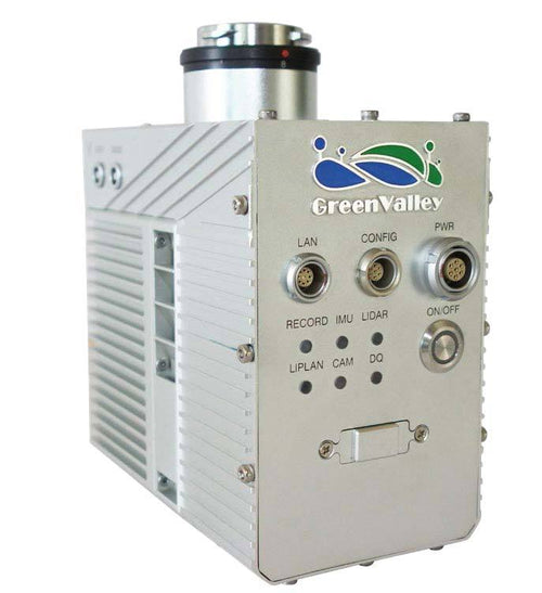
The LiAir V70 is a lightweight and cost-effective drone-mounted LiDAR system from GreenValley International (GVI), designed for high-accuracy 3D surveying and mapping applications. Featuring the Livox AVIA laser scanner, this system ensures precise 3D point cloud data collection with exceptional range and accuracy.
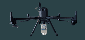
Built for compatibility with DJI’s Matrice 600 Pro, M300 RTK, and Matrice 210 series platforms, the LiAir V70 is easy to integrate and deploy. It also offers an optional high-definition camera, enabling the generation of photogrammetry products and true color 3D point clouds. With its wide field of view and fast scan rate, the LiAir V70 is perfect for forestry, surveying, and a variety of other industries requiring affordable yet powerful LiDAR solutions.
Key Features
- Livox AVIA Laser Scanner: Delivers exceptional range accuracy of ±2 cm and system accuracy of ±5 cm.
- Fast and Efficient Scanning: Achieves up to 720,000 pts/s with triple return for rapid data collection.
- Compact and Lightweight: Weighs only 1.1 kg, making it easy to integrate with drone platforms.
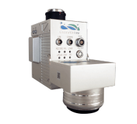
- Optional High-Definition Camera: Enhance mapping outputs with photogrammetry products and true color point clouds.
- Proprietary Software Integration: Includes LiPlan for route planning and LiAcquire for data acquisition.
Detailed Specifications
| Specification | Details |
|---|---|
| Laser Sensor | Livox AVIA |
| Range Accuracy | ±2 cm |
| Scan Range | 190 m @ 10% reflectance, 230 m @ 20%, 320 m @ 80% reflectance |
| System Accuracy | ±5 cm |
| POS System Performance | Attitude: 0.008° (1σ), Azimuth: 0.038° (1σ) |
| Onboard Storage | 128 GB |
| Weight (Excl. Battery) | 1.1 kg (Including Camera) |
| Dimensions | 11081.6140.2 mm |
| Route Planning Software | LiPlan (proprietary) |
| Acquisition/PP Software | LiAcquire web, LiGeoreference |
| Field of View | 70.4° |
| Scan Rate | 240,000 pts/s (first return), 480,000 pts/s (dual return), 720,000 pts/s (triple return) |
Applications
- Forestry: Precision mapping for forest management and ecological studies.
- Surveying: Accurate 3D data collection for land and infrastructure surveys.
- Construction: High-resolution mapping for project planning and monitoring.
- Utilities: Inspection and mapping of power lines, pipelines, and other infrastructure.
- Environmental Monitoring: Generate 3D models for environmental assessments and monitoring.
In Package
- LiAir V70 Main Unit
- Livox AVIA Laser Scanner
- Optional High-Definition Camera
- Onboard Storage (128 GB)
- LiPlan and LiAcquire Software Licenses
- User Manual and Documentation
Manuals & Documents
General Warranty Info
GreenValley International works closely with its manufacturing partners to ensure that your warranty needs are met.
The majority of products come with a manufacturer-represented warranty covering manufacturing defects for at least a 12-month period after the date of sale.
Expendable components and "wear parts", such as batteries and storage devices, may be excluded from warranty coverage.
Please contact us for specific warranty details regarding products and parts you cannot find!
Videos
Shipping
$1 Shipping Quote Info:
- Contact Us For Shipping Quotes. All $1 products are listed as quote only because we can not display their pricing online.
- Low shipping rates for customers. We have negotiated the best possible rates for customers from our trusted carriers (ODFL, ESTES, UPS, and FedEx) & Top Private Drivers
- Negotiate shipping rates if you think we can do better please reach out. Keep in mind some shipping rates also include assembly & configuration as well!
- Complimentary lift gate service on all freight shipments where it’s possible. We guarantee safe delivery!