


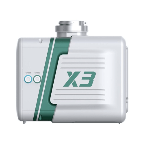
Green Valley Lidar Systems-LiAir X3 LiDAR Mapping System
Green Valley Lidar Systems-LiAir X3 LiDAR Mapping System
Couldn't load pickup availability
Couldn't load pickup availability


Product Description
Green Valley Lidar Systems-LiAir X3 LiDAR Mapping System
Description
The LiAir X3 Compact LiDAR System by GreenValley International is the newest addition to the LiAir series, designed to elevate efficiency and precision in aerial mapping and surveying. With its innovative integrated design, this lightweight system incorporates a powerful LiDAR sensor, high-resolution camera, self-developed inertial navigation, and onboard computer systems for seamless operation.
The LiAir X3 features an upgraded 26MP mapping camera for ultra-clear images and true-color point clouds, making it an ideal choice for photogrammetry and high-resolution mapping projects. The LiPlan Flight Assistance Software simplifies fieldwork by offering real-time point cloud display, parameter adjustment, and status monitoring directly on compatible remote controllers.
Rugged, efficient, and user-friendly, the LiAir X3 is built to handle diverse environments, ensuring reliable performance across various mapping and surveying applications.
Key Features
- Integrated Design: Combines lightweight LiDAR, high-resolution camera, GNSS, and IMU into one compact unit.
- High-Performance LiDAR: 905nm wavelength, 240,000 points/s scan rate, and up to 3 returns for detailed, accurate data.
- Advanced GNSS & IMU Systems: GPS, GLONASS, BeiDou support with 0.038° azimuth and 0.008° attitude accuracy.
- Powerful Camera: 26MP APS-C sensor with options for 16mm or 24mm focal lengths, delivering sharp and detailed orthophotos.
- Optimized Workflow: Pre- and post-processing software (LiGeoreference and LiDAR360) ensure efficient data alignment and analysis.
- Durable & Efficient: IP54-rated, lightweight at just 1.25kg, and low power consumption of 22W for extended operation.
Applications
Aerial Mapping
- Generate accurate topographical maps with high-resolution LiDAR data.
Surveying
- Simplify land, environmental, and infrastructure surveys with real-time monitoring and precise measurements.
Photogrammetry
- Produce true-color point clouds and orthophotos for detailed analysis.
Environmental Studies
- Conduct terrain modeling, vegetation analysis, and resource management with precision data.
Detailed Specifications
System Parameters
| Feature | Specification |
|---|---|
| Detection Range | 190m @ 10% reflectance, 450m @ 80% reflectance |
| System Accuracy (Vertical) | 5cm @ 70m |
| Dimensions | 136 x 106 x 138 mm |
| Weight | 1.25kg |
| Internal Storage | 256G TF Card |
| Power Consumption | 22W |
| Operating Temperature | -20°C to 50°C |
| Storage Temperature | -30°C to 60°C |
LiDAR Sensor Parameters
| Feature | Specification |
|---|---|
| Wavelength | 905nm |
| Laser Class | Class 1 |
| Range Accuracy | 2cm (1σ@20m) |
| FOV | 70.4° (H) × 4.5° (V) |
| Scan Rate | 240,000 points/s |
| Returns | Up to 3 |
Inertial Navigation System
| Feature | Specification |
|---|---|
| GNSS | GPS, GLONASS, BeiDou |
| Azimuth Accuracy | 0.038° |
| Attitude Accuracy | 0.008° |
| IMU Data Frequency | 200 Hz |
Camera Parameters
| Feature | Specification |
|---|---|
| Image Sensor | APS-C |
| Pixels | 26 Megapixels |
| Focal Length | 16mm/24mm |
| Image Size | 6252 x 4168 |
Software Compatibility
| Feature | Software |
|---|---|
| Post-Processing | LiDAR360 |
| Pre-Processing | LiGeoreference |
| Flight Planning | LiPlan |
In Package
- 1 x LiAir X3 LiDAR Unit
- 1 x 26MP High-Resolution Mapping Camera
- 1 x Integrated GNSS & IMU System
- Pre-installed LiPlan Software
- 256G TF Card for Data Storage
- Owner’s Manual
Manuals & Documents
General Warranty Info:
- Ripping It Outdoors works closely with our manufacturers to supply and support your products warranty needs as best as possible!
- The majority of products come with a manufacturer represented warranty against manufacturing defects for at least a 12 month period after the date of sale.
- Expendable components and "wear parts" including but not limited to blades, knives, teeth, oil, chain sprockets, skid shoes, knife mounting discs, and similar components are usually excluded from manufacturer warranties.
- Please reach out to us for any specific warranty information needed about products and parts you can’t find!
Videos
Shipping
General Shipping Info:
- Instantly calculate shipping quotes to the lower 48 states by 1. adding this product to your cart, 2. click continue to the checkout page and 3. enter your shipping address to check rates. Contact us for quotes for shipping to Hawaii, Alaska, Canada, Mexico and Internationally.
- Complimentary lift gate service on all freight shipments where it’s possible. We guarantee safe delivery!
- Low shipping rates for customers. We have negotiated the best possible rates for customers from our trusted carriers (ODFL, ESTES, UPS, and FedEx).
- Negotiate shipping rates if you think we can do better please reach out. Keep in mind some shipping rates also include assembly & configuration as well!