


LIDARit Explorer R Surveying Camera
LIDARit Explorer R Surveying Camera
Couldn't load pickup availability
Couldn't load pickup availability


How To Get A Quote
***Online pricing not available, Please request a quote:***
How To Get A Quote:
Option 1:
“Contact Us to make sure you are getting the best unit possible. These machines are complex so let us help you get exactly what you need!
Option 2: (quickest response times)
Step 1. Add the item to your cart
Step 2. Checkout or Click on the Chat button box that is at the bottom right of your screen
Step 3. Please tell us any info you think we would need to know
Step 4. Relax, our team is processing your request and an expert will be in touch to get you exactly what you need!
Products Description
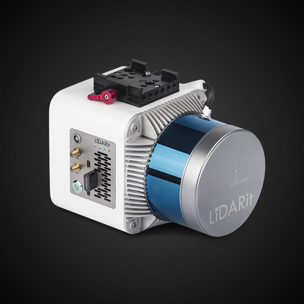
LIDARit Explorer R Surveying Camera
DESCRIPTION
The LiDARit Explorer R is a state-of-the-art, multi-purpose LiDAR system designed to revolutionize your geospatial projects. Built for versatility and precision, it excels in various applications, from land surveying and canopy penetration to stockpile measurements and underground or indoor mapping.
Delivering a maximum range of 150m at 20% reflectivity, the Explorer R ensures precise measurements with laser accuracy of 2 cm and an RMSE of 2.5 cm at 50m. It operates efficiently at a maximum scan height of 100m and features dual echoes for enhanced data acquisition.
Unlike photogrammetry, which relies solely on RGB or infrared light, the Explorer R uses laser-enabled LiDAR to provide highly detailed and accurate measurements—even under dense vegetation or in complete darkness. This makes it indispensable for projects requiring precision mapping, 3D modeling, or industrial inspections.
Key Features
- High-Precision Data: Laser accuracy of 2 cm @ 150m ensures reliable and detailed results.
- Day/Night Functionality: Operates effectively in daylight or darkness, making it ideal for power line inspections and other round-the-clock tasks.
- Dense Vegetation Penetration: Accurately measures ground surfaces even under heavy forest canopies.
- Superior Speed: Gathers and processes data faster than photogrammetry cameras.
- Versatile Applications: Suitable for land surveying, stockpile measurement, infrastructure inspection, and 3D mapping.
Detailed Specifications
| Specification | Detail |
|---|---|
| Max Range Reflectivity | 150m @ 20% reflectivity |
| Laser Accuracy | 2 cm @ 150m |
| Point Cloud RMSE | 2.5 cm @ 50m |
| Echoes | 2 |
| Recommended Scan Height | 100m |
| Weight | 1.6 kg (1600g) |
| Applications | Land surveying, stockpile measurements, indoor and underground mapping. |
| Build |
Smart, lightweight, and highly portable |
What’s Included in the Package
- 1x LiDARit Explorer R Unit
- Mounting Accessories for Multiplatform Compatibility
- Data Processing Software License
- USB Connectivity Cable
- User Manual and Setup Guide
Manuals & Documents
General Warranty Info:
- Ripping It Outdoors works closely with our manufacturers to supply and support your products warranty needs as best as possible!
- The majority of products come with a manufacturer represented warranty against manufacturing defects for at least a 12 month period after the date of sale.
- Expendable components and "wear parts" including but not limited to blades, knives, teeth, oil, chain sprockets, skid shoes, knife mounting discs, and similar components are usually excluded from manufacturer warranties.
- Please reach out to us for any specific warranty information needed about products and parts you can’t find!
Videos
Shipping
$1 Shipping Quote Info:
- Contact Us For Shipping Quotes. All $1 products are listed as quote only because we can not display their pricing online.
- Low shipping rates for customers. We have negotiated the best possible rates for customers from our trusted carriers (ODFL, ESTES, UPS, and FedEx) & Top Private Drivers
- Negotiate shipping rates if you think we can do better please reach out. Keep in mind some shipping rates also include assembly & configuration as well!
- Complimentary lift gate service on all freight shipments where it’s possible. We guarantee safe delivery!