


Garmin GPSMAP® 65 Series Multi-Band GPS Handheld with Sensors 65s
Garmin GPSMAP® 65 Series Multi-Band GPS Handheld with Sensors 65s
Couldn't load pickup availability
Couldn't load pickup availability


Product Description
Garmin GPSMAP® 65 Series Multi-Band GPS Handheld with Sensors 65s
DESCRIPTION
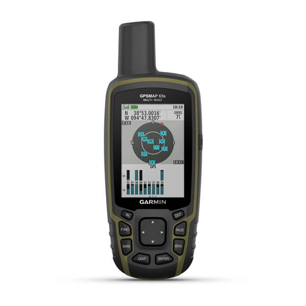
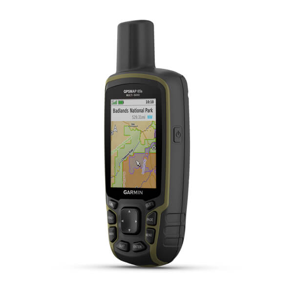
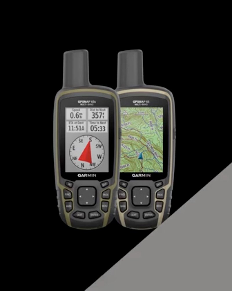
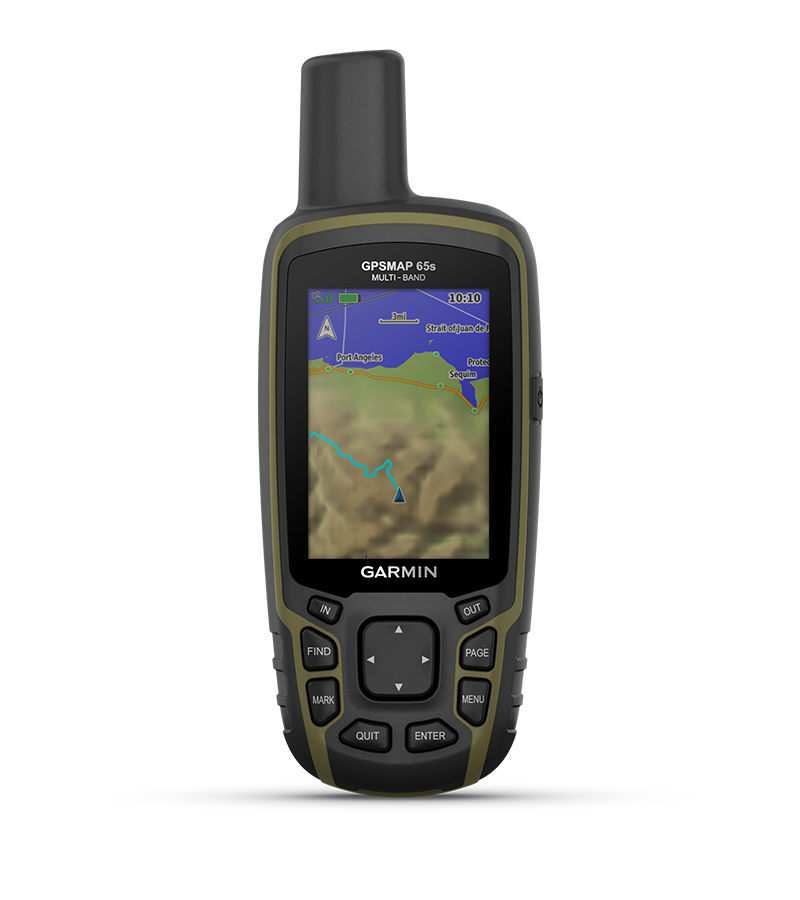
The Garmin GPSMAP® 65s is a rugged, multi-band GPS handheld device designed for hikers, hunters, and outdoor enthusiasts who need high-precision navigation in remote or difficult terrain. Featuring support for GPS, GLONASS, GALILEO, and QZSS, this device delivers superior tracking performance in environments where other GPS units struggle.
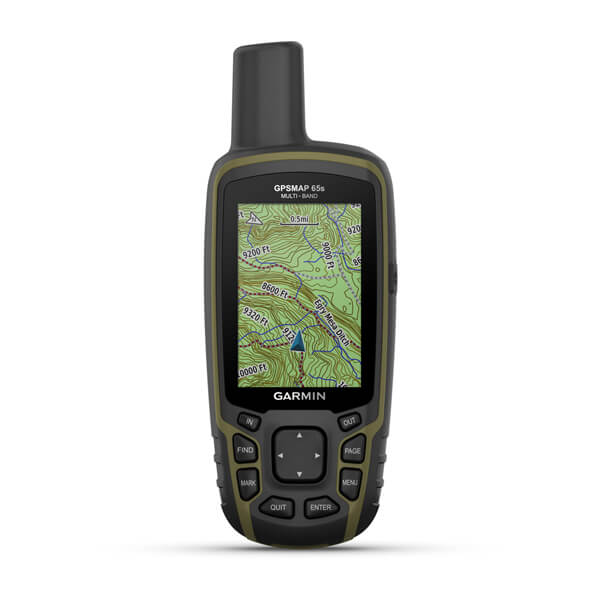
With multi-frequency reception, the GPSMAP 65s improves positioning accuracy, ensuring precise location data in areas with signal reflections, weak coverage, or thick vegetation. Preloaded TopoActive maps for the U.S. and Canada offer detailed terrain insights, while ABC sensors provide altitude, weather monitoring, and compass guidance for on-the-go adjustments.
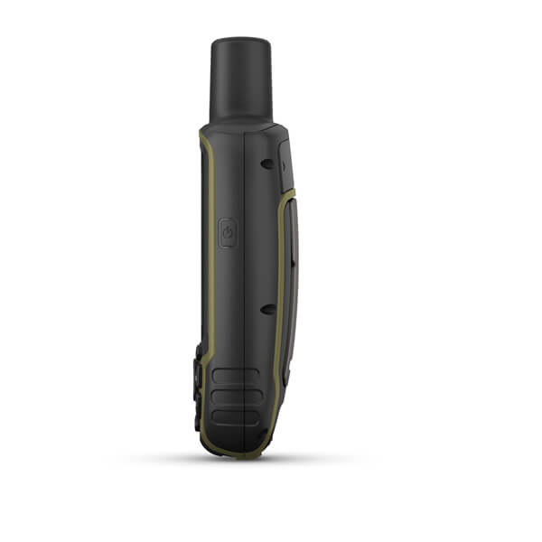
With a 16-hour battery life, IPX7 water rating, and high-contrast transflective display, the Garmin GPSMAP® 65s is an essential tool for outdoor explorers who require dependable navigation in any condition.
Key Features
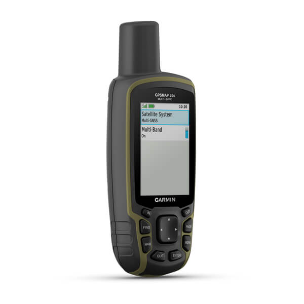
EXPANDED GNSS SUPPORT
Access multiple global navigation satellite systems (GPS, GLONASS, GALILEO, and QZSS) to track in more challenging environments.
MULTI-BAND FREQUENCY SUPPORT
Receive and utilize multiple frequencies sent by navigation satellites which enable improved user position accuracy, specifically in areas where GNSS signals are reflected, weak, or typically do not penetrate. Get superior accuracy using state-of-the-art technology, previously only available to the military.

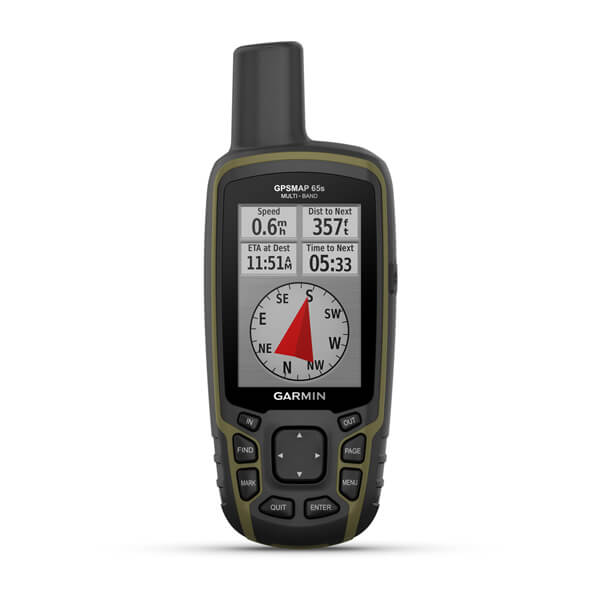
ABC SENSORS
Navigate every trail with ABC sensors, including an altimeter for elevation data, a barometer to monitor weather, and 3-axis electronic compass.

PRELOADED TOPO MAPS
Preloaded TopoActive U.S. and Canada maps show you terrain contours, topographic elevations, summits, parks, coastlines, rivers, lakes, and geographical points.

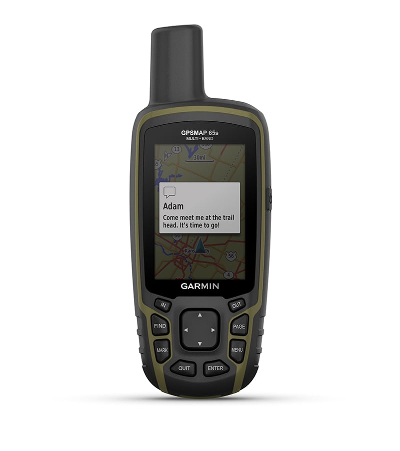
SMART NOTIFICATIONS
Receive emails, texts, and alerts right on your handheld when paired with your compatible device.
Detailed Specifications
Garmin GPSMAP® 65s Specifications
| Specification | Details |
|---|---|
| Brand Name | GARMIN GPSMAP® 65s |
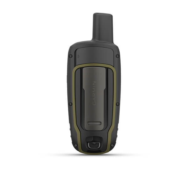
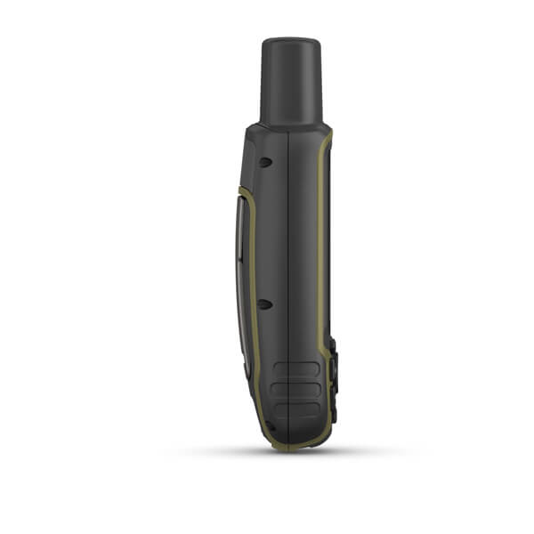
| Physical Dimensions | 2.4" x 6.3" x 1.4" (6.1 x 16.0 x 3.6 cm) |
| Display Size | 1.43" x 2.15" (3.6 x 5.5 cm); 2.6" diagonal (6.6 cm) |
| Display Resolution | 160 x 240 pixels |
| Display Type | Transflective, 65K color TFT |
| Weight | 7.7 oz (217 g) with batteries |
| Battery Type | 2 AA batteries (not included); NiMH or Lithium recommended |
| Battery Life | 16 hours |
| Water Rating | IPX7 |
| High-Sensitivity Receiver | Yes |
| Interface | High-speed mini USB and NMEA 0183 compatible |
| Memory/History | 16 GB (userspace varies based on included mapping) |
In Package
- 1x Multi-Band GPS Handheld with Sensors
- GPSMAP 65s
- USB cable
- Carabiner clip
- Documentation
Manuals & Documents
General Warranty Info:
- Ripping It Outdoors works closely with our manufacturers to supply and support your products warranty needs as best as possible!
- The majority of products come with a manufacturer represented warranty against manufacturing defects for at least a 12 month period after the date of sale.
- Expendable components and "wear parts" including but not limited to blades, knives, teeth, oil, chain sprockets, skid shoes, knife mounting discs, and similar components are usually excluded from manufacturer warranties.
- Please reach out to us for any specific warranty information needed about products and parts you can’t find!
Videos
Shipping
General Shipping Info:
- Instantly calculate shipping quotes to the lower 48 states by 1. adding this product to your cart, 2. click continue to the checkout page and 3. enter your shipping address to check rates. Contact us for quotes for shipping to Hawaii, Alaska, Canada, Mexico and Internationally.
- Complimentary lift gate service on all freight shipments where it’s possible. We guarantee safe delivery!
- Low shipping rates for customers. We have negotiated the best possible rates for customers from our trusted carriers (ODFL, ESTES, UPS, and FedEx).
- Negotiate shipping rates if you think we can do better please reach out. Keep in mind some shipping rates also include assembly & configuration that as well