1
/
of
2
Pix4d Software Pix4Dfields Subscription
Pix4d Software Pix4Dfields Subscription
Regular price
$1,650.00
Regular price
Sale price
$1,650.00
Unit price
/
per
Couldn't load pickup availability
Couldn't load pickup availability


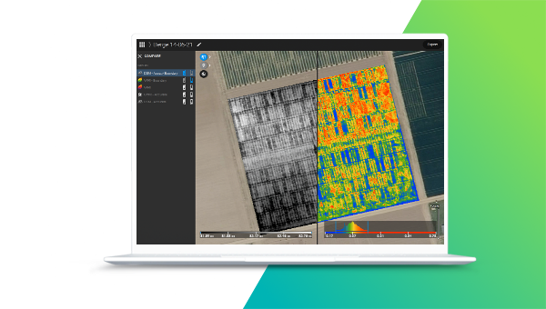
- Precision Agriculture Mapping: Create detailed maps using drone and satellite imagery for accurate crop analysis.
- Hybrid Mapping Technology: Combines drone and satellite data, tailored for farmers, agronomists, and researchers.
- Unlimited Desktop Processing: High-resolution outputs with a floating license for use on one device at a time.
- User Support and Upgrades: Enjoy personal support and regular upgrades during your subscription period.
- Flexible Subscription Model: Recurrent yearly subscription with the freedom to cancel anytime.

Product Description
Pix4d Software Pix4Dfields Subscription
DESCRIPTION
Transform your agricultural operations with the Pix4Dfields Subscription, the premier hybrid mapping software for precision agriculture. Designed with input from farmers, agronomists, and researchers, Pix4Dfields provides a powerful solution to manage crops effectively by using both drone and satellite data.
A UNIQUE SUITE OF PHOTOGRAMMETRY SOFTWARE FOR DRONE MAPPING
Capture images with the Pix4D app, process on desktop or cloud and create maps and 3D models.
Create precision agriculture maps using images from drones and satellite. The only hybrid mapping software solution for agriculture based on knowledge from farmers, agronomists, and researchers.
Desktop application with floating license (use on 1 device at a time). Unlimited desktop processing and high-resolution outputs. Personal support and upgrades included during your subscription.
Recurrent yearly subscription. Cancel anytime.
DELIVERING Powerful Photogrammetry Software Technology
Pix4D makes software solutions for professional drone-based mapping, purely from images. Its vision of modern photogrammetry is transforming workflows and the use of drone data and aerial imagery across various industries.
Key Features
- Hybrid Data Processing: Seamlessly integrate drone and satellite data for detailed agricultural mapping.
- Unlimited Outputs: Process an unlimited number of images to produce high-resolution maps.
- Flexible License: Use the floating license on one device at a time with easy portability.
- Advanced Crop Insights: Monitor crop health, optimize inputs, and maximize yield potential.
- Subscription Benefits: Personal support and software upgrades for uninterrupted productivity.
Pix4D Serves Multiple Enterprises:
Real Estate
- Real estate developers who need to accurately map developments and create 3D presentations for potential investors, then keep them apprised of progress.
- Real estate brokers and agents who need accurate measurements to create listings and must dress up sales material with images that pop.
Inspection
- Home inspectors who need to examine roofs and chimneys without using ladders.
Public Safety
- First responders who need highly accurate maps to respond accurately to emergencies, and who need to map crime or fire scenes.
Construction
- Engineers who need to measure distances and calculate areas quickly.
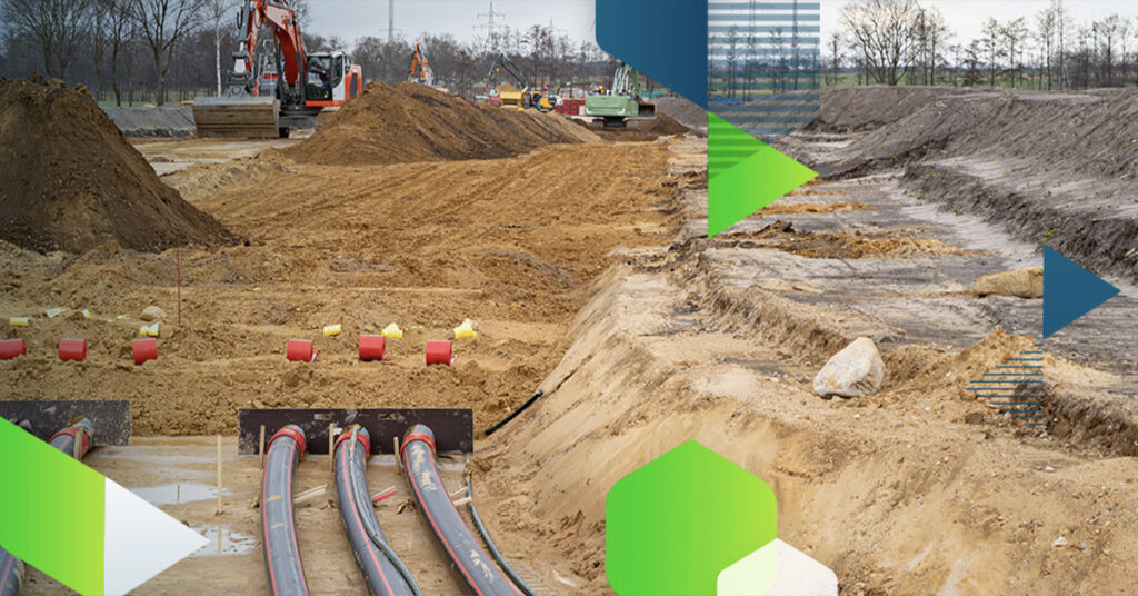
- Construction contractors who need to monitor and illustrate progress on jobs, act on the data collected, and coordinate team activities.
Mining
- Mining professionals who need to measure distances, calculate volumes, and make geotechnical assessments.
Energy
- Industrial inspectors who need to safely evaluate tall, remote or sprawling assets, such as cell towers, high-power lines and towers, wind turbines and solar arrays.
Using Pix4D
Safety and precision increase with Pix4D. Workers stay on the ground while the drone accesses conditions in otherwise hazardous places — towers, high-rises, bridges, busy highways, rooftops and emergency environments.
GPS and geo-tagging allow drones to return to precise points to gather updated data on construction, for example, or on evolving crop and field health.
Using Pix4D in mining operations allows equipment to continue to operate while data is collected for inspecting infrastructure, measuring stock, assessing geotechnical conditions and planning blasts. Errors decrease with the elimination of fatigue from ground-based data collectors.

ELEVATED SURVEYING & MAPPING
Quickly generate survey-grade 3D maps and models from a diverse range of images, enabling you to unlock a new dimension of precision and detail in your deliverables. Pix4D empowers you to navigate complex terrains and capture intricate spatial data with ease, streamlining your workflow and approach to surveying and mapping tasks.

ENERGY, UTILITIES, & INFRASTRUCTURE
Leverage state-of-the-art photogrammetry and cutting-edge analytics with Pix4D. Make smarter business decisions with actionable insights derived from comprehensive data analysis, enhancing your strategic advantage within the energy, utilities, and infrastructure domains.

PRECISION AGRICULTURE
Experience the future of precision agriculture with the Pix4D hybrid approach, seamlessly integrating drone and satellite mapping technologies. From crop scouting and trial plot management to precision variable rate application, Pix4D redefines how you use data to cultivate success.

ARCHITECTURE, ENGINEERING, & CONSTRUCTION
Leverage both ground-level and aerial imagery to effortlessly map, quantify, analyze, and generate progress reports for your projects.

PUBLIC SAFETY & FORENSICS
Modernize your approach to public safety and forensic operations by seamlessly converting images into meticulously detailed 2D and 3D models. Empower first responders with the precision of highly accurate maps, enabling them to navigate emergencies with pinpoint accuracy.

TELECOMMUNICATIONS
Provide industrial inspectors with a secure means to assess towering, distant, or expansive assets, including cell towers, high-voltage power lines and pylons, wind turbines, and solar arrays, with uncompromised safety and efficiency.
ADVANTAGES
DJI CompatibilityPix4D is compatible with any DJI drone, enabling it to function as a data collection tool for aerial mapping and 3D modeling. |
Heightened EfficiencyDrones enabled by Pix4D gather data and images for aerial mapping and modeling in a fraction of the time needed by ground-based teams. |
Ortho-Corrected ImagesPix4D corrects 2D images for scale, topographical relief, lens distortion and camera angle, assembling a dimensionally accurate 3D mosaic. |
Exportable DataData processed by Pix4D can be exported to a range of other programs, including CAD and GIS, for deeper analysis, and shared by multiple users. |
Drone Services
https://rippingitoutdoors.com/pages/drone-services
Detailed Specifications
| Feature | Specification |
|---|---|
| Software Type | Precision Agriculture Mapping |
| Compatibility | Drone and Satellite Imagery |
| License Type | Floating License (One Device at a Time) |
| Processing Capability | Unlimited Desktop Processing |
| Primary Use Case | Crop Health Monitoring, Trial Management |
| Subscription Type | Yearly, Cancel Anytime |
In Package
- Access to the Pix4Dfields Subscription software.
- Detailed user manual and installation guide.
- Regular updates to enhance performance and add features.
- Comprehensive customer support during the subscription period.
Manuals & Documents
General Warranty Info:
- Ripping It Outdoors works closely with our manufacturers to supply and support your products warranty needs as best as possible!
- The majority of products come with a manufacturer represented warranty against manufacturing defects for at least a 12 month period after the date of sale.
- Expendable components and "wear parts" including but not limited to blades, knives, teeth, oil, chain sprockets, skid shoes, knife mounting discs, and similar components are usually excluded from manufacturer warranties.
- Please reach out to us for any specific warranty information needed about products and parts you can’t find!
Videos
Shipping
General Shipping Info:
- Instantly calculate shipping quotes to the lower 48 states by 1. adding this product to your cart, 2. click continue to the checkout page and 3. enter your shipping address to check rates. Contact us for quotes for shipping to Hawaii, Alaska, Canada, Mexico and Internationally.
- Complimentary lift gate service on all freight shipments where it’s possible. We guarantee safe delivery!
- Low shipping rates for customers. We have negotiated the best possible rates for customers from our trusted carriers (ODFL, ESTES, UPS, and FedEx).
- Negotiate shipping rates if you think we can do better please reach out. Keep in mind some shipping rates also include assembly & configuration that as well!


