


Garmin inReach Explorer®+ Satellite Communicator with Maps and Sensors
Garmin inReach Explorer®+ Satellite Communicator with Maps and Sensors
Couldn't load pickup availability
Couldn't load pickup availability


Product Description
Garmin inReach Explorer®+ Satellite Communicator with Maps and Sensors
DESCRIPTION
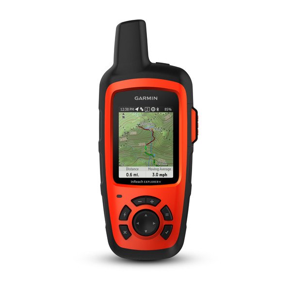
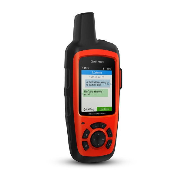
Designed for adventurers, Garmin’s inReach Explorer+ is a rugged, handheld satellite communicator that ensures two-way messaging, GPS navigation, and emergency support—anywhere in the world. Whether you're off-grid hiking, kayaking, hunting, or traveling internationally, this device keeps you connected when cell service is unavailable.
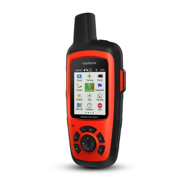
Using the global Iridium® satellite network, the inReach Explorer+ allows users to send and receive text messages, share GPS locations, and trigger interactive SOS alerts to the 24/7 Garmin IERCC emergency center. Unlike the inReach SE+, the Explorer+ includes preloaded TOPO maps, GPS waypoint routing, and essential sensors like a digital compass, barometric altimeter, and accelerometer for enhanced off-grid navigation.
With up to 100 hours of battery life, weather forecasting, and seamless smartphone integration, the inReach Explorer+ is the ultimate satellite communicator for outdoor explorers who demand safety, reliability, and precise navigation.
Key Features
Handheld Satellite Communicators with GPS Navigation
- Rugged handheld satellite communicators enable two-way text messaging via 100% global Iridium®satellite network (satellite subscription required)
- Trigger an interactive SOS to the 24/7 search and rescue monitoring center
- Track and share your location with family and friends
- Pair with compatible mobile devices using the free Earthmate® app for access to downloadable maps¹, U.S. NOAA charts, color aerial imagery, and more
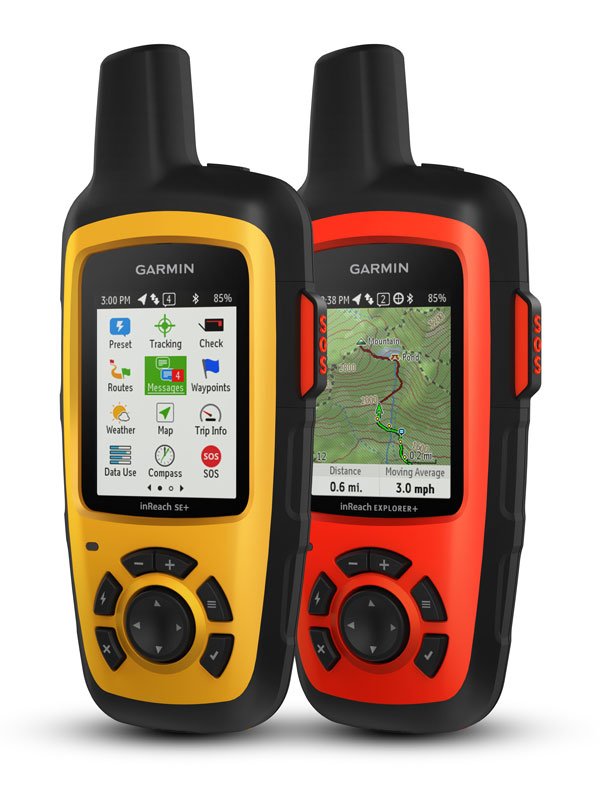
- inReach Explorer+ device adds preloaded DeLorme® TOPO maps with onscreen GPS routing plus built-in digital compass, barometric altimeter and accelerometer.

You may venture off the grid, but you can still stay in touch — as long as you’re carrying an inReach SE+ or inReach Explorer+. These handheld satellite communicators are designed for the outdoor enthusiast who wants to roam farther and experience more — without compromising their loved ones‘ peace of mind. From backcountry experiences to international adventures, inReach provides communication, location sharing, navigation, and critical SOS functions for anyone who loves getting away from it all, on land, water, or in the skies.
Explore Anywhere. Communicate Globally.
Using the worldwide coverage of the Iridium satellite network, these go-anywhere portable devices let you exchange text messages with any cell phone number or email address — while using GPS to track and share your journey’s progress. You can also post to social media or even communicate inReach-to-inReach in the field.
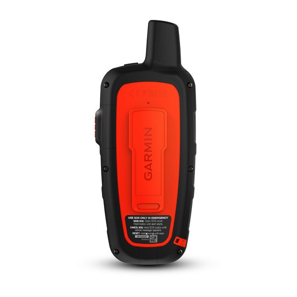
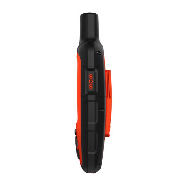
In case of an at-risk situation, you can also use inReach to trigger an SOS to the 24/7 monitoring center, text back and forth about the nature of your emergency, and receive a confirmation when help is on the way.
Track and Share Your Whereabouts
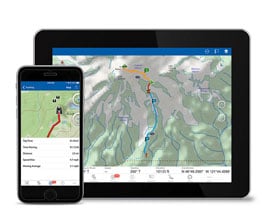
Turn on the tracking function of your inReach SE+ or Explorer+ communicator, and let family and friends follow your progress on their computers or mobile devices, using the web-based MapShare™ portal. The inReach device will send waypoints at preselected time intervals, so followers can track your whereabouts online. You can also invite your crew back home to use MapShare to ping your inReach unit and see your GPS location, track your movements, and exchange messages during your trip. You can even embed your MapShare page on a blog, website, or social media.
Pair with Your Mobile Device
For even more capability and convenience, the free Earthmate® app syncs your inReach handheld via Bluetooth® with your compatible Apple® or Android™ device¹ so you can access unlimited maps, aerial imagery, and U.S. NOAA charts. Plus, Earthmate allows you to conveniently use all of the inReach features on your paired mobile device. For easier messaging, you can also access your phone’s contact list from the Earthmate app to connect with fewer keystrokes.
Get Weather Wherever
The optional inReach weather forecast service provides detailed updates directly to your inReach device, compatible smartphone or tablet paired with the Earthmate app, so you’ll know what conditions to expect en route. Basic and premium weather packages are offered. And you can request weather forecasts for your current location or any other waypoint or destination on your itinerary.

Who Will Answer Your SOS? Garmin IERCC will.

Which inReach Is Right for You?
As satellite communicators, both the inReach SE+ and Explorer+ offer identical messaging capabilities. However, it’s on the GPS navigation side that their differences become apparent. While inReach SE+ uses GPS to provide basic grid navigation and allow you to drop waypoints, mark key locations, track your progress, and follow a breadcrumb trail back to base — the inReach Explorer+ goes a step beyond, providing full-fledged GPS on-map guidance with preloaded TOPO mapping and waypoint routings viewable directly on the unit. Plus, a built-in digital compass, barometric altimeter, and accelerometer are included with Explorer+ to help you get and maintain accurate bearings on or off the beaten path.

Affordable, Flexible Satellite Airtime Plans
To access the Iridium network and communicate with your inReach SE+ or Explorer+ device, an active satellite subscription is required. Depending on your usage level, you can opt for an annual contract package or flexible month-to-month airtime plan.
Unlimited Cloud Storage and Trip Planning are Included
Every inReach device comes with free access to a cloud-powered Garmin Explore website to plan your trips with routes and waypoints, create preset messages and quick texts, sync and manage your device settings, update your firmware, download additional TOPO maps, link your social media accounts, store all your location tracking data and much more.
Detailed Specifications
| Specification | Details |
|---|---|
| Brand Name | GARMIN inReach Explorer® |
| Physical Dimensions | 2.7" x 6.5" x 1.5" (6.8 x 16.4 x 3.8 cm) (with keypad and SOS door bump) |
| Display Size | 1.4"W x 1.9"H (3.5 x 4.7 cm); 2.31" diagonal (5.9 cm) |
| Display Resolution | 200 x 265 pixels |
| Display Type | Transflective color TFT |
| Weight | 7.5 oz (213.0 g) |
| Battery Type | Rechargeable internal lithium-ion |
| Battery Life | Up to 100 hours at 10-minute tracking mode (default) |
| Water Rating | IPX7 |
| High-Sensitivity Receiver | Yes |
| Interface | Micro USB |
| Memory/History | 2 GB (userspace varies based on included mapping) |
In Pacakge
- inReach Explorer+
- Preloaded with TOPO
- USB cable
- Carabiner clip
- Documentation
- 1x inReach Satellite Communicator
Manuals & Documents
General Warranty Info:
- Ripping It Outdoors works closely with our manufacturers to supply and support your products warranty needs as best as possible!
- The majority of products come with a manufacturer represented warranty against manufacturing defects for at least a 12 month period after the date of sale.
- Expendable components and "wear parts" including but not limited to blades, knives, teeth, oil, chain sprockets, skid shoes, knife mounting discs, and similar components are usually excluded from manufacturer warranties.
- Please reach out to us for any specific warranty information needed about products and parts you can’t find!
Videos
Shipping
General Shipping Info:
- Instantly calculate shipping quotes to the lower 48 states by 1. adding this product to your cart, 2. click continue to the checkout page and 3. enter your shipping address to check rates. Contact us for quotes for shipping to Hawaii, Alaska, Canada, Mexico and Internationally.
- Complimentary lift gate service on all freight shipments where it’s possible. We guarantee safe delivery!
- Low shipping rates for customers. We have negotiated the best possible rates for customers from our trusted carriers (ODFL, ESTES, UPS, and FedEx).
- Negotiate shipping rates if you think we can do better please reach out. Keep in mind some shipping rates also include assembly & configuration that as well!