


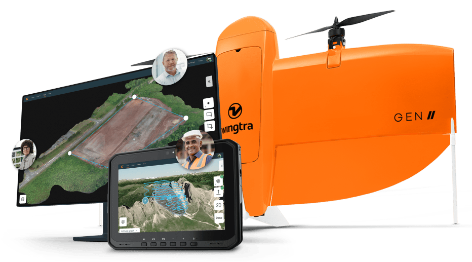
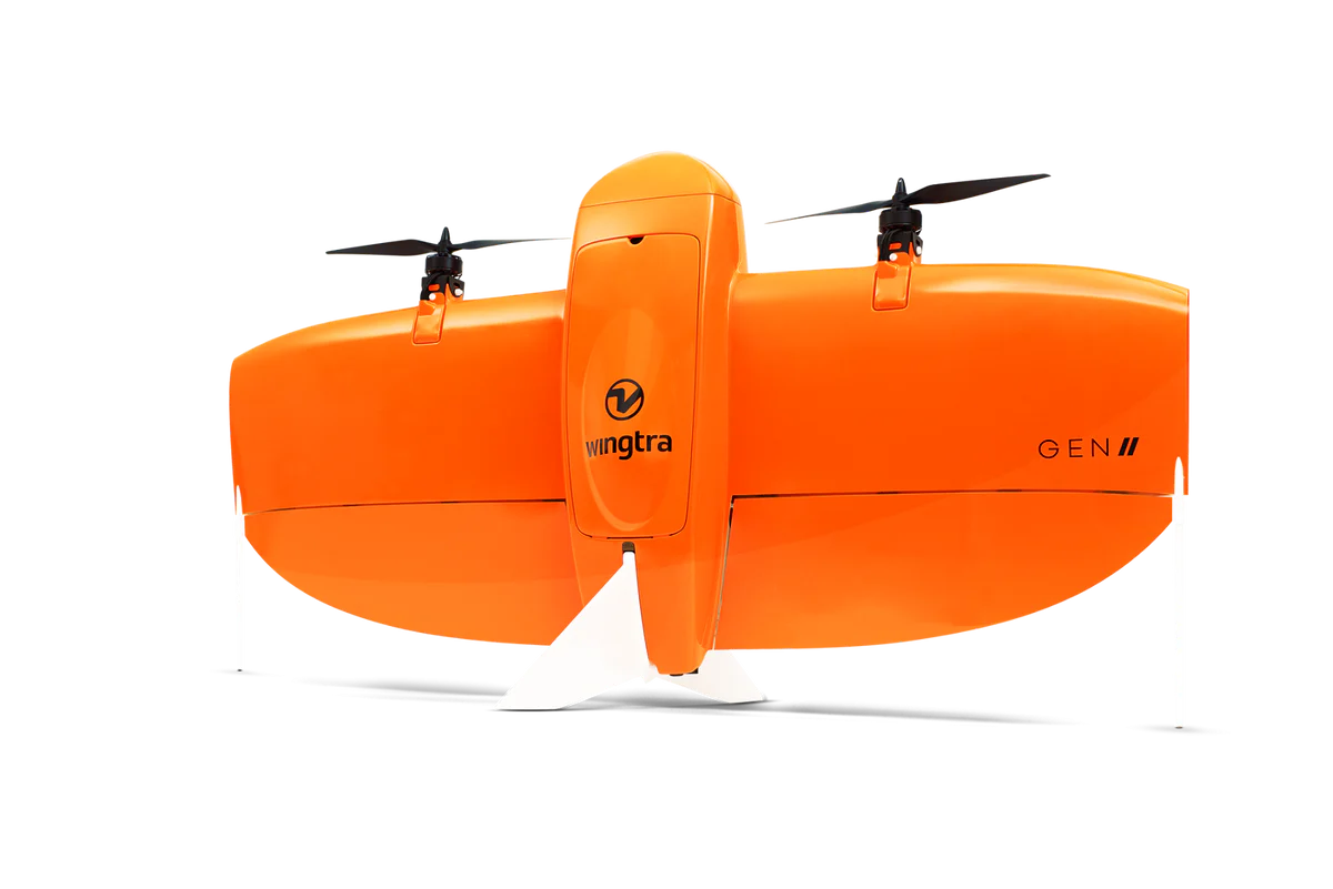
Wingtra | Wingtra One GEN II | VTOL Mapping Drone | 61 MP | Up to 59 Min Flight Time | 16 m/s Flight Speed | 6-25 MP Camera GIS & Engineering
Wingtra | Wingtra One GEN II | VTOL Mapping Drone | 61 MP | Up to 59 Min Flight Time | 16 m/s Flight Speed | 6-25 MP Camera GIS & Engineering
Couldn't load pickup availability
Couldn't load pickup availability


Product Description
Wingtra | Wingtra One GEN II | VTOL Mapping Drone | 61 MP | Up to 59 Min Flight Time | 16 m/s Flight Speed | 6-25 MP Camera GIS & Engineering
DESCRIPTION
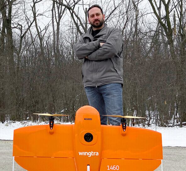
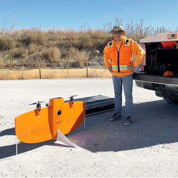
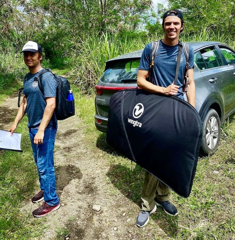
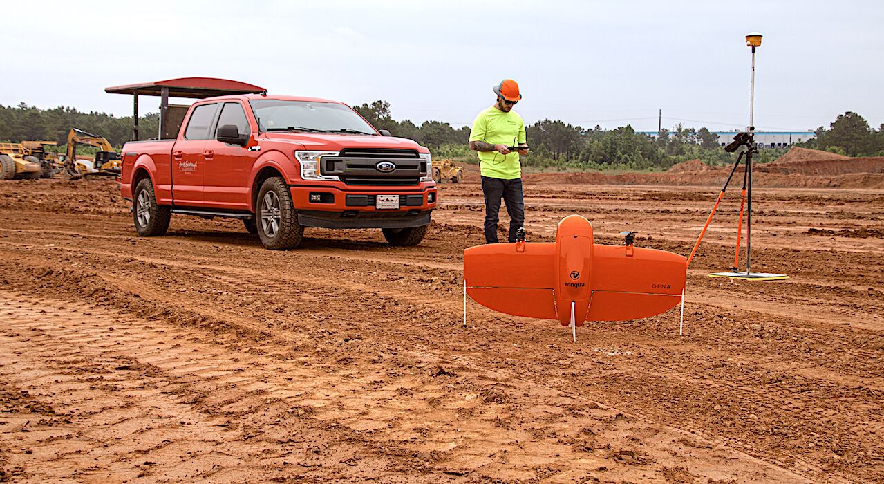
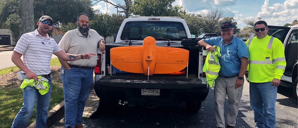
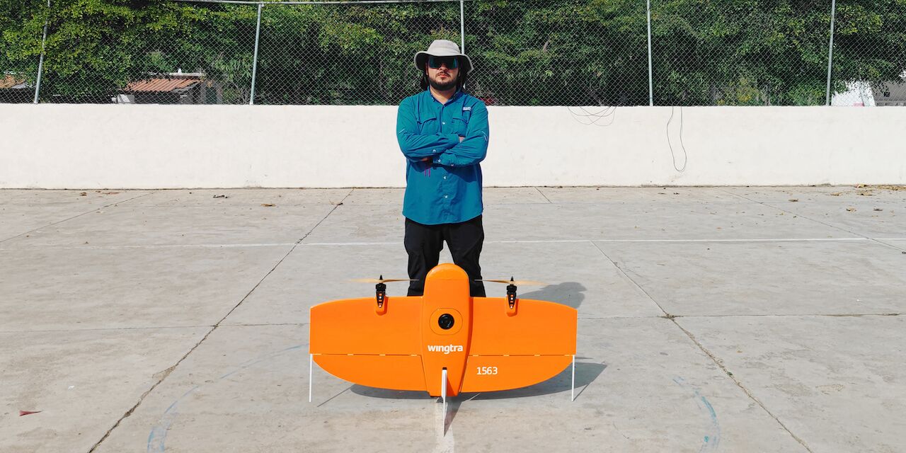
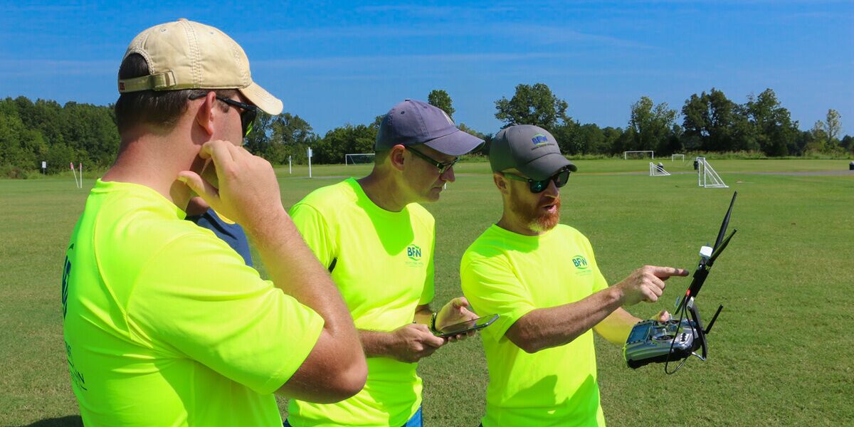
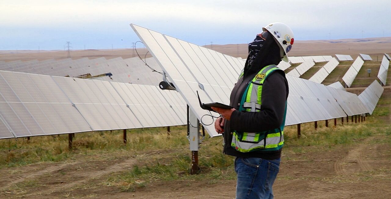
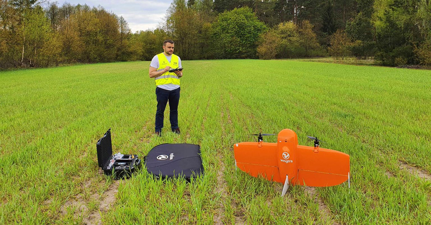
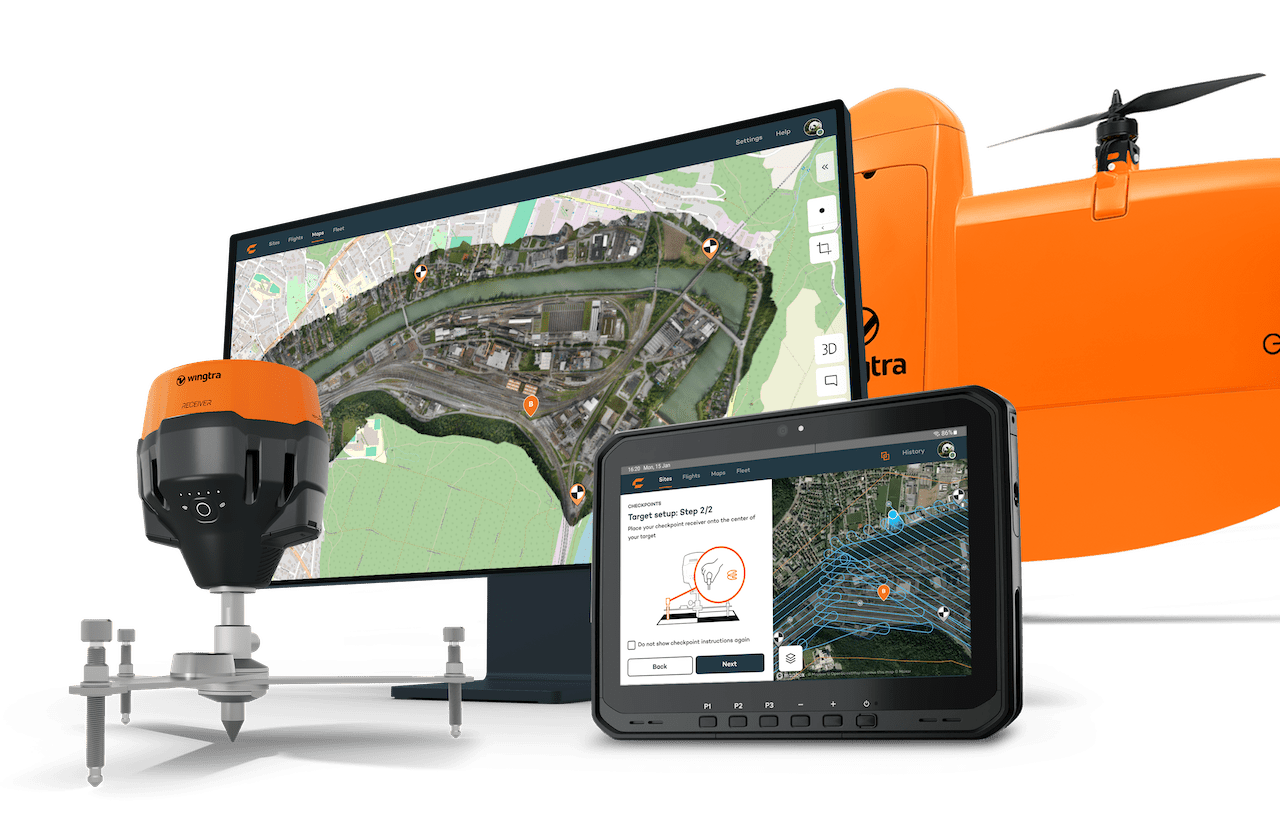
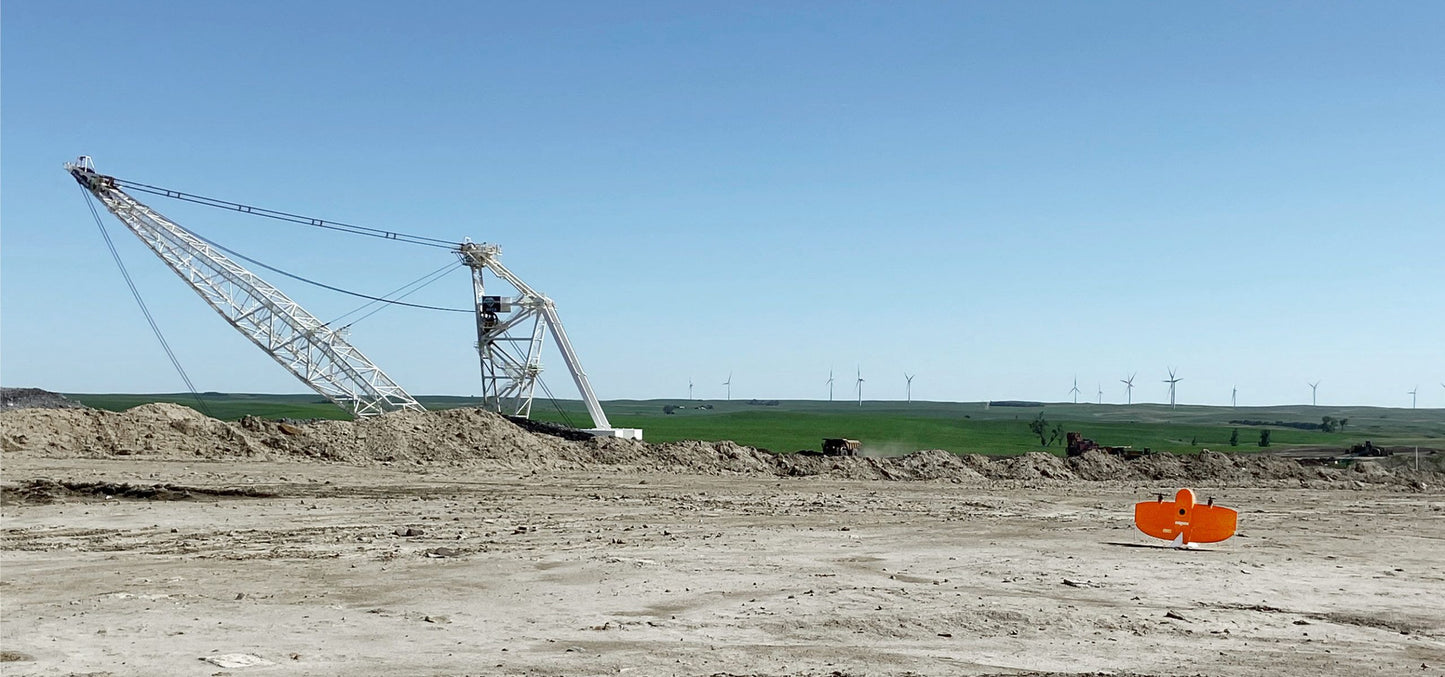
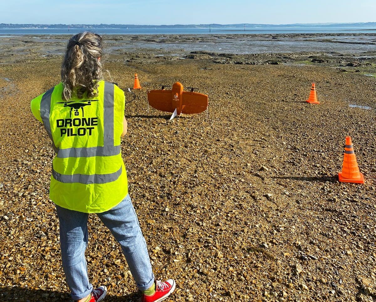
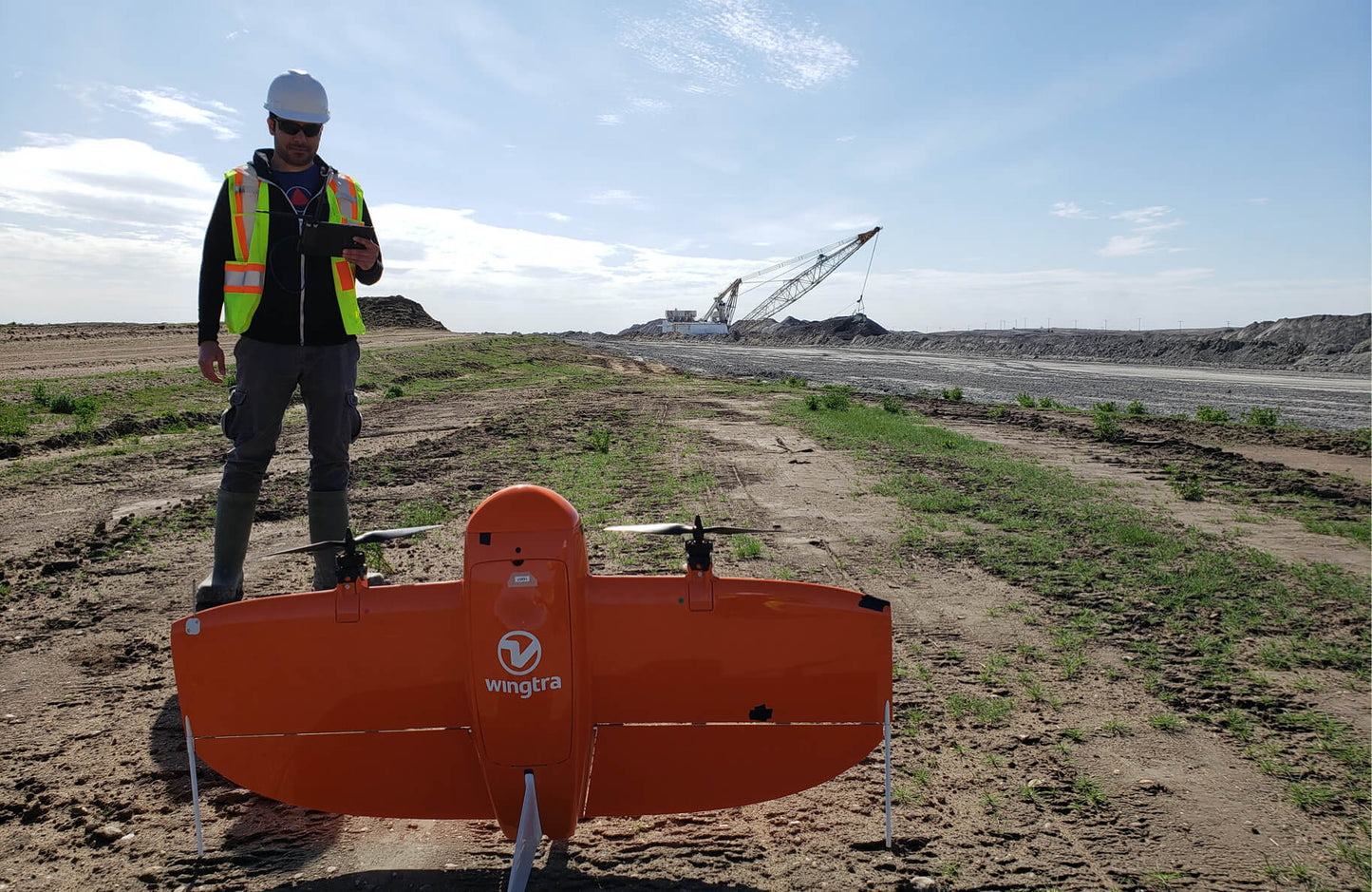
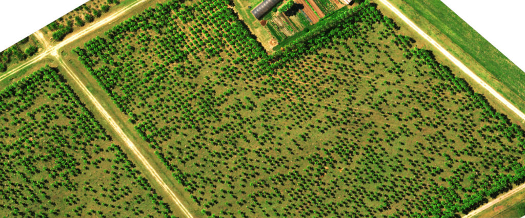
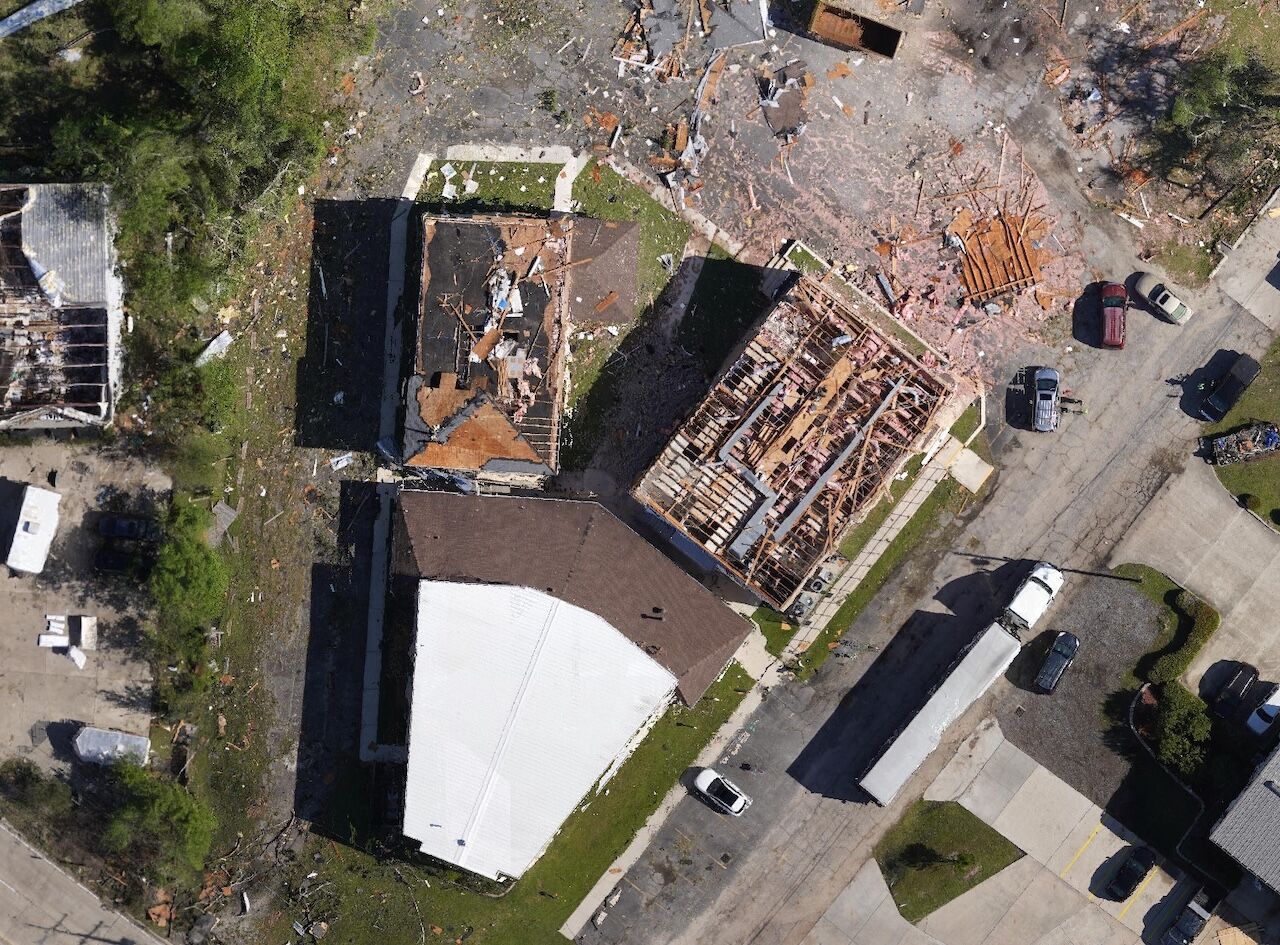
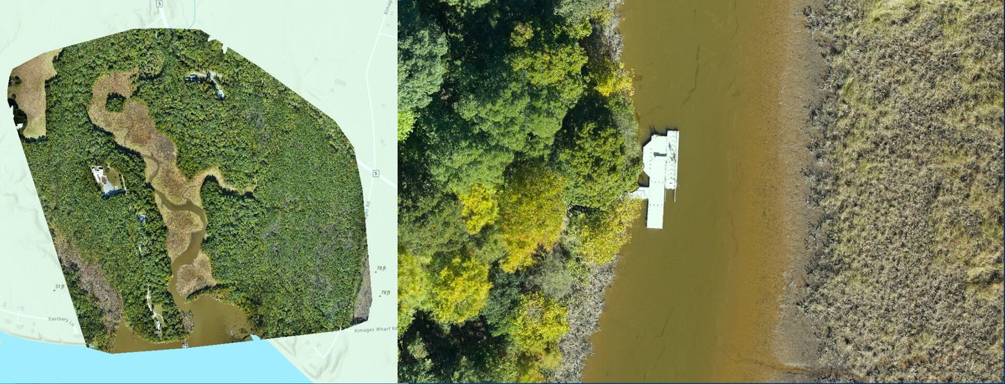
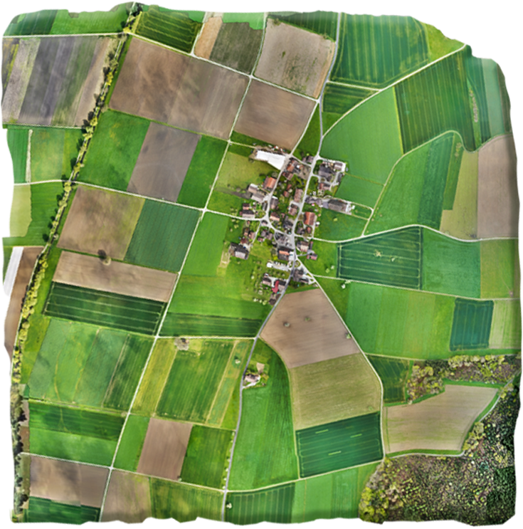
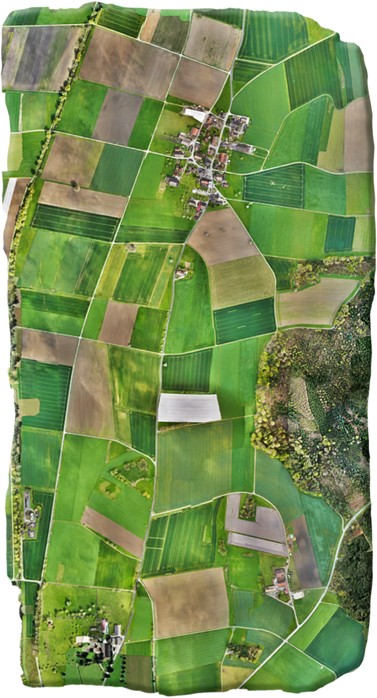
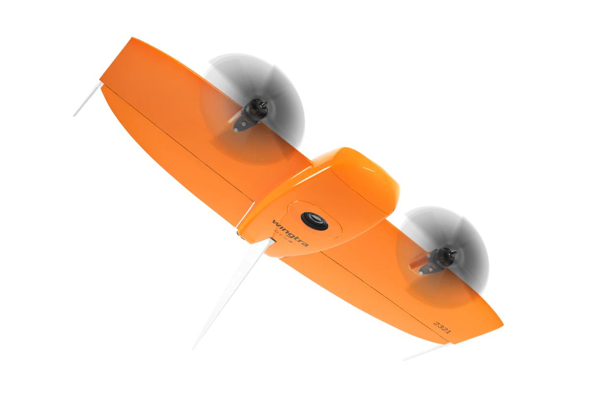
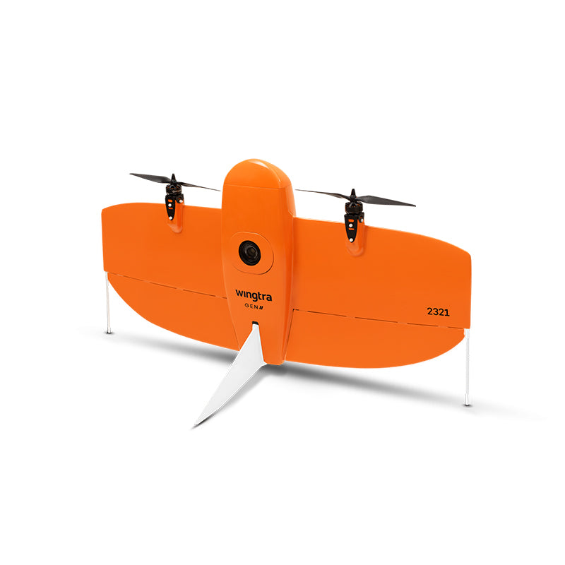
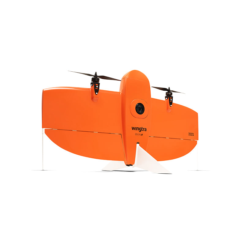
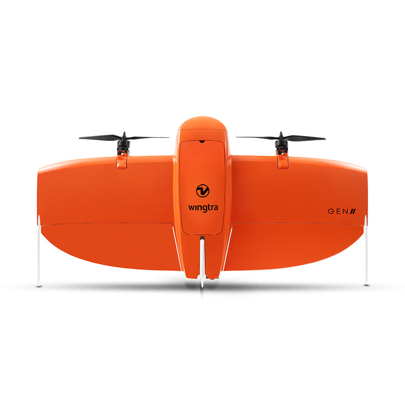
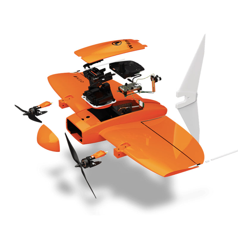
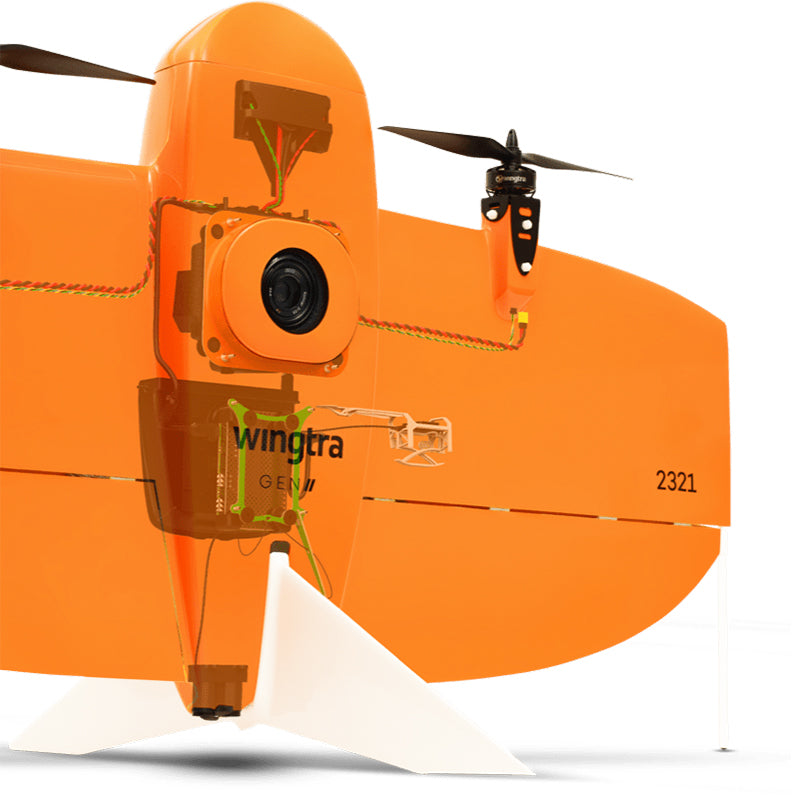
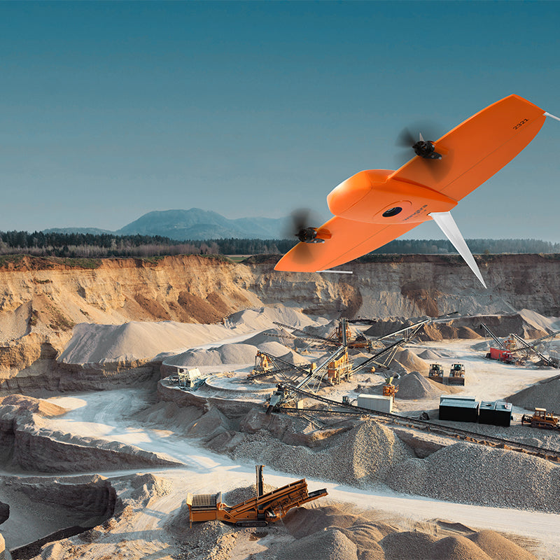
Meet the WingtraOne GEN II a professional-grade surveying and mapping drone designed for organizations that demand unmatched aerial data accuracy, wide-area coverage, and operational efficiency. From precision agriculture to civil engineering and large-scale infrastructure projects, WingtraOne revolutionizes aerial surveying with its advanced VTOL (Vertical Take-Off and Landing) design and robust photogrammetry and LiDAR capabilities.
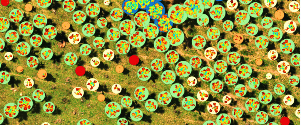
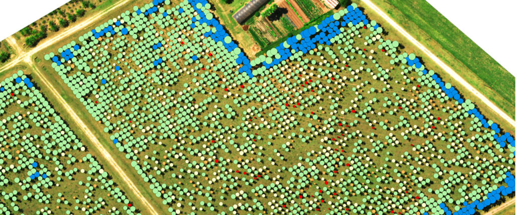
With a flight time of up to 59 minutes, a full-frame 61 MP RGB camera, and absolute horizontal accuracy down to 1 cm, WingtraOne empowers you to map complex terrains faster and more accurately than ever before even without ground control points (GCPs).
Built in Switzerland with over 100,000 real-world flights behind its engineering, the WingtraOne is your trusted partner for high-efficiency aerial mapping, regardless of terrain, altitude, or weather conditions.
Key Features
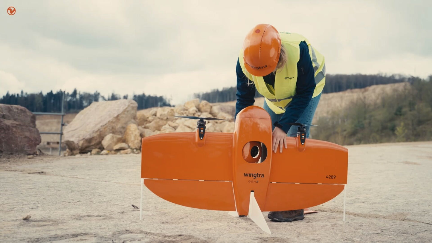
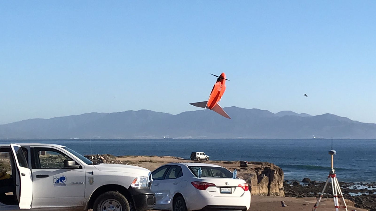
- VTOL Take-Off and Landing Launch and land safely in tight, rugged environments with zero runway space needed.
- Unrivaled Surveying Accuracy Achieve absolute horizontal accuracy down to 1 cm, and vertical accuracy down to 3 cm even without GCPs using built-in PPK GNSS technology.
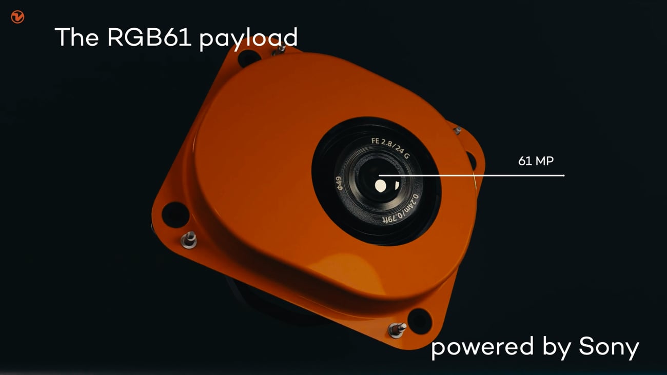
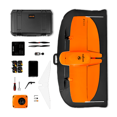
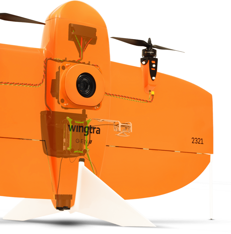
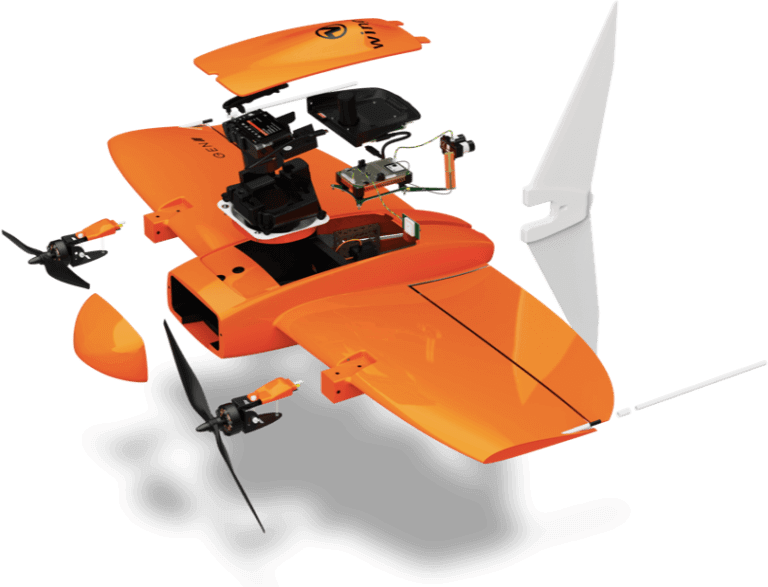
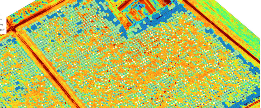
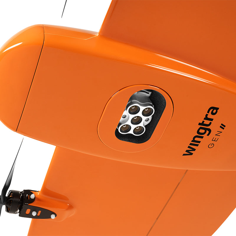
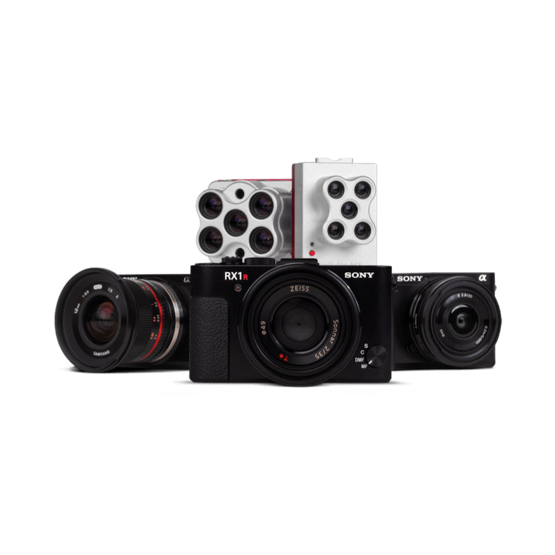
- Full-Frame 61 MP Camera Capture ultra-sharp images with the Sony RGB61 sensor, enabling a GSD as low as 0.7 cm/px for high-resolution maps and 3D models.
- Massive Area Coverage Map up to 460 hectares (1,140 acres) per flight at 120 m AGL over 11x faster than multicopter drones.
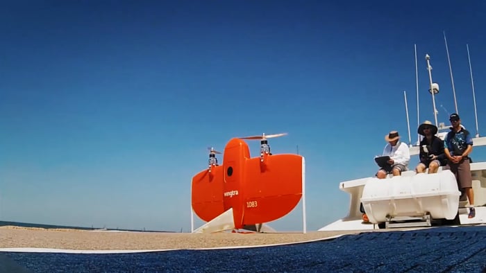
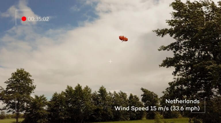
- Reliable in Challenging Conditions Operates safely in sustained winds up to 12 m/s (27 mph) and gusts up to 18 m/s (40 mph).
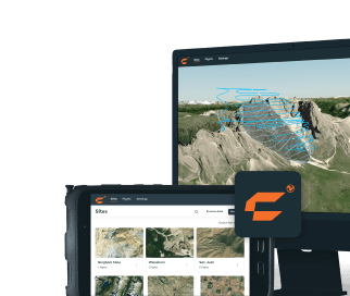
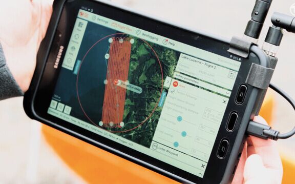
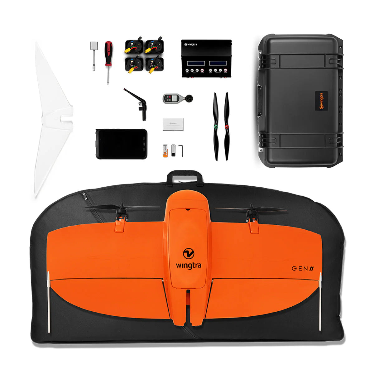
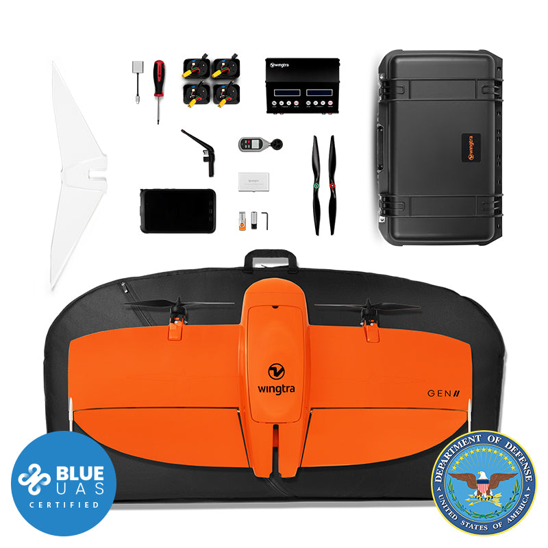
- Built for Productivity Reduce field labor and project costs with fast deployment, minimal GCP use, and intelligent flight automation via WingtraPilot.
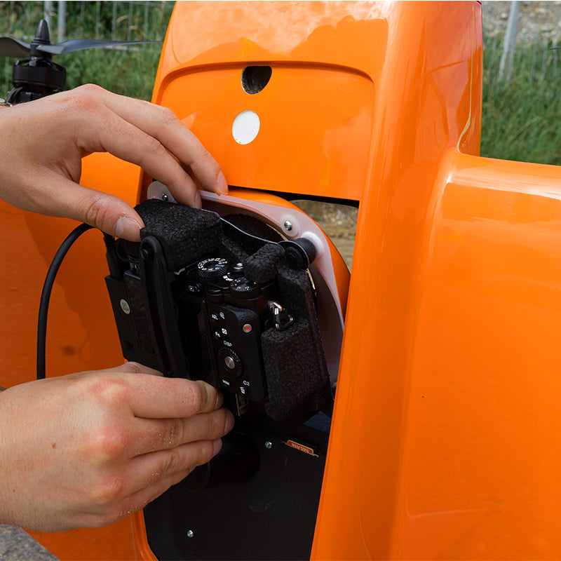
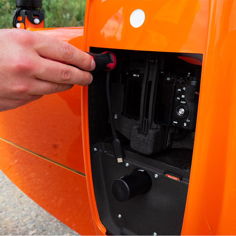
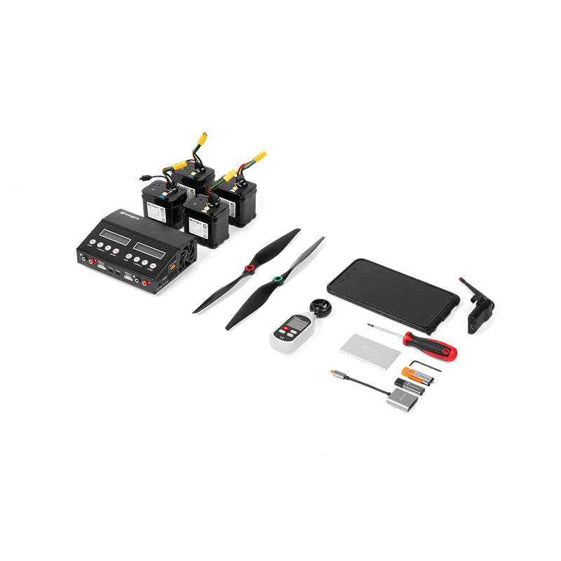
- Multi-Sensor Compatible Supports a wide range of sensors, including RGB61, MAP61, Sony a6100, MicaSense RedEdge-P, and Wingtra LiDAR, making it ideal for photogrammetry, multispectral imaging, and terrain modeling.
- Seamless Integration Fully compatible with leading GIS and photogrammetry platforms like Esri, Pix4D, Bentley, and DroneDeploy.
Detailed Specifications
| Category | Specification |
|---|---|
| Drone Type | VTOL Fixed-Wing (Tailsitter) |
| Max Take-Off Weight | 4.8 kg (10.6 lb) |
| Payload Capacity | 800 g (1.8 lb) |
| Max Flight Time | Up to 59 minutes |
| Flight Speed | 16 m/s (35.8 mph) |
| Wind Resistance (Airborne) | Sustained: 12 m/s (27 mph); Gusts: 18 m/s (40 mph) |
| Max Coverage per Flight | 460 ha @ 120 m altitude with MAP61 sensor |
| Max GSD | 0.7 cm/px @ 45 m AGL (RGB61 sensor) |
| Horizontal Accuracy (PPK) | Down to 1 cm (0.4 in) |
| Vertical Accuracy (PPK) | Down to 3 cm (1.2 in) |
| Sensor Options | RGB61, MAP61, Sony a6100, Oblique a6100, RedEdge-P, Wingtra LIDAR |
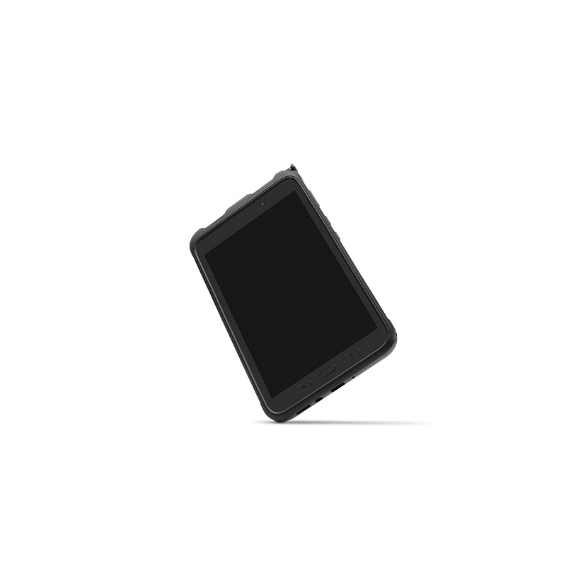
| Flight Software | WingtraPilot (pre-installed on rugged Samsung tablet) |
| Key Flight Features | Terrain Following, Corridor Mapping, KML Import, Pause/Resume, Battery Swap |
| Compatible Platforms | Esri, Pix4D, Bentley, Delair, DroneDeploy |
Manuals & Documents
General Warranty Info:
- Ripping It Outdoors works closely with our manufacturers to supply and support your products warranty needs as best as possible!
- The majority of products come with a manufacturer represented warranty against manufacturing defects for at least a 12 month period after the date of sale.
- Expendable components and "wear parts" including but not limited to blades, knives, teeth, oil, chain sprockets, skid shoes, knife mounting discs, and similar components are usually excluded from manufacturer warranties.
- Please reach out to us for any specific warranty information needed about products and parts you can’t find!
Videos
Shipping
General Shipping Info:
- Instantly calculate shipping quotes to the lower 48 states by 1. adding this product to your cart, 2. click continue to the checkout page and 3. enter your shipping address to check rates. Contact us for quotes for shipping to Hawaii, Alaska, Canada, Mexico and Internationally.
- Complimentary lift gate service on all freight shipments where it’s possible. We guarantee safe delivery!
- Low shipping rates for customers. We have negotiated the best possible rates for customers from our trusted carriers (ODFL, ESTES, UPS, and FedEx).
- Negotiate shipping rates if you think we can do better please reach out. Keep in mind some shipping rates also include assembly & configuration as well!