


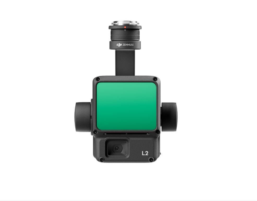
DJI Zenmuse L2 Camera High-Precision Aerial LiDAR System | Care Basic
DJI Zenmuse L2 Camera High-Precision Aerial LiDAR System | Care Basic
Couldn't load pickup availability
Couldn't load pickup availability


Product Description
DJI Zenmuse L2 Camera High-Precision Aerial LiDAR System | Care Basic
DESCRIPTION
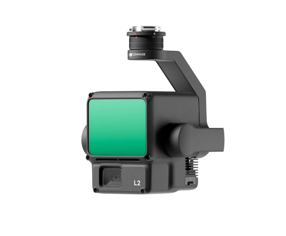
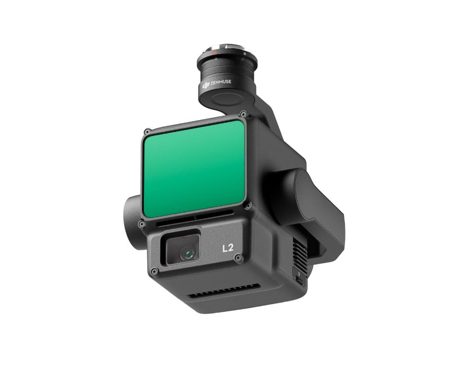
HIGH-PRECISION AERIAL LIDAR SYSTEM
Zenmuse L2 integrates frame LiDAR, a self-developed high-accuracy IMU system, and a 4/3 CMOS RGB mapping camera, providing DJI flight platforms with more precise, efficient, and reliable geospatial data acquisition. When used with DJI Terra, it delivers a turnkey solution for 3D data collection and high-accuracy post-processing.
INTEGRATED LIDAR SOLUTION
Supported by its powerful hardware, L2 can allow for a precise scan of complex subjects within an extended range and faster point cloud acquisition. During operations, users can preview, playback, and process point cloud models on-site, with Task Quality Reports generated by DJI Terra, offering a simple, one-stop solution to improve overall efficiency. This enables users to achieve high-precision point cloud results with one-stop post-processing.
- High-Level Precision: By combining GNSS and a high-accuracy self-developed IMU, this solution achieves 4cm vertical accuracy and 5cm horizontal accuracy.
- Exceptional Efficiency: It’s ready for work as soon as it’s powered on and can collect both geospatial and RGB data from a 2.5km2 area in a single flight.
- Intuitive Operation: In conjunction with Matrice 350 RTK and DJI Terra, L2 offers a turnkey solution that is simple to use, lowering the operational threshold.
FRAME-BASED LIDAR
30% Detection Range Increase
L2 can detect from 250 meters at 10% reflectivity and 100 klx, [3] and up to 450 meters at 50% reflectivity and 0 klx. [3] The typical operational altitude now extends up to 120 meters, notably enhancing operational safety and efficiency.
Smaller Laser Spots, Denser Point Clouds
With a reduced spot size of 4×12 cm @100m, only a fifth of that of L1, L2 not only detects smaller objects with more details, but can also penetrate denser vegetation, generating more accurate digital elevation models (DEM).
Supports 5 Returns
In densely vegetated areas, L2 can capture more ground points beneath the foliage.
Effective Point Cloud Rate: 240,000 pts/s
In both single and multiple return modes, L2 can reach a max point cloud emission rate of 240,000 points per second, allowing the acquisition of more point cloud data in a given time frame.
Two Scanning Modes
L2 supports two scanning modes, offering flexibility for users based on their task demands. In repetitive scanning mode, L2's LiDAR can achieve more uniform and accurate point clouds while meeting high-precision mapping requirements. In non-repetitive scanning mode, it offers deeper penetration for more structural information, making it suitable for power line inspection, forestry surveying, and other scenarios.
Frame-based Design
The frame-based design results in an effective point cloud data rate of up to 100%. Together with a three-axis gimbal, it brings more possibilities to surveying scenarios.
HIGH-ACCURACY IMU SYSTEM
Improved Accuracy
The high-accuracy self-developed IMU system, combined with the drone’s RTK positioning system for data fusion during post-processing, gives L2 access to highly accurate absolute position, speed, and attitude information. In addition, the IMU system’s enhanced environmental adaptability improves the operational reliability and precision of L2.
No IMU Warm-up
The performance of the IMU system has been significantly enhanced, and it is ready for use the moment it's powered on. And, the accompanying drone is ready to begin tasks immediately once the RTK is in FIX status, delivering an optimized in-the-field experience.
RGB MAPPING CAMERA
4/3 CMOS, Mechanical Shutter
Pixel size has been enlarged to 3.3 μm, and effective pixels now reach 20 MP, resulting in a significant improvement in overall imaging, as well as more enriched true-color point cloud details. The minimum photo interval has been reduced to 0.7 seconds. The mapping camera has a shutter count of up to 200,000 times, further reducing operational costs. When point cloud collection is not needed, the RGB camera can still take photos and videos, or collect images for visible light mapping.
ENHANCED OPERATIONAL EXPERIENCE
Diverse Flight - Route Types - Point Cloud - LiveView - Point Cloud Model - Playback and Merging - Auto-Generated Task - Quality Report - PPK Solution - One Click Processing on DJI Terra
APPLICATION SCENARIOS
In coordination with DJI Enterprise flight platforms and DJI Terra, Zenmuse L2 can be applied to land surveying and mapping, electricity, forestry, and infrastructure management, as well as other scenarios.
Key Features
- Turnkey Solution: Integrates hardware and software for end-to-end workflows.
- Enhanced Point Cloud: Captures smaller objects and penetrates dense vegetation for accurate DEM generation.
- High-Accuracy IMU: Provides reliable absolute positioning and environmental adaptability.
- RGB Camera: Equipped with a 4/3 CMOS sensor, 20 MP resolution, and mechanical shutter for enriched point cloud details.
- Intuitive Operation: Simplifies workflows with DJI Terra's one-click processing and auto-generated reports.
Detailed Specifications
| Attribute | Details |
|---|---|
| LiDAR Detection Range | 250m @ 10% reflectivity, 450m @ 50% reflectivity |
| Point Cloud Rate | 240,000 pts/s |
| Scanning Modes | Repetitive and Non-repetitive |
| IMU Accuracy | Vertical: 4cm; Horizontal: 5cm |
| RGB Camera | 4/3 CMOS, 20 MP, mechanical shutter |
| Effective Pixels | 20 MP |
| Shutter Life | 200,000 actuations |
| Point Cloud LiveView | Supported |
| Power Consumption | 28W (typical), 58W (max) |
| Dimensions (L × W × H) | 155×128×176 mm |
| Weight | 905 g |
| Ingress Protection | IP54 |
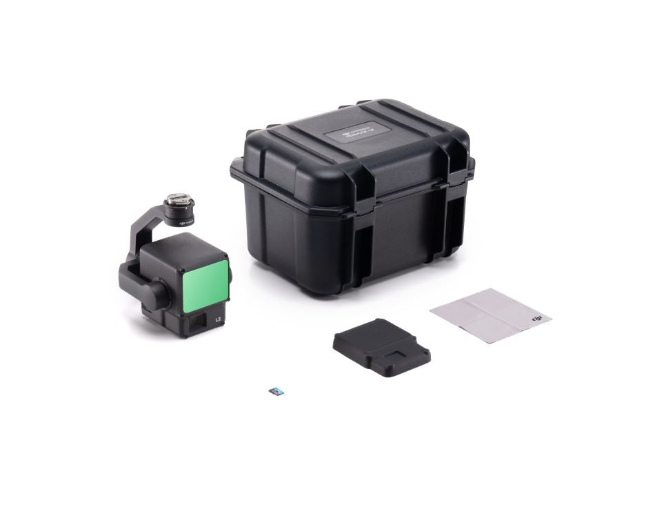
In Package
- 1x DJI Zenmuse L2 Camera
- 1x 128GB MicroSD Card
- 1x Storage Case
- 1x Lens Cap
- 1x Lens Cleaning Cloth
- 1x DJI Terra Activation Code
- 1x DJI Care Enterprise Basic
Manuals & Documents
General Warranty Info:
- Ripping It Outdoors works closely with our manufacturers to supply and support your products warranty needs as best as possible!
- The majority of products come with a manufacturer represented warranty against manufacturing defects for at least a 12 month period after the date of sale.
- Expendable components and "wear parts" including but not limited to blades, knives, teeth, oil, chain sprockets, skid shoes, knife mounting discs, and similar components are usually excluded from manufacturer warranties.
- Please reach out to us for any specific warranty information needed about products and parts you can’t find!
Videos
Shipping
General Shipping Info:
- Instantly calculate shipping quotes to the lower 48 states by 1. adding this product to your cart, 2. click continue to the checkout page and 3. enter your shipping address to check rates. Contact us for quotes for shipping to Hawaii, Alaska, Canada, Mexico and Internationally.
- Complimentary lift gate service on all freight shipments where it’s possible. We guarantee safe delivery!
- Low shipping rates for customers. We have negotiated the best possible rates for customers from our trusted carriers (ODFL, ESTES, UPS, and FedEx).
- Negotiate shipping rates if you think we can do better please reach out. Keep in mind some shipping rates also include assembly & configuration as well!