


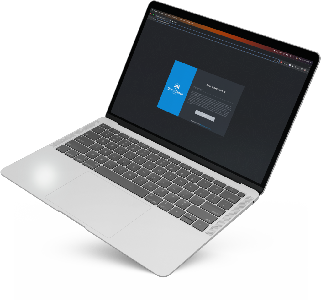
DroneSense-The Comprehensive Situational Awareness Platform Built for Public Safety
DroneSense-The Comprehensive Situational Awareness Platform Built for Public Safety
Couldn't load pickup availability
Couldn't load pickup availability


How to Get A Quote
***Online pricing not available, Please request a quote:***
How To Get A Quote:
Option 1:
“Contact Us to make sure you are getting the best unit possible. These machines are complex so let us help you get exactly what you need!
Option 2: (quickest response times)
Step 1. Add the item to your cart
Step 2. Checkout or Click on the Chat button box that is at the bottom right of your screen
Step 3. Please tell us any info you think we would need to know
Step 4. Relax, our team is processing your request and an expert will be in touch to get you exactly what you need!
Product Description
DroneSense-The Comprehensive Situational Awareness Platform Built for Public Safety
DESCRIPTION
DroneSense is the ultimate data and operational platform for public safety agencies, designed to leverage the power of drones to improve outcomes and save lives. With a suite of tools built for pilots, operations, and administrators, DroneSense delivers unparalleled situational awareness, enabling faster and more informed decision-making.
This platform empowers law enforcement, fire & rescue, and emergency management teams to respond effectively to routine calls and disaster scenarios. From live video streaming and telemetry data to automated flight logging and collaborative mission planning, DroneSense is a force multiplier for public safety agencies.
DroneSense is built for teams of all sizes, offering complete control over your drone program with an intuitive interface, secure data handling, and advanced collaboration capabilities. Equip your team with the tools they need to proactively address hazards and deliver exceptional public safety outcomes.
Key Features
DroneSense for Pilots
- Flight Control: Consistent interface for any drone, automatic flight logging, and remote live streaming.
- Telemetry Tracking: Access real-time data, including speed, height (MSL, AGL, HAT), drone orientation, and gimbal angle.
- Sensor Flexibility: Switch between visual and thermal cameras, with features like zoom and thermal palette adjustments.
- Persistent Map View: Always maintain awareness of drone position and orientation.
DroneSense for Operations
- Real-Time Data Access: Secure live streaming with low latency and end-to-end encryption.
- Collaborative Missions: Invite external organizations to join missions without sharing account credentials.
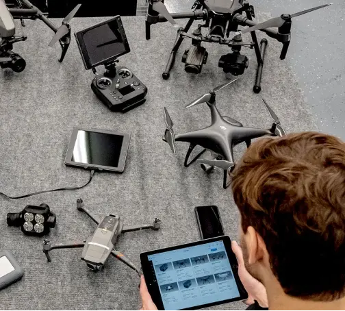
- Centralized Application: Access data from multiple drones and devices in one easy-to-use interface.
DroneSense for Administrators
- Effortless Organization: Manage pilots, missions, hardware, and flights with a complete system of record.
- Data Insights: Generate high-level visualizations and drill down into mission specifics as needed.
- Comprehensive Reporting: Track pilot and mission data with ease, ensuring transparency and accountability.
- Map & Calendar Views: Visualize timing and locations of drone flights and activities.
Using DroneSense, public safety teams can obtain a comprehensive view of every evolving situation, creating a deeper understanding of the environment and identifying potential hazards before they escalate into major problems.

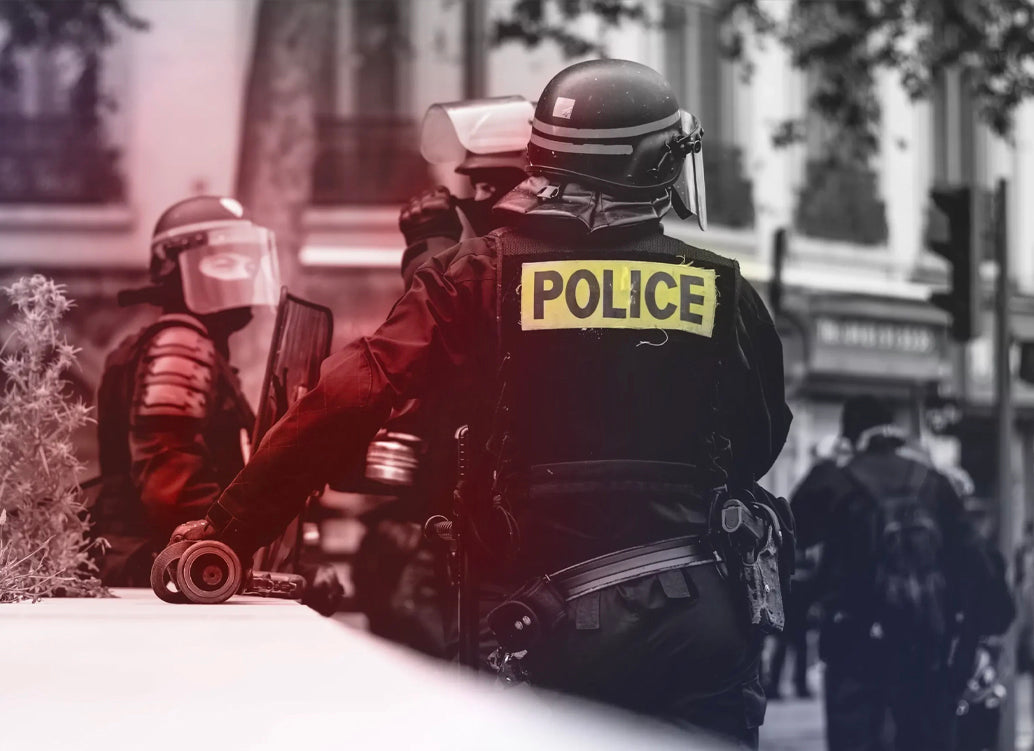
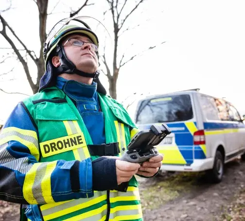
Law Enforcement
Designed for every service level from local, state, and federal law enforcement agencies, DroneSense can help you successfully use drones to aid with crimes-in-progress, accident and crime scene reconstruction, SWAT operations, large event overwatch, and more.

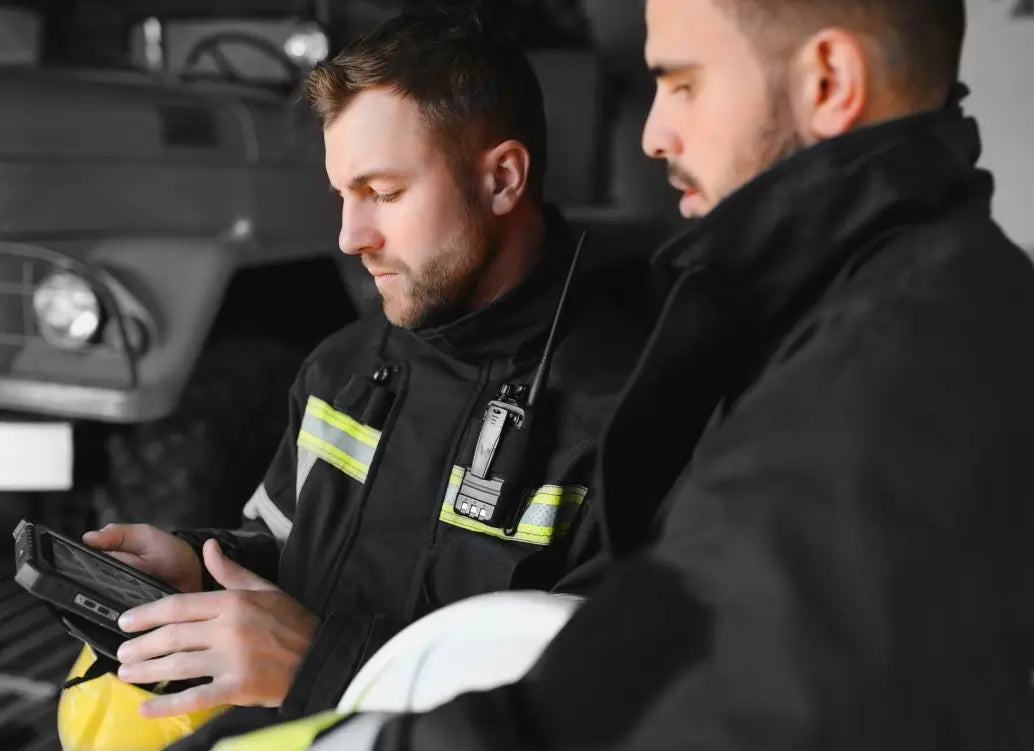
Fire & Rescue
The use of drones in fire service support has become immeasurable. DroneSense can assist fire and rescue agencies of all sizes in integrating drones to support activities such as pre-fire planning, identifying hot spots, overseeing live scenes, creating post-fire maps, and conducting search and rescue operations.

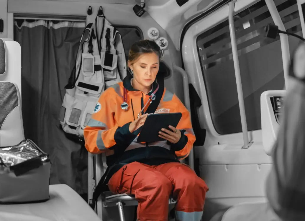
Emergency Management
Whether you want to expand your capabilities over a large area, or assist victims in tandem with rescue personnel, DroneSense can help coordinate your drone teams to effectively respond to a variety of emergency situations
A Powerful, Intuitive App for Any Drone in Your Fleet
Take control of your missions with a consistent flight control interface, automatic flight logging, and remote live streaming.
Clear Telemetry
View pertinent telemetry data including height (MSL, AGL, and HAT), speed, relative drone position and orientation to pilot, and gimbal angle.
Extensive Sensor Support
Use the best visual or thermal camera for any operation. Toggle between sensors and access features unique to each, like zoom controls and thermal palettes.
Persistent Map View
Maintain awareness of your aircraft’s position and orientation at all times, even while viewing the full video screen.
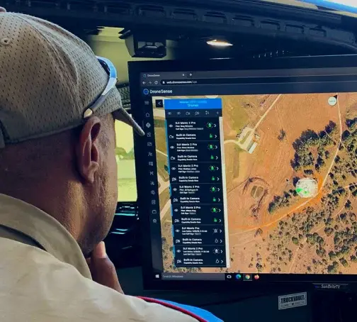
Complete Situational Awareness
Better decisions lead to better outcomes. With secure access to live data, your command center can pull data from multiple sources into one central and easy-to-use application.
Collaborative Missions
Use email and text to invite other organizations to your missions without giving them access to your DroneSense account.
Fast and Secure
Low latency, end-to-end encrypted, real-time video streaming of an unlimited number of aircraft and devices.
Detailed Specifications
| Feature | Details |
|---|---|
| Telemetry Data | Height (MSL, AGL, HAT), speed, drone orientation |
| Sensor Compatibility | Visual and thermal cameras with advanced controls |
| Live Streaming | End-to-end encrypted, low-latency, real-time video |
| Collaboration Tools | Invite external teams securely via email/text |
| Sorting & Filtering | Flights, personnel, hardware, and mission data |
| Data Integration | Supports multiple drone platforms and devices |
| Mapping Tools | Persistent map views and detailed flight logging |
| Compatible Drones | Universal—works with most drone models |
Manuals & Documents
General Warranty Info:
- Ripping It Outdoors works closely with our manufacturers to supply and support your products warranty needs as best as possible!
- The majority of products come with a manufacturer represented warranty against manufacturing defects for at least a 12 month period after the date of sale.
- Expendable components and "wear parts" including but not limited to blades, knives, teeth, oil, chain sprockets, skid shoes, knife mounting discs, and similar components are usually excluded from manufacturer warranties.
- Please reach out to us for any specific warranty information needed about products and parts you can’t find!
Videos
Shipping
$1 Shipping Quote Info:
- Contact Us For Shipping Quotes. All $1 products are listed as quote only because we can not display their pricing online.
- Low shipping rates for customers. We have negotiated the best possible rates for customers from our trusted carriers (ODFL, ESTES, UPS, and FedEx) & Top Private Drivers
- Negotiate shipping rates if you think we can do better please reach out. Keep in mind some shipping rates also include assembly & configuration as well!
- Complimentary lift gate service on all freight shipments where it’s possible. We guarantee safe delivery!