


Freefly RTK GPS Ground Station | For Aerial Mapping & Surveying
Freefly RTK GPS Ground Station | For Aerial Mapping & Surveying
Couldn't load pickup availability
Couldn't load pickup availability


Product Description
Freefly RTK GPS Ground Station | For Aerial Mapping & Surveying
DESCRIPTION
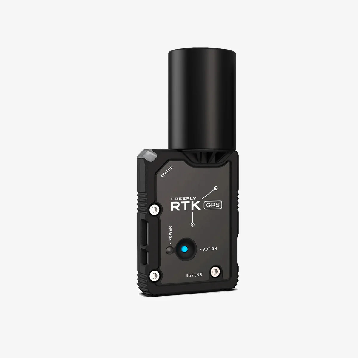
Need centimeter-level accuracy for your Alta X or Astro? Freefly RTK GPS utilizes Real Time Kinematic (RTK) technology to enable pin-point location accuracy vertically and horizontally.
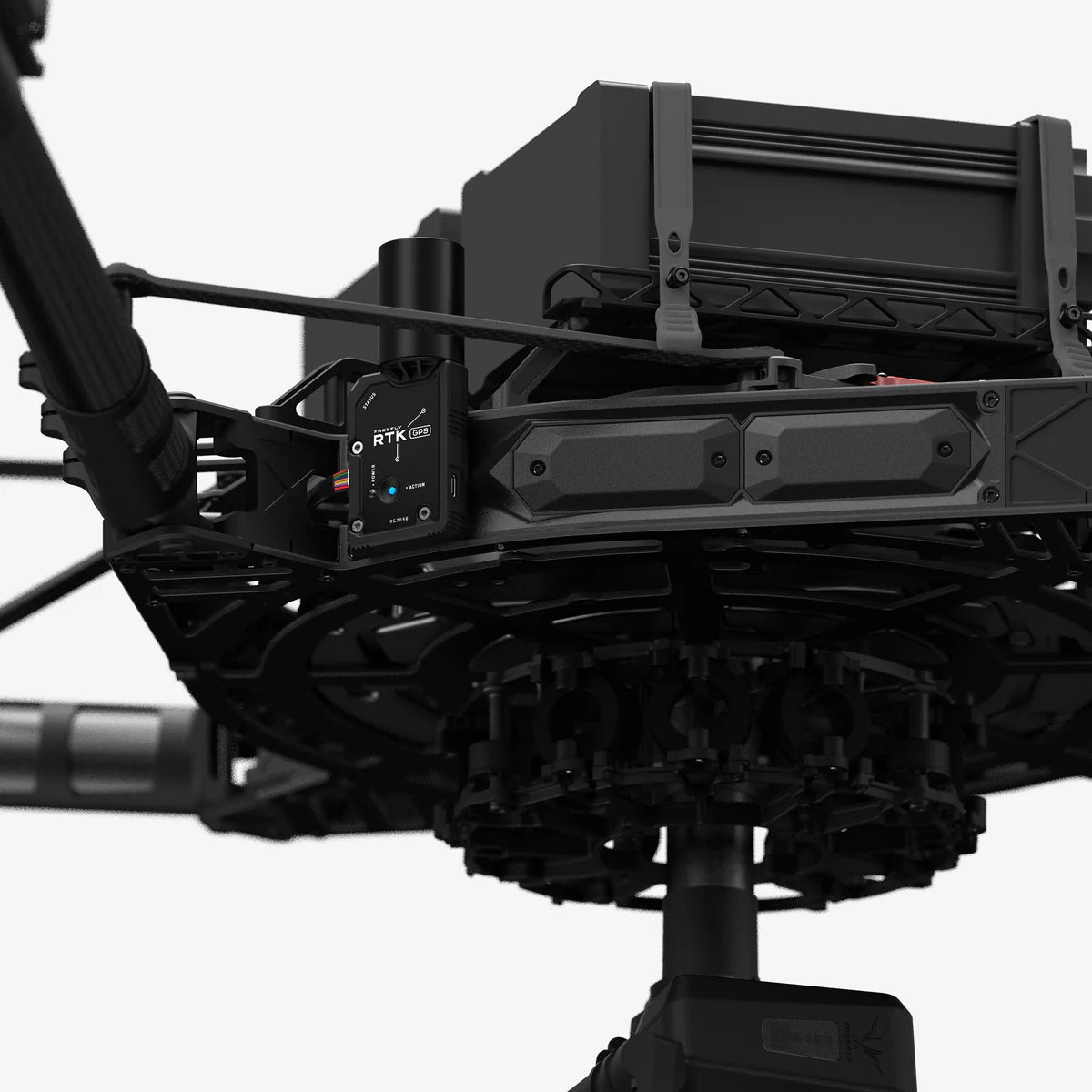
The FreeFly RTK GPS Ground Station provides centimeter-level accuracy for your Alta X or Astro drone, utilizing Real-Time Kinematic (RTK) technology to deliver precise vertical and horizontal positioning. This system is designed to ensure the highest level of accuracy, which is essential for demanding applications such as surveying, mapping, and other professional-level drone operations.This RTK GPS system offers reliable performance, even in environments where standard GPS systems might struggle, ensuring that your drone maintains precise location data throughout its flight. It’s fully compatible with the Alta X and Astro, and its easy setup ensures that you can quickly get to work in the field without unnecessary delays.
Whether you’re performing precision surveying or other high-accuracy tasks, the FreeFly RTK GPS Ground Station is the ultimate solution for your drone operations.
Key Features
- Real-Time Kinematic Technology: Provides centimeter-level accuracy for precise location data.
- Precision for Aerial Mapping & Surveying: Ideal for high-accuracy applications.
- Easy Setup: Quickly integrates with Alta X and Astro drones for streamlined operation.
- Reliable Performance: Maintains accurate positioning even in complex environments.
Detailed Specifications
| Specification | Details |
|---|---|
| SKU | 910-00659 |
| Manufacturer | FreeFly |
| Technology | Real-Time Kinematic (RTK) |
| Compatible With | Alta X, Astro |
| Positioning Accuracy | Centimeter-level (Vertical & Horizontal) |
| Mounting | Ground Station |
In the Box
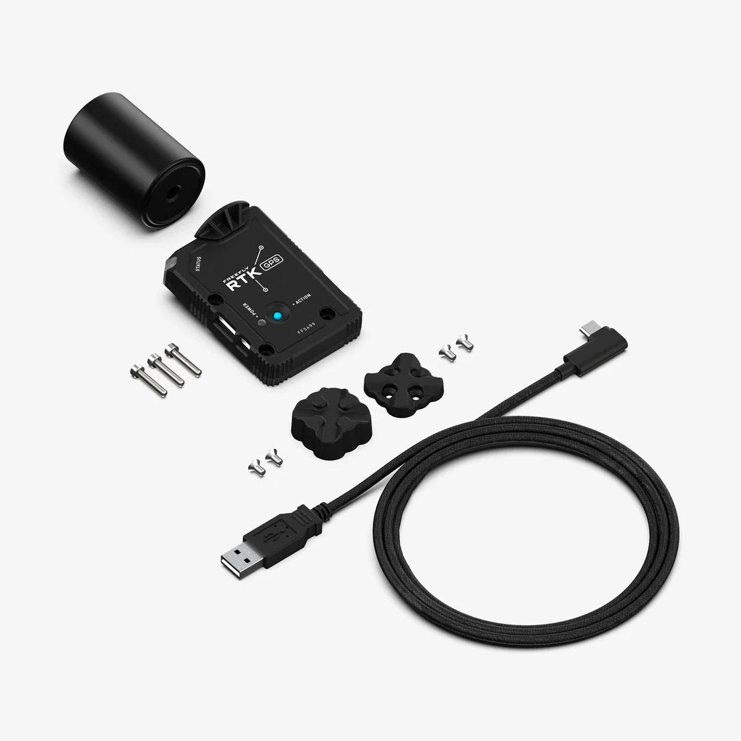
- Qty 1 - RTK GPS module
- Qty 1 - Multi-band RTK GPS antenna
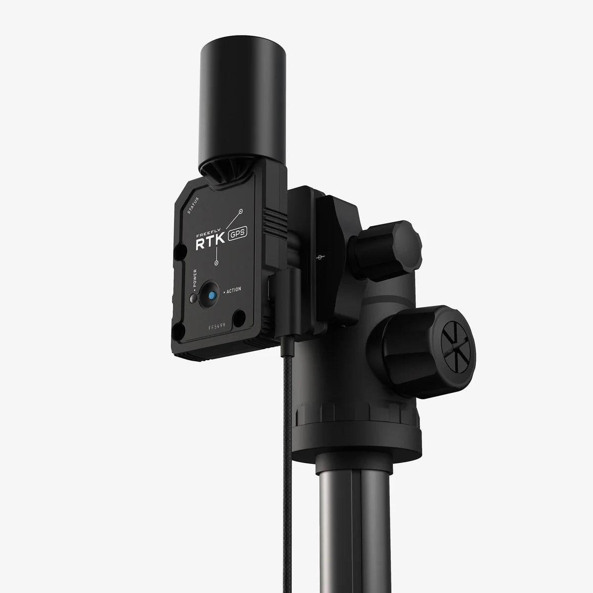
- Qty 1 - Magnetic mounting kit for tripod, etc (¼ 20 interface)
- Qty 4 - Mounting screws for Magnetic Mounting Kit (M3 x 6 FHCS)
- Qty 1 - USB cable, Type C right-angle to Type A (3 m / 9.84 ft long)
- Qty 3 - Mounting Screws for Alta X Rover installation (M3 x 16 SHCS)
Manuals & Documents
General Warranty Info:
- Ripping It Outdoors works closely with our manufacturers to supply and support your products warranty needs as best as possible!
- The majority of products come with a manufacturer represented warranty against manufacturing defects for at least a 12 month period after the date of sale.
- Expendable components and "wear parts" including but not limited to blades, knives, teeth, oil, chain sprockets, skid shoes, knife mounting discs, and similar components are usually excluded from manufacturer warranties.
- Please reach out to us for any specific warranty information needed about products and parts you can’t find!
Videos
Shipping
General Shipping Info:
- Instantly calculate shipping quotes to the lower 48 states by 1. adding this product to your cart, 2. click continue to the checkout page and 3. enter your shipping address to check rates. Contact us for quotes for shipping to Hawaii, Alaska, Canada, Mexico and Internationally.
- Complimentary lift gate service on all freight shipments where it’s possible. We guarantee safe delivery!
- Low shipping rates for customers. We have negotiated the best possible rates for customers from our trusted carriers (ODFL, ESTES, UPS, and FedEx).
- Negotiate shipping rates if you think we can do better please reach out. Keep in mind some shipping rates also include assembly & configuration that as well!