


Garmin GPSMAP® 743xsv, 943xsv, 1243xsv Chartplotters SideVü, ClearVü and Traditional CHIRP Sonar with Worldwide Basemap and Mapping
Garmin GPSMAP® 743xsv, 943xsv, 1243xsv Chartplotters SideVü, ClearVü and Traditional CHIRP Sonar with Worldwide Basemap and Mapping
Couldn't load pickup availability
Couldn't load pickup availability


Product Description
Garmin GPSMAP® 743xsv, 943xsv, 1243xsv Chartplotters SideVü, ClearVü and Traditional CHIRP Sonar with Worldwide Basemap and Mapping
DESCRIPTION
The Garmin GPSMAP® Series delivers unparalleled navigation and performance with powerful processors, premium displays, and seamless connectivity. Whether you’re a professional angler, cruiser, or sailor, these chartplotters are engineered to enhance your time on the water.
From the compact GPSMAP 723 to the full-featured GPSMAP 1243xsv, these devices provide a sharper view, effortless integration, and advanced sonar and mapping capabilities.
Key Features
Enhanced Display Technology
- IPS Screens: Wider viewing angles, superior clarity, and better sunlight readability.
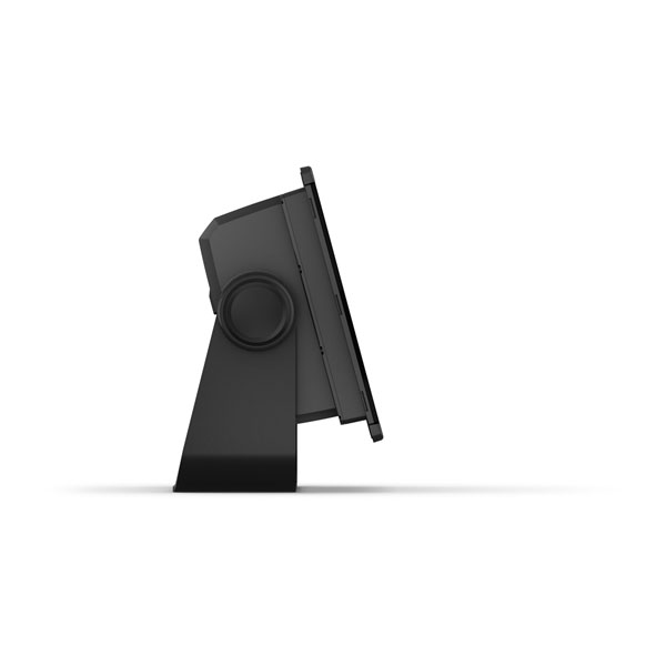
- Slimline Design: Edge-to-edge glass and compact footprint for flexible dash mounting options.
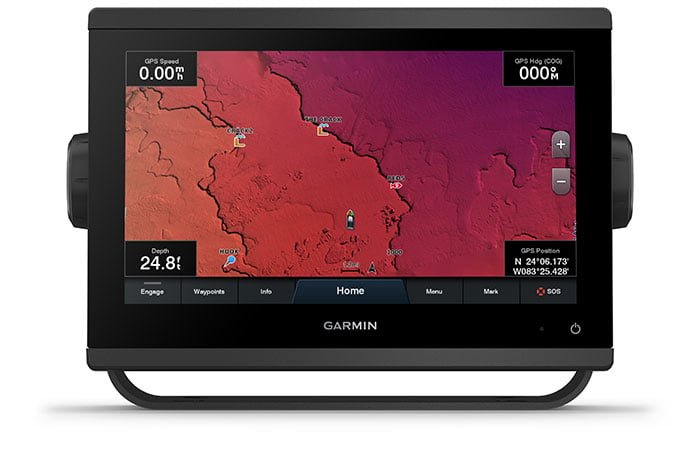
Advanced Mapping
- Preloaded Charts: BlueChart® g3 and LakeVü g3 maps with Navionics® data for detailed cartography.
- Auto Guidance Technology: Automatically calculate safe routes based on your vessel's specifications.
- Quickdraw Contours: Create personalized HD fishing maps with 1-foot contours.
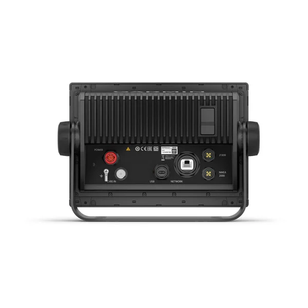
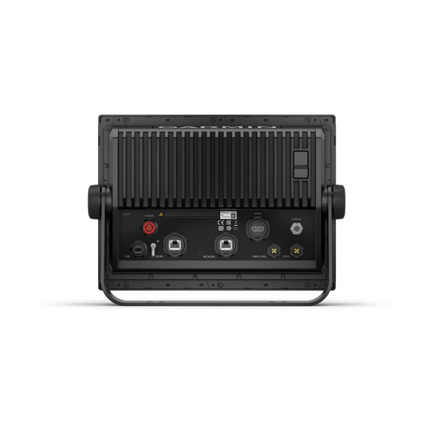
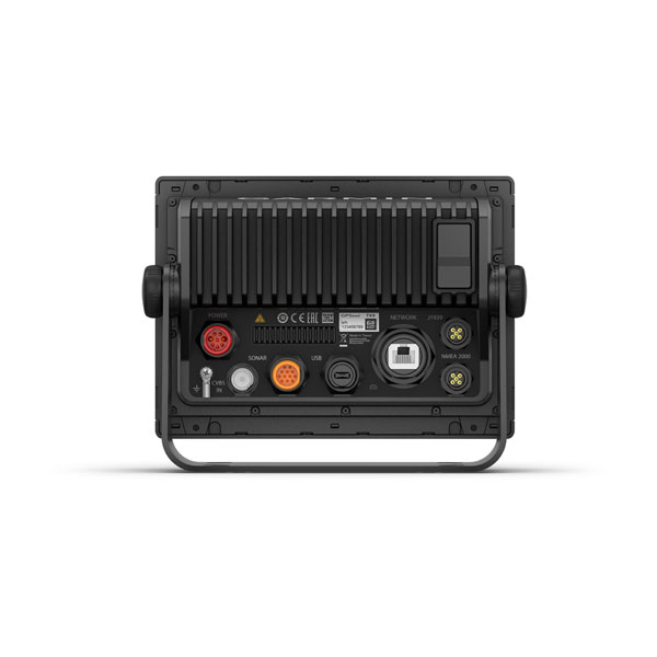
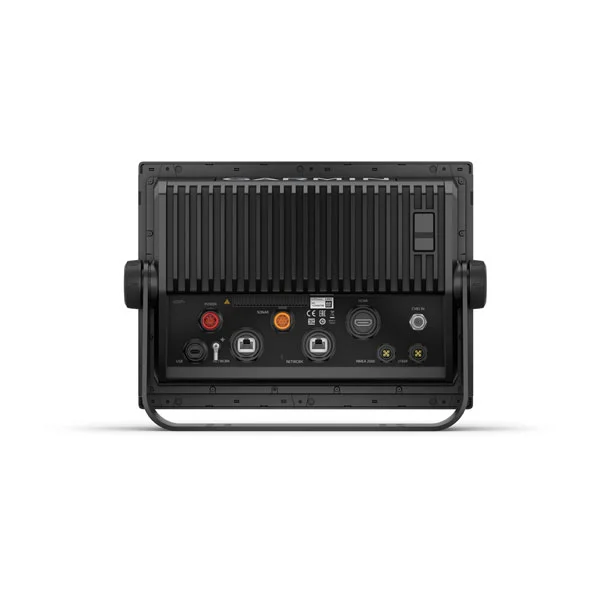
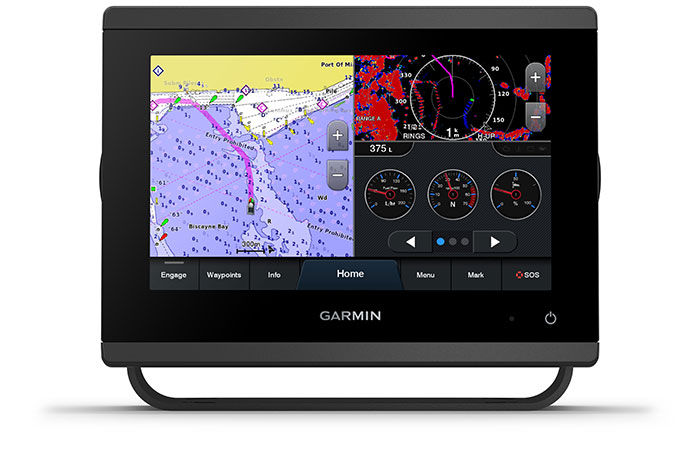
Connectivity and Networking
- Garmin Marine Network: Share maps, radar, and sonar across multiple devices.
- ActiveCaptain Integration: Manage your marine experience remotely with trip planning, notifications, and updates.
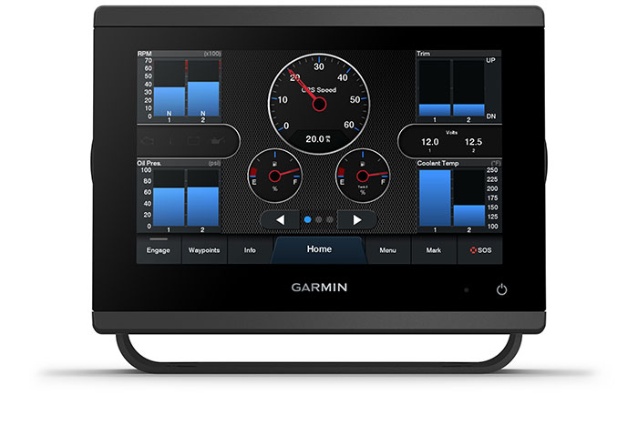
- NMEA 2000® & J1939 Support: Connect to autopilots, engines, and third-party marine products.
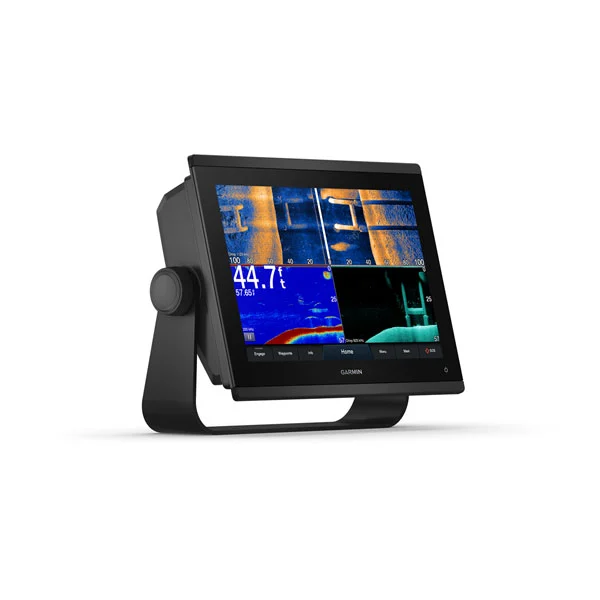
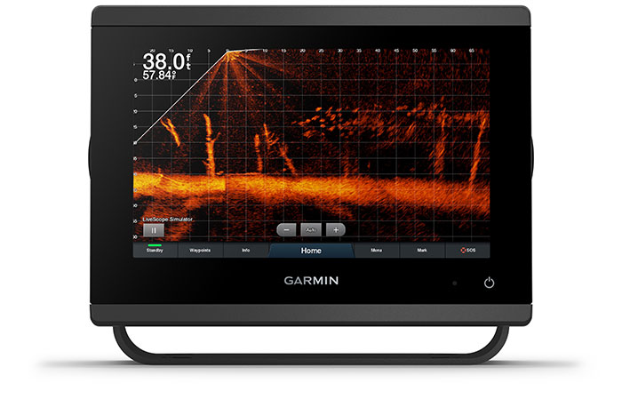
Optional Sonar Technology
- SideVü and ClearVü: Available on "xsv" models for detailed underwater scanning.
- Traditional CHIRP Sonar: Built-in support or optional with external black boxes.
- Maximum Depth: Up to 5,000 ft with compatible transducers.
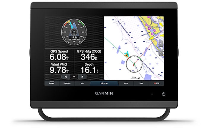
Sailing Tools
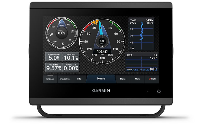
- Garmin SailAssist™: Laylines, race start line guidance, and wind data for optimized sailing performance
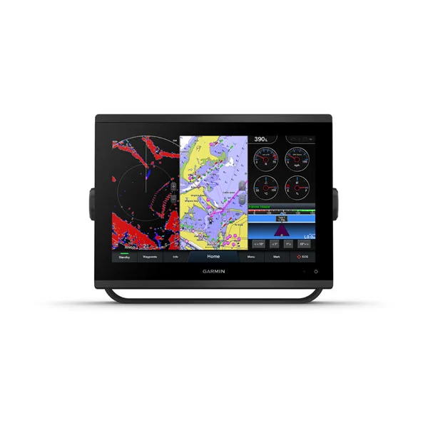
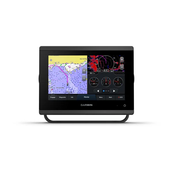
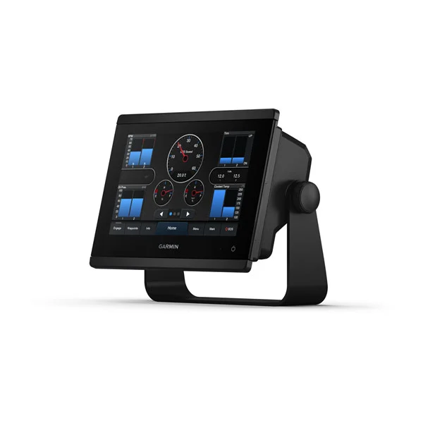
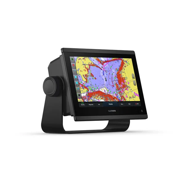
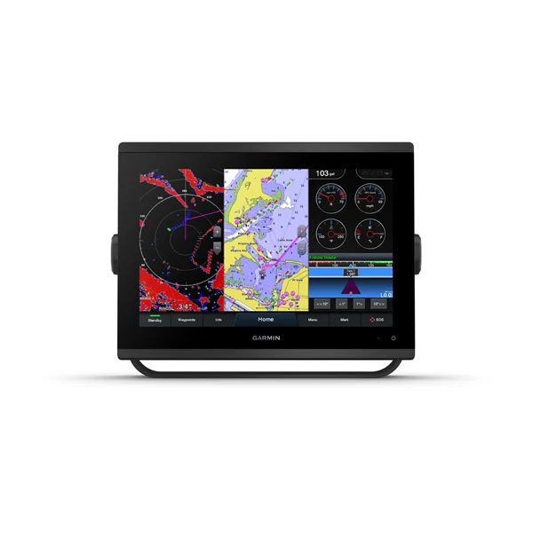
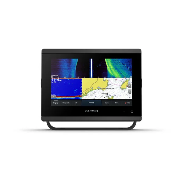
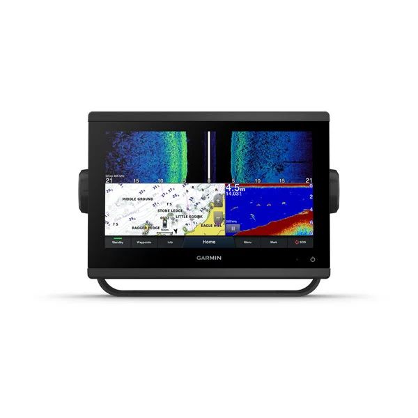
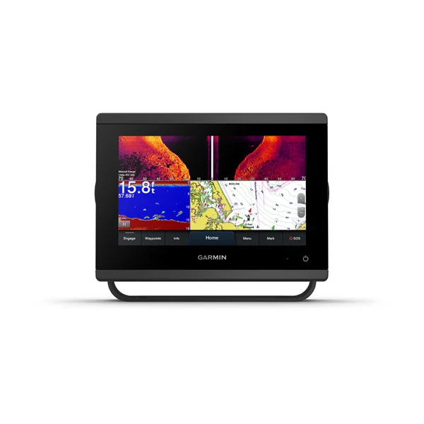
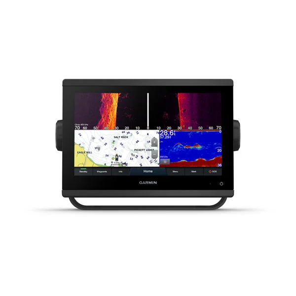
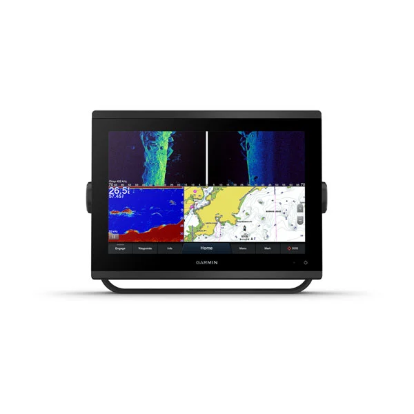
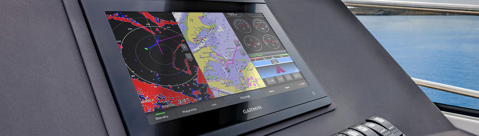
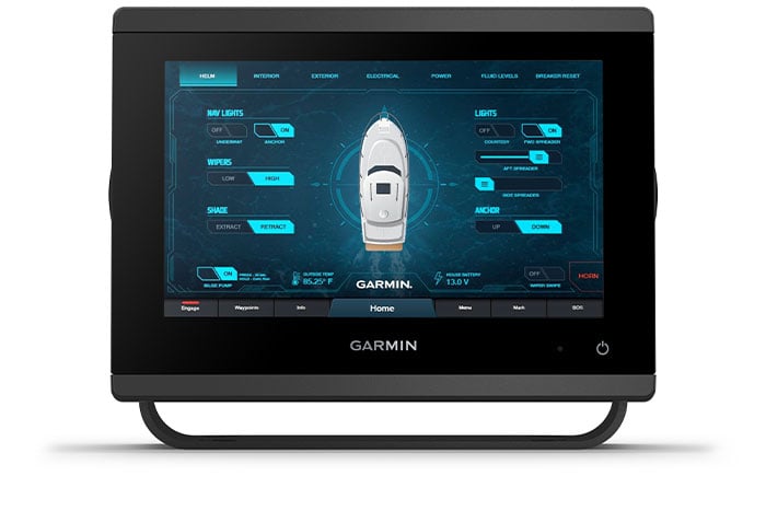
GET A SHARPER VIEW FROM YOUR CONNECTED HELM
With 60% more display pixels and nearly double the processing power of previous-generation 7” GPSMAP devices, this crisp high-resolution chartplotter integrates seamlessly into your Garmin marine system.
Sail and navigate with ease.

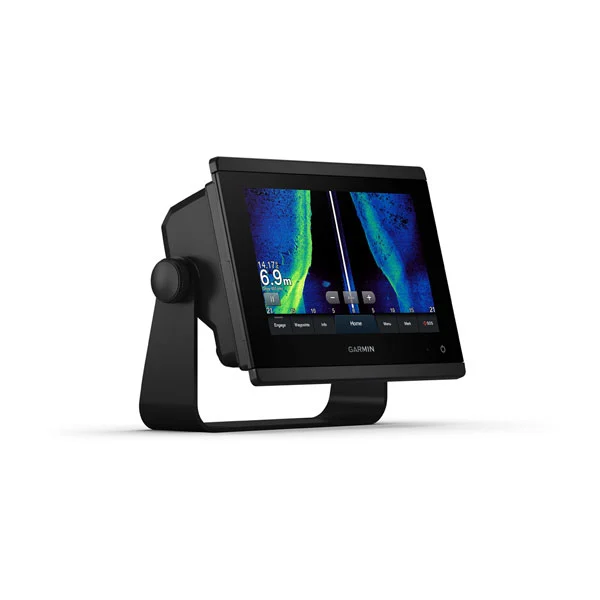
FAST, SHARP, SMART:
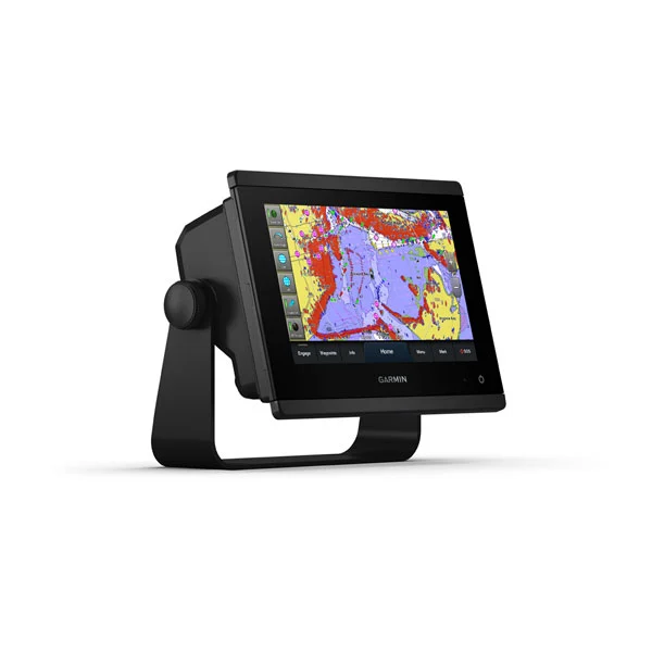
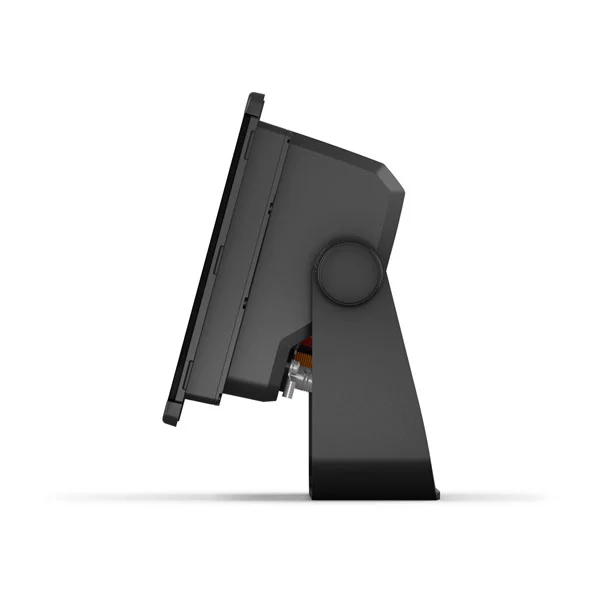
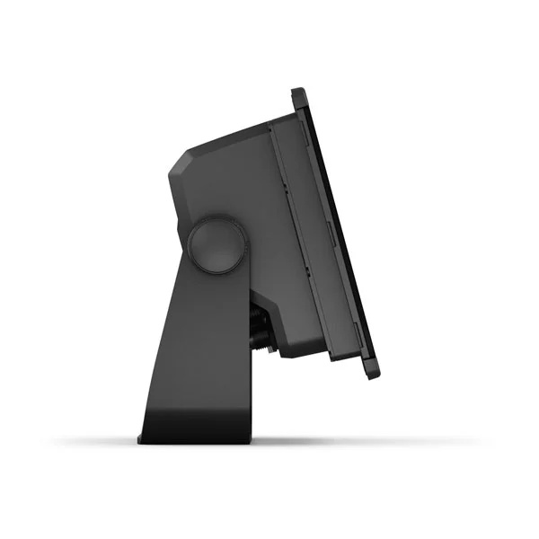
With its powerful technology and new slimline design featuring edge-to-edge glass and a smaller unit footprint, it’s easy to retrofit this 12” plotter in a wider range of dash configurations.
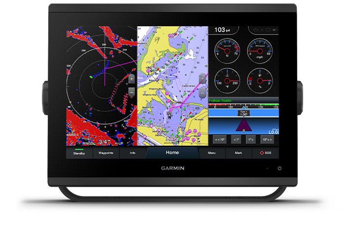
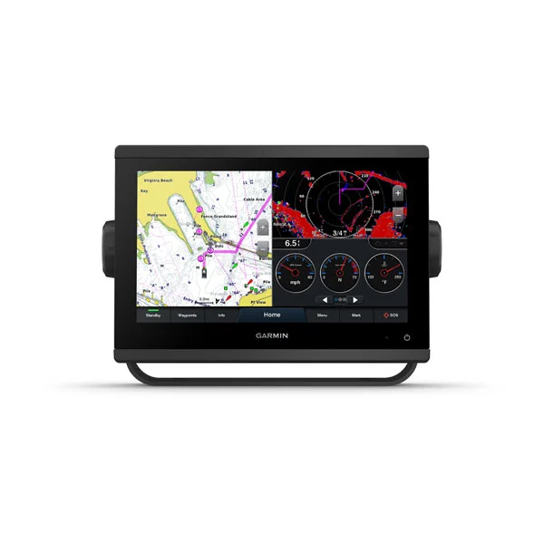
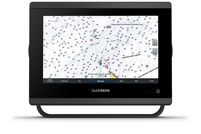
PRELOADED MAPPING:
Experience unparalleled coverage and detail with preloaded BlueChart® g3 coastal charts and LakeVü g3 inland maps featuring integrated Garmin and Navionics® content and Auto Guidance2 technology.
Connect to everything on your boat.
GARMIN MARINE NETWORK:
If you have multiple compatible Garmin devices on your boat, you can share information — such as maps, user data, radar and IP camera video — among them.
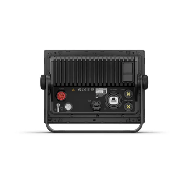
NMEA 2000® AND NMEA 0183 NETWORKS:
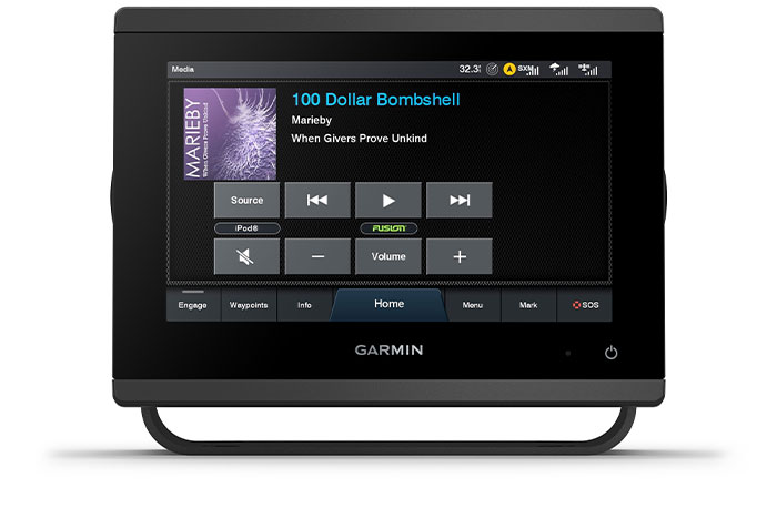
Connect to compatible autopilots, digital switching, weather, Fusion-Link™ audio system, media, VHF, AIS and more from one screen.
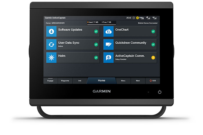
ACTIVECAPTAIN® APP:
Built-in Wi-Fi® connectivity pairs with the free all-in-one mobile app for access to the OneChart™ feature, smart notifications2, software updates, Garmin Helm™ digital switching, Garmin Quickdraw™ Community data and more5.
INTEGRATED ANT® TECHNOLOGY:
Connect with some of your favorite devices, such as quatix® marine watches, gWind™ Wireless 2 transducers, GNX™ Wind marine instruments and wireless remote controls.
J1939 CONNECTIVITY:
Now you can connect your chartplotter to different kinds of engines, including select Yamaha engines.
ONEHELM FEATURE:
This exclusive feature brings together all the operations and capabilities of select third-party devices, such as EmpirBus™ digital switching, on one screen.
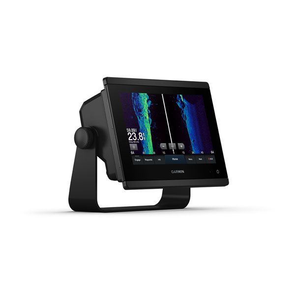
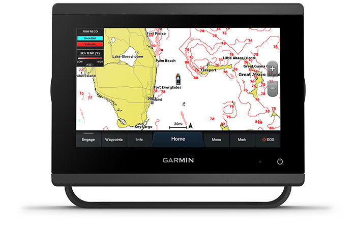
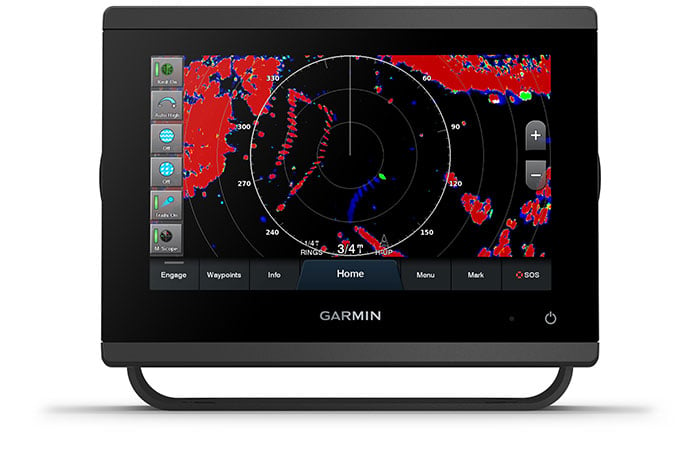
See the world below.

PANOPTIX™ SONAR SUPPORT:
Pair with Panoptix PS51 (transducer sold separately) with FrontVü scanning sonar6 to help you see and avoid submerged obstacles in real time as you approach within a 300’ range.
OPTIONAL BLUECHART® G3 VISION® CHARTS:
Upgrade to our reliable premium charts,3 which add even more unparalleled features, such as high-resolution relief shading, to help you on each trip.
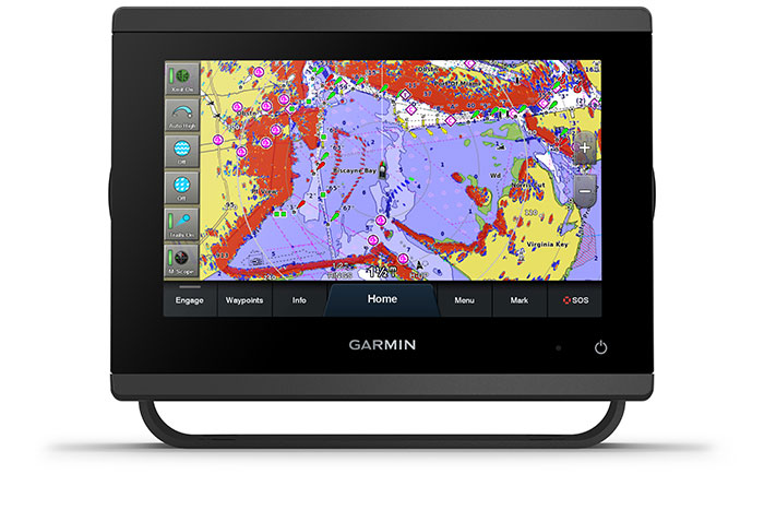
FASTER, SHARPER, SMARTER:
With its added processing power and new slimline design featuring edge-to-edge glass and a smaller unit footprint, it’s easy to retrofit this 7” plotter in a wider range of dash configurations.
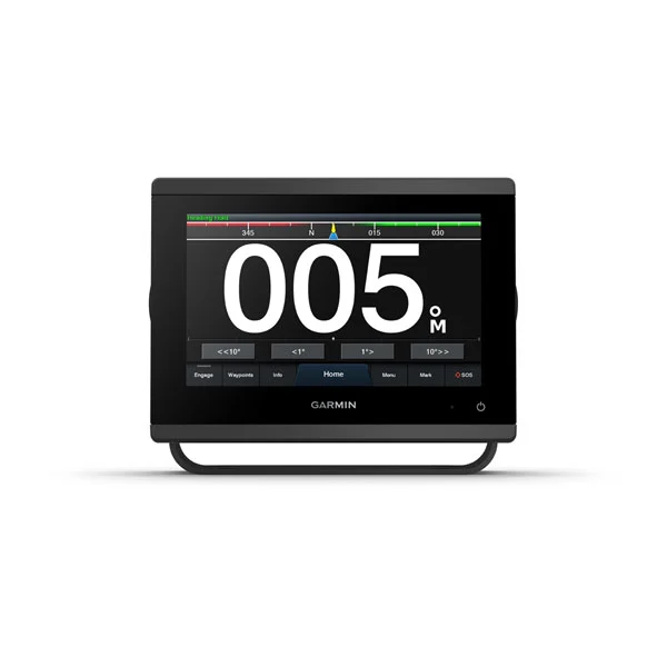
IMPROVED DISPLAY OPTICS:
New higher-resolution 7” displays offer improved sunlight readability with 60% more pixels than previous-generation 7” GPSMAP devices.
GARMIN SAILASSIST™ SAILING FEATURES:
View laylines, race start line guidance, enhanced wind rose, heading and course-over-ground lines, true wind data fields and tide/current/time slider, wind angle, set and drift, wind speed and more3.
OPTIONAL BLUECHART® G3 VISION® CHARTS:
These optional charts offer the best of Garmin and Navionics® data, Auto Guidance4 technology and other premium navigation features.
Detailed Specifications
| Specification |
GPSMAP® 723 |
GPSMAP® 923xsv |
GPSMAP® 1243xsv |
|---|---|---|---|
| Display Size | 7” | 9” | 12” |
| Resolution | 1024 × 600 | 1280 × 720 | 1280 × 800 |
| Sonar | Optional (via Black Box) | SideVü, ClearVü, CHIRP | SideVü, ClearVü, CHIRP |
| Weight | 2.8 lbs | 3.6 lbs | 6.6 lbs |
| Maps Included | Worldwide Basemap | BlueChart® g3, LakeVü g3 | BlueChart® g3, LakeVü g3 |
| Connectivity | NMEA 2000®, Wi-Fi | NMEA 2000®, J1939, Wi-Fi | NMEA 2000®, J1939, Wi-Fi |
GPSMAP® 723 7" Non-sonar with Worldwide Basemap
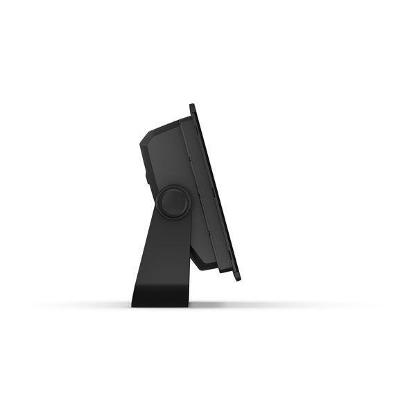
General Specifications:
| Specification | Details |
|---|---|
| Physical Dimensions | 7.6" x 5.5" x 2.9" (19.2 x 14.0 x 7.4 cm) |
| Display Size | 6.1" x 3.5"; 7.0" diagonal (17.8 cm) |
| Display Resolution | 1024 x 600 pixels |
| Display Type | WSVGA display |
| Weight | 2.8 lbs (1.3 kg) |
| Water Rating | IPX7 |
| Mounting Options | Bail, flush, or flat |
| Power Consumption | Max: 1.5 A (12 Vdc) |
| Antenna | Internal or external over NMEA 2000 |
| Receiver | 10 Hz high-sensitivity |
| Garmin Marine Ports | 1 |
Maps & Memory:
| Specification | Details |
| Preloaded Maps | Worldwide Basemap |
| Accepts Data Cards | 2 microSD™ cards (back) |
| Waypoints | 5,000 |
| Track Log | 50,000 points; 50 tracks |
| Routes | 100 |
Sonar Features:
| Specification | Details |
| ClearVü | Yes (with external black box) |
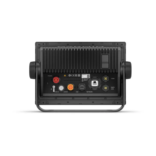
Connections:
| Specification | Details |
| NMEA 2000 Compatible | Yes |
| NMEA 0183 Input Ports | 1 (Differential) |
| NMEA 0183 Output Ports | 1 (Differential) |
| Wireless Connectivity | Yes |
| J1939 Compatible | Yes |
| USB Port | 1 |
GPSMAP® 923 9" Non-sonar with Worldwide Basemap
General Specifications:
| Specification | Details |
| Physical Dimensions | 9.2" x 6.4" x 3" (23.3 x 16.2 x 7.6 cm) |
| Display Size | 7.8" x 4.4"; 9.0" diagonal (22.9 cm) |
| Display Resolution | 1280 x 720 pixels |
| Display Type | WXGA IPS display |
| Weight | 3.6 lbs (1.6 kg) |
| Water Rating | IPX7 |
| Mounting Options | Bail, flush, or flat |
| Power Consumption | Max: 1.8 A (12 Vdc) |
| Antenna | Internal or external over NMEA 2000 |
| Receiver | 10 Hz high-sensitivity |
| Garmin Marine Ports | 1 |
Maps & Memory:
| Specification | Details |
| Preloaded Maps | Worldwide Basemap |
| Accepts Data Cards | 2 microSD™ cards (back) |
| Waypoints | 5,000 |
| Track Log | 50,000 points; 50 tracks |
| Routes | 100 |
Sonar Features:
| Specification | Details |
| ClearVü | Yes (with external black box) |
Connections:
| Specification | Details |
| NMEA 2000 Compatible | Yes |
| NMEA 0183 Input Ports | 1 (Differential) |
| NMEA 0183 Output Ports | 1 (Differential) |
| Wireless Connectivity | Yes |
| J1939 Compatible | Yes |
| USB Port | 1 |
General Specifications:
| Specification | Details |
| Physical Dimensions | 12.1" x 8.9" x 3.2" (30.8 x 22.8 x 8.2 cm) |
| Display Size | 10.3" x 6.4"; 12.1" diagonal (30.7 cm) |
| Display Resolution | 1280 x 800 pixels |
| Display Type | WXGA IPS display |
| Weight | 6.6 lbs (3.0 kg) |
| Water Rating | IPX7 |
| Mounting Options | Bail or flush |
| Power Consumption | Max: 2.2 A (12 Vdc) |
| Antenna | Internal or external over NMEA 2000 |
| Receiver | 10 Hz high-sensitivity |
| Garmin Marine Ports | 2 |
Maps & Memory:
| Specification | Details |
| Preloaded Maps | Worldwide Basemap |
| Accepts Data Cards | 2 microSD™ cards (back) |
| Waypoints | 5,000 |
| Track Log | 50,000 points; 50 tracks |
| Routes | 100 |
Sonar Features:
| Specification | Details |
| Dual-Frequency Sonar | Yes (with external black box) |
| Dual-Beam Sonar | Yes (with external black box) |
| ClearVü | Yes (with external black box) |
Connections:
| Specification | Details |
| NMEA 2000 Compatible | Yes |
| NMEA 0183 Input Ports | 1 |
| NMEA 0183 Output Ports | 1 |
| Wireless Connectivity | Yes |
| J1939 Compatible | Yes |
| USB Port |
In Package
GPSMAP® 723 7" Non-sonar with Worldwide Basemap:
- GPSMAP 723 chartplotter
- microSD™ card preinstalled
- Power cable
- NMEA 2000® T-connector
- NMEA 2000 drop cable (2 meters)
- Bail mount kit with knobs
- Flush mount kit with gasket
- Protective cover
- Trim piece snap covers
- Documentation
GPSMAP® 923 9" Non-sonar with Worldwide Basemap:
- GPSMAP 923 chartplotter
- microSD™ card preinstalled
- Power cable
- NMEA 2000® T-connector
- NMEA 2000 drop cable (2 meters)
- Bail mount kit with knobs
- Flush mount kit with gasket
- Protective cover
- Trim piece snap covers
- Documentation
GPSMAP® 1223 12" Non-sonar with Worldwide Basemap:
- GPSMAP 1223 chartplotter
- microSD™ card preinstalled
- Power cable
- NMEA 2000® T-connector
- NMEA 2000 drop cable (2 meters)
- Bail mount kit with knobs
- Flush mount kit with gasket
- Protective cover
- Trim piece snap covers
- Documentation
GPSMAP® 743 7" Non-sonar with Mapping:
- GPSMAP 743 chartplotter
- microSD™ card preinstalled
- Power cable
- NMEA 2000® T-connector
- NMEA 2000 drop cable (2 meters)
- Bail mount kit with knobs
- Flush mount kit with gasket
- Protective cover
- Trim piece snap covers
- Documentation
GPSMAP® 943 9" Non-sonar with Mapping:
- GPSMAP 943 chartplotter
- microSD™ card preinstalled
- Power cable
- NMEA 2000® T-connector
- NMEA 2000 drop cable (2 meters)
- Bail mount kit with knobs
- Flush mount kit with gasket
- Protective cover
- Trim piece snap covers
- Documentation
GPSMAP® 1243 12" Non-sonar with Mapping:
- GPSMAP 1243 chartplotter
- microSD™ card preinstalled
- Power cable
- NMEA 2000® T-connector
- NMEA 2000 drop cable (2 meters)
- Bail mount kit with knobs
- Flush mount kit with gasket
- Protective cover
- Trim piece snap covers
- Documentation
GPSMAP® 723 7" SideVü, ClearVü and Traditional CHIRP Sonar with Worldwide Basemap:
- GPSMAP 723xsv chartplotter
- microSD™ card preinstalled
- Power cable
- NMEA 2000® T-connector
- NMEA 2000 drop cable (2 meters)
- 8-pin transducer to 12-pin sounder adapter cable
- Bail mount kit with knobs
- Flush mount kit with gasket
- Protective cover
- Trim piece snap covers
- Documentation
GPSMAP® 923 9" SideVü, ClearVü and Traditional CHIRP Sonar with Worldwide Basemap:
- GPSMAP 923xsv chartplotter
- microSD™ card preinstalled
- Power cable
- NMEA 2000® T-connector
- NMEA 2000 drop cable (2 meters)
- 8-pin transducer to 12-pin sounder adapter cable
- Bail mount kit with knobs
- Flush mount kit with gasket
- Protective cover
- Trim piece snap covers
- Documentation
GPSMAP® 1223 12" SideVü, ClearVü and Traditional CHIRP Sonar with Worldwide Basemap:
- GPSMAP 1223xsv chartplotter
- microSD™ card preinstalled
- Power cable
- NMEA 2000® T-connector
- NMEA 2000 drop cable (2 meters)
- 8-pin transducer to 12-pin sounder adapter cable
- Bail mount kit with knobs
- Flush mount kit with gasket
- Protective cover
- Trim piece snap covers
- Documentation
GPSMAP® 743xsv 7" SideVü, ClearVü and Traditional CHIRP Sonar with Mapping:
- GPSMAP 743xsv chartplotter
- microSD™ card preinstalled
- Power cable
- NMEA 2000® T-connector
- NMEA 2000 drop cable (2 meters)
- 8-pin transducer to 12-pin sounder adapter cable
- Bail mount kit with knobs
- Flush mount kit with gasket
- Protective cover
- Trim piece snap covers
- Documentation
GPSMAP® 943xsv 9" SideVü, ClearVü and Traditional CHIRP Sonar with Mapping:
- GPSMAP 943xsv chartplotter
- microSD™ card preinstalled
- Power cable
- NMEA 2000® T-connector
- NMEA 2000 drop cable (2 meters)
- 8-pin transducer to 12-pin sounder adapter cable
- Bail mount kit with knobs
- Flush mount kit with gasket
- Protective cover
- Trim piece snap covers
- Documentation
GPSMAP® 1243xsv 12" SideVü, ClearVü and Traditional CHIRP Sonar with Mapping:
- GPSMAP 1243xsv chartplotter
- microSD™ card preinstalled
- Power cable
- NMEA 2000® T-connector
- NMEA 2000 drop cable (2 meters)
- 8-pin transducer to 12-pin sounder adapter cable
- Bail mount kit with knobs
- Flush mount kit with gasket
- Protective cover
- Trim piece snap covers
- Documentation
Manuals & Documents
General Warranty Info:
- Ripping It Outdoors works closely with our manufacturers to supply and support your products warranty needs as best as possible!
- The majority of products come with a manufacturer represented warranty against manufacturing defects for at least a 12 month period after the date of sale.
- Expendable components and "wear parts" including but not limited to blades, knives, teeth, oil, chain sprockets, skid shoes, knife mounting discs, and similar components are usually excluded from manufacturer warranties.
- Please reach out to us for any specific warranty information needed about products and parts you can’t find!
Videos
Shipping
General Shipping Info:
- Instantly calculate shipping quotes to the lower 48 states by 1. adding this product to your cart, 2. click continue to the checkout page and 3. enter your shipping address to check rates. Contact us for quotes for shipping to Hawaii, Alaska, Canada, Mexico and Internationally.
- Complimentary lift gate service on all freight shipments where it’s possible. We guarantee safe delivery!
- Low shipping rates for customers. We have negotiated the best possible rates for customers from our trusted carriers (ODFL, ESTES, UPS, and FedEx).
- Negotiate shipping rates if you think we can do better please reach out. Keep in mind some shipping rates also include assembly & configuration as well!